
-
Federal
Process Monitoring Dataset from the Additive Manufacturing Metrology Testbed (AMMT): Overhang Part X4
National Institute of Standards and Technology —
This dataset includes files from the experiment titled 'OverhangPartX4' pertaining to a three-dimensional (3D) additive manufacturing (AM) build performed on the... -
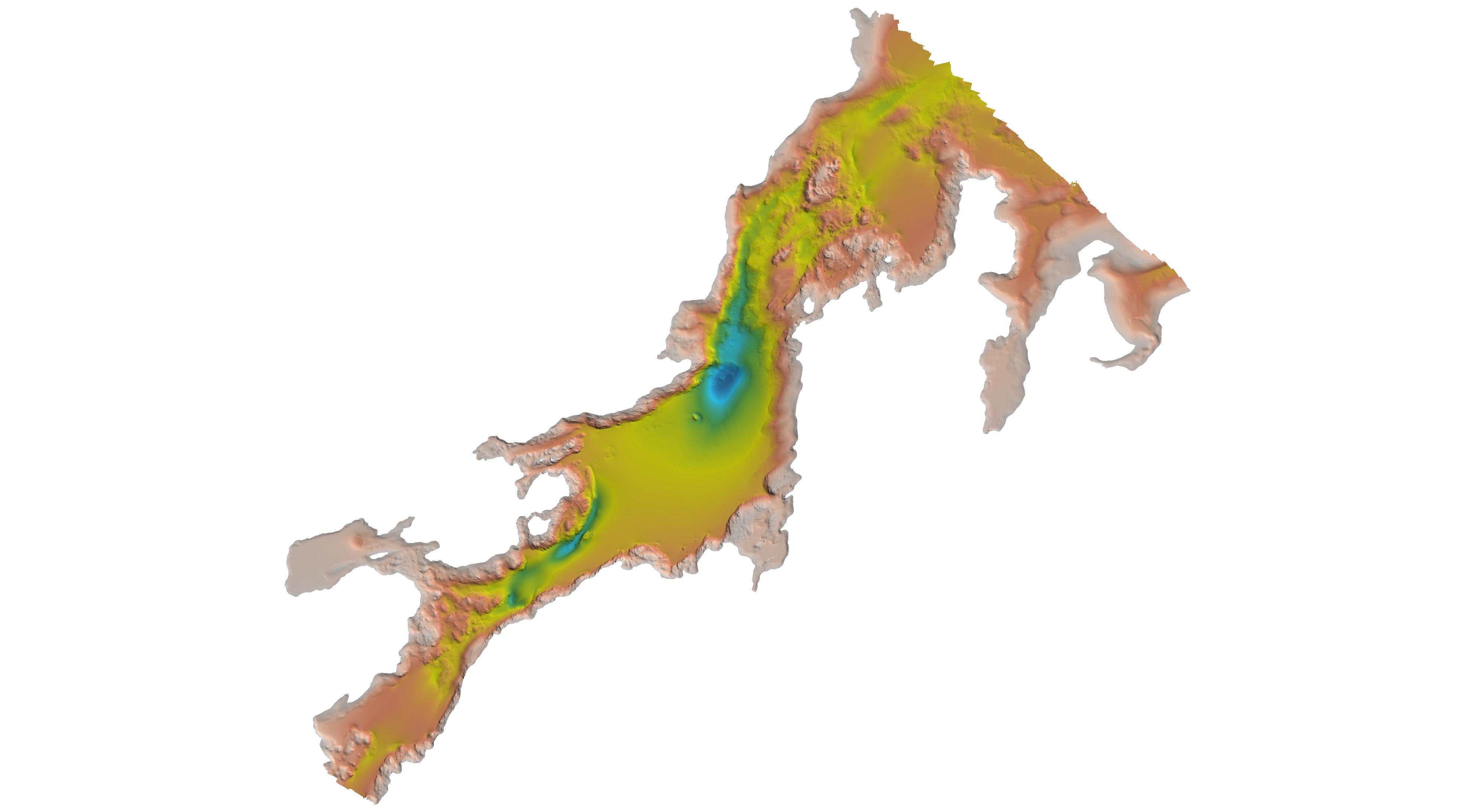
Federal
H08333: NOS Hydrographic Survey , Guemes Channel, Bellingham Channel and Rosario Strait, Washington, 1955-09-09
National Oceanic and Atmospheric Administration, Department of Commerce —
The National Oceanic and Atmospheric Administration (NOAA) has the statutory mandate to collect hydrographic data in support of nautical chart compilation for safe... -
Federal
H04218: NOS Hydrographic Survey , 1922-12-31
National Oceanic and Atmospheric Administration, Department of Commerce —
The National Oceanic and Atmospheric Administration (NOAA) has the statutory mandate to collect hydrographic data in support of nautical chart compilation for safe... -
Federal
AM Bench 2022 Microstructure Measurements for IN718 3D builds
Department of Commerce —
The following data files include microstructure measurement results associated with the 2022 Additive Manufacturing Benchmark test series (AM-Bench 2022) AMB2022-01... -
Federal
Data from: Topographic position index predicts within-field yield variation in a dryland cereal production system
Department of Agriculture —
We investigated drivers of sub-field spatial variability in yield for 3 crops (hard red winter wheat, Triticum aestivum L. variety Langin; corn, Zea mays L.; and... -
Federal
Coastal/Marine Ecological Classification Standard (CMECS) Classification Data for Assateague Island National Seashore
Department of the Interior —
Habitat classification map based on surveys completed along the 58‐km long Assateague barrier island stretching from the Ocean City inlet in Maryland, down past... -
Federal
H10983C: NOS Hydrographic Survey , Salem Sound, Massachusetts, 2000-06-27
National Oceanic and Atmospheric Administration, Department of Commerce —
The National Oceanic and Atmospheric Administration (NOAA) has the statutory mandate to collect hydrographic data in support of nautical chart compilation for safe... -
Federal
DEEPEN Leapfrog Geodata Model Cleaned and Reformatted Exploration Datasets from Newberry Volcano
Department of Energy —
DEEPEN stands for DE-risking Exploration of geothermal Plays in magmatic ENvironments. As part of the DEEPEN 3D play fairway analysis (PFA) conducted at Newberry... -
Federal
H11398: NOS Hydrographic Survey , New York Harbor, New York, 2007-08-30
National Oceanic and Atmospheric Administration, Department of Commerce —
The National Oceanic and Atmospheric Administration (NOAA) has the statutory mandate to collect hydrographic data in support of nautical chart compilation for safe... -
Federal
H03610: NOS Hydrographic Survey
National Oceanic and Atmospheric Administration, Department of Commerce —
The National Oceanic and Atmospheric Administration (NOAA) has the statutory mandate to collect hydrographic data in support of nautical chart compilation for safe... -
Federal
H03587: NOS Hydrographic Survey
National Oceanic and Atmospheric Administration, Department of Commerce —
The National Oceanic and Atmospheric Administration (NOAA) has the statutory mandate to collect hydrographic data in support of nautical chart compilation for safe... -
Federal
H03624: NOS Hydrographic Survey
National Oceanic and Atmospheric Administration, Department of Commerce —
The National Oceanic and Atmospheric Administration (NOAA) has the statutory mandate to collect hydrographic data in support of nautical chart compilation for safe... -
University
2011 Las Conchas Post Fire, h535106_sw_nw, CIR
Earth Data Analysis Center, University of New Mexico —
Wilson and Company collected and processed multi-spectral (red, green, blue, near-infrared) digital aerial imagery of the Las Conchas Fire that burned in the Santa Fe... -
University
2011 Las Conchas Post Fire, h435106_sw_se, CIR
Earth Data Analysis Center, University of New Mexico —
Wilson and Company collected and processed multi-spectral (red, green, blue, near-infrared) digital aerial imagery of the Las Conchas Fire that burned in the Santa Fe... -
University
2012 Whitewater Baldy Post Fire, Rice Ranch SW NE, RGB
Earth Data Analysis Center, University of New Mexico —
This dataset contains imagery for the Gila National Forest, Catron and Grant County, New Mexico. The imagery was flown to provide coverage after the 2012 Whitewater-... -
Federal
H00172: NOS Hydrographic Survey
National Oceanic and Atmospheric Administration, Department of Commerce —
The National Oceanic and Atmospheric Administration (NOAA) has the statutory mandate to collect hydrographic data in support of nautical chart compilation for safe... -
Federal
H13761: NOS Hydrographic Survey , 2023-10-25
National Oceanic and Atmospheric Administration, Department of Commerce —
The National Oceanic and Atmospheric Administration (NOAA) has the statutory mandate to collect hydrographic data in support of nautical chart compilation for safe... -
Federal
H11099: NOS Hydrographic Survey , Kasaan Bay, Alaska, 2002-08-16
National Oceanic and Atmospheric Administration, Department of Commerce —
The National Oceanic and Atmospheric Administration (NOAA) has the statutory mandate to collect hydrographic data in support of nautical chart compilation for safe... -
Federal
H13825: NOS Hydrographic Survey , 2023-07-31
National Oceanic and Atmospheric Administration, Department of Commerce —
The National Oceanic and Atmospheric Administration (NOAA) has the statutory mandate to collect hydrographic data in support of nautical chart compilation for safe... -
University
2011 Las Conchas Post Fire, h435106_ne_se, CIR
Earth Data Analysis Center, University of New Mexico —
Wilson and Company collected and processed multi-spectral (red, green, blue, near-infrared) digital aerial imagery of the Las Conchas Fire that burned in the Santa Fe...

Official websites use .gov
A
.gov website belongs to an official government
organization in the United States.
Secure .gov websites use HTTPS
A
lock (
) or https:// means you’ve safely connected to
the .gov website. Share sensitive information only on official,
secure websites.