
-
Federal
LBA-ECO TG-03 Solar Surface Irradiance and PAR, Brazilian Amazon: 1999-2004
National Aeronautics and Space Administration —
This data set includes solar surface irradiance from Kipp and Zonen CM-21 pyranometers, both total unfiltered and filtered (RG695), and photosynthetically active... -
Federal
VEMAP 2: U.S. Daily Climate Change Scenarios
National Aeronautics and Space Administration —
The Vegetation/Ecosystem Modeling and Analysis Project (VEMAP) Phase 2 has developed a number of transient climate change scenarios based on coupled atmosphere-ocean... -
Federal
LBA-ECO LC-01 SRTM 90-Meter Digital Elevation Model, Northern Ecuadorian Amazon
National Aeronautics and Space Administration —
This data set provides 90-meter resolution Digital Elevation Model data used in the University of North Carolina's Carolina Population Center (CPC) Ecuador Projects.... -
Federal
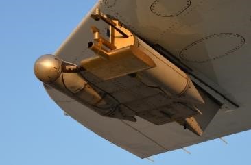
SAFARI 2000 Airborne Sunphotometer Aerosol Optical Depth and Water Vapor Data
National Aeronautics and Space Administration —
The NASA Ames Airborne Tracking 14-channel Sunphotometer (AATS-14) was operated successfully aboard the University of Washington CV-580 for 24 data flights during the... -
Federal
NWS Daily Climatology Data: 1980 (SNF)
National Aeronautics and Space Administration —
Weather data were collected by the National Weather Service in International Falls, Minnesota. International Falls is about 80 miles from the SNF, but the weather... -
Federal
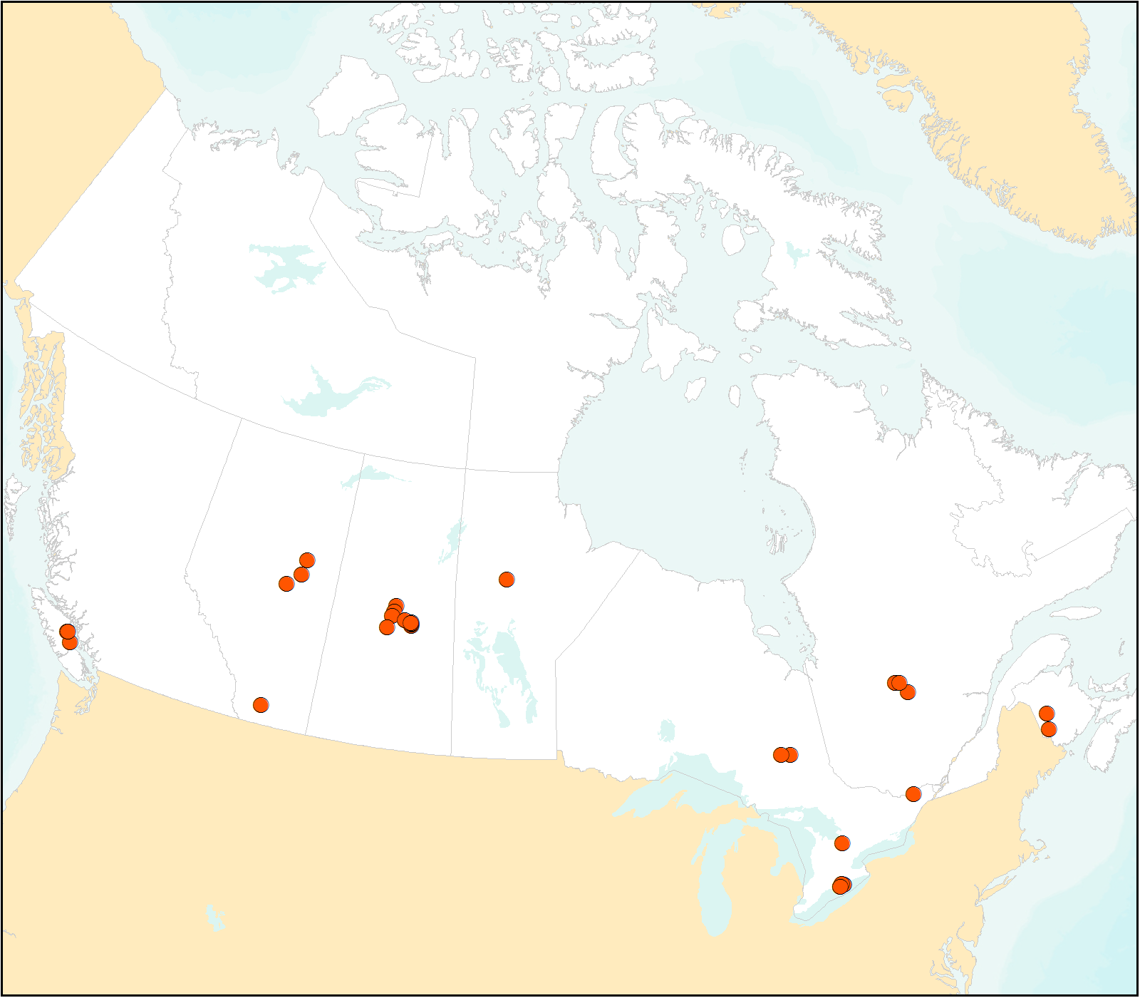
FLUXNET Canada Research Network - Canadian Carbon Program Data Collection, 1993-2014
National Aeronautics and Space Administration —
FLUXNET Canada is a Fluxnet research network comprised of the Fluxnet-Canada Research Network (FCRN) and the Canadian Carbon Program (CCP) operating from 1993 through... -
Federal
LBA Regional Land Cover from AVHRR, 8-km, 1984 (DeFries et al.)
National Aeronautics and Space Administration —
This data set is a subset of an 8-km global land cover product (DeFries et al. 1998). This subset was created for the study area of the Large Scale Biosphere-... -
Federal
SAFARI 2000 AERONET Ground-based Aerosol Data, Dry Season 2000
National Aeronautics and Space Administration —
AERONET (AErosol RObotic NETwork) is an optical ground-based aerosol monitoring network and data archive system. AERONET measurements of the column-integrated aerosol... -
Federal
NWS Daily Climatology Data: 1989 (SNF)
National Aeronautics and Space Administration —
Weather data were collected by the National Weather Service in International Falls, Minnesota. International Falls is about 80 miles from the SNF, but the weather... -
Federal
VEMAP 2: U.S. Monthly Climate Change Scenarios, Version 2
National Aeronautics and Space Administration —
The Vegetation/Ecosystem Modeling and Analysis Project (VEMAP) Phase 2 has developed a number of transient climate change scenarios based on coupled atmosphere-ocean... -
Federal
SAFARI 2000 Tree Cover from AVHRR, 1-km, 1992-1993 (DeFries et al.)
National Aeronautics and Space Administration —
The data set consists of a southern Africa subset of the 1km Global Tree Cover Data Set developed at the Laboratory for Global Remote Sensing Studies (LGRSS) at the... -
Federal
NWS Daily Climatology Data: 1983 (SNF)
National Aeronautics and Space Administration —
Weather data were collected by the National Weather Service in International Falls, Minnesota. International Falls is about 80 miles from the SNF, but the weather... -
Federal
LBA Regional Historical Croplands, 5-min, 1900-1992 (Ramankutty and Foley)
National Aeronautics and Space Administration —
This data set is a subset of a global croplands data set (Ramankutty and Foley 1999a). The subset was created for the study area of the Large Scale Biosphere-... -
Federal
NWS Daily Climatology Data: 1981 (SNF)
National Aeronautics and Space Administration —
Weather data were collected by the National Weather Service in International Falls, Minnesota. International Falls is about 80 miles from the SNF, but the weather... -
Federal
Biome-BGC: Terrestrial Ecosystem Process Model, Version 4.1.1
National Aeronautics and Space Administration —
Biome-BGC is a computer program that estimates fluxes and storage of energy, water, carbon, and nitrogen for the vegetation and soil components of terrestrial... -
Federal
LBA Regional Land Cover from AVHRR, 1-Degree, 1987 (Defries and Townshend)
National Aeronautics and Space Administration —
This data set consists of a subset for the study area of the Large Scale Biosphere-Atmosphere Experiment in Amazonia (LBA) in South America (i.e., longitude 85 deg to... -
Federal
NWS Daily Climatology Data: 1973 (SNF)
National Aeronautics and Space Administration —
Weather data were collected by the National Weather Service in International Falls, Minnesota. International Falls is about 80 miles from the SNF, but the weather... -
Federal
NWS Daily Climatology Data: 1977 (SNF)
National Aeronautics and Space Administration —
Weather data were collected by the National Weather Service in International Falls, Minnesota. International Falls is about 80 miles from the SNF, but the weather... -
Federal
ATom: Cloud and Coarse Aerosol Measurements from CAPS Instrument, 2016-2018
National Aeronautics and Space Administration —
This dataset contains cloud type and coarse aerosol contents measured by the University of Vienna's second-generation Cloud Aerosol and Precipitation Spectrometer... -
Federal
SAFARI 2000 Land Cover from AVHRR, 8-km, 1984 (DeFries et al.)
National Aeronautics and Space Administration —
This data set consists of a southern African subset of the University of Maryland (UMD) 8-km Global Land Cover product in ASCII GRID and binary image files formats....

Official websites use .gov
A
.gov website belongs to an official government
organization in the United States.
Secure .gov websites use HTTPS
A
lock (
) or https:// means you’ve safely connected to
the .gov website. Share sensitive information only on official,
secure websites.