
-
Federal
VEMAP 1: U.S. Soil
National Aeronautics and Space Administration —
The Vegetation/Ecosystem Modeling and Analysis Project (VEMAP) is an ongoing multiinstitutional, international effort addressing the response of biogeography and... -
Federal
SAFARI 2000 Freshwater Wetlands, 1-Deg (Stillwell-Soller et al.)
National Aeronautics and Space Administration —
The data set consists of a southern Africa subset of the Global Distribution of Freshwater Wetlands database 1-degree data and are available in ASCII GRID and binary... -
Federal
SHIFT: HyTES L1 Brightness Temperature, March 23 2022
National Aeronautics and Space Administration —
This dataset holds Level 1 (L1) brightness temperature data collected by the Hyperspectral Thermal Emission Spectrometer (HyTES) instrument. This imagery was acquired... -
Federal
Global Leaf Area Index from Field Measurements, 1932-2000
National Aeronautics and Space Administration —
Approximately 1000 published estimates of leaf area index (LAI) from nearly 400 unique field sites, covering the period 1932-2000, have been compiled into a single... -
Federal
AMAZE-08 Aerosol Characterization and Meteorological Data, Central Amazon Basin: 2008
National Aeronautics and Space Administration —
This data set provides measurements from the Amazonian Aerosol Characterization Experiment (AMAZE-08) carried out during the wet season from February 4 to March 21,... -
Federal
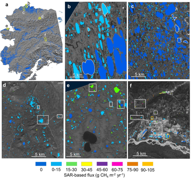
ABoVE: SAR-based Methane Ebullition Flux from Lakes, Five Regions, Alaska, 2007-2010
National Aeronautics and Space Administration —
This dataset provides Synthetic Aperture Radar (SAR) estimates of lake-source methane ebullition flux in mg CH4/m2/d for thousands of lakes in five regions across... -
Federal
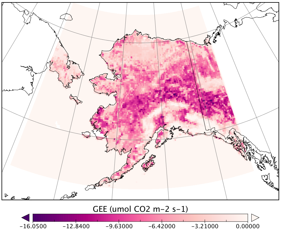
CARVE Modeled Gross Ecosystem CO2 Exchange and Respiration, Alaska, 2012-2014
National Aeronautics and Space Administration —
This data set provides 3-hourly estimates of gross ecosystem CO2 exchange (GEE) and respiration (autotrophic and heterotrophic) for the state of Alaska from 2012 to... -
Federal
PnET-BGC: Modeling Biogeochemical Processes in a Northern Hardwood Forest Ecosystem
National Aeronautics and Space Administration —
This archived model product contains the directions, executables, and procedures for running PnET-BGC to recreate the results of Gbondo-Tugbawa, S.S., C.T. Driscoll ,... -
Federal
Global Distribution of Fine Root Biomass in Terrestrial Ecosystems
National Aeronautics and Space Administration —
A global data set of root biomass, rooting profiles, and concentrations nutrients in roots was compiled from the primary literature and used to study distributions of... -
Federal
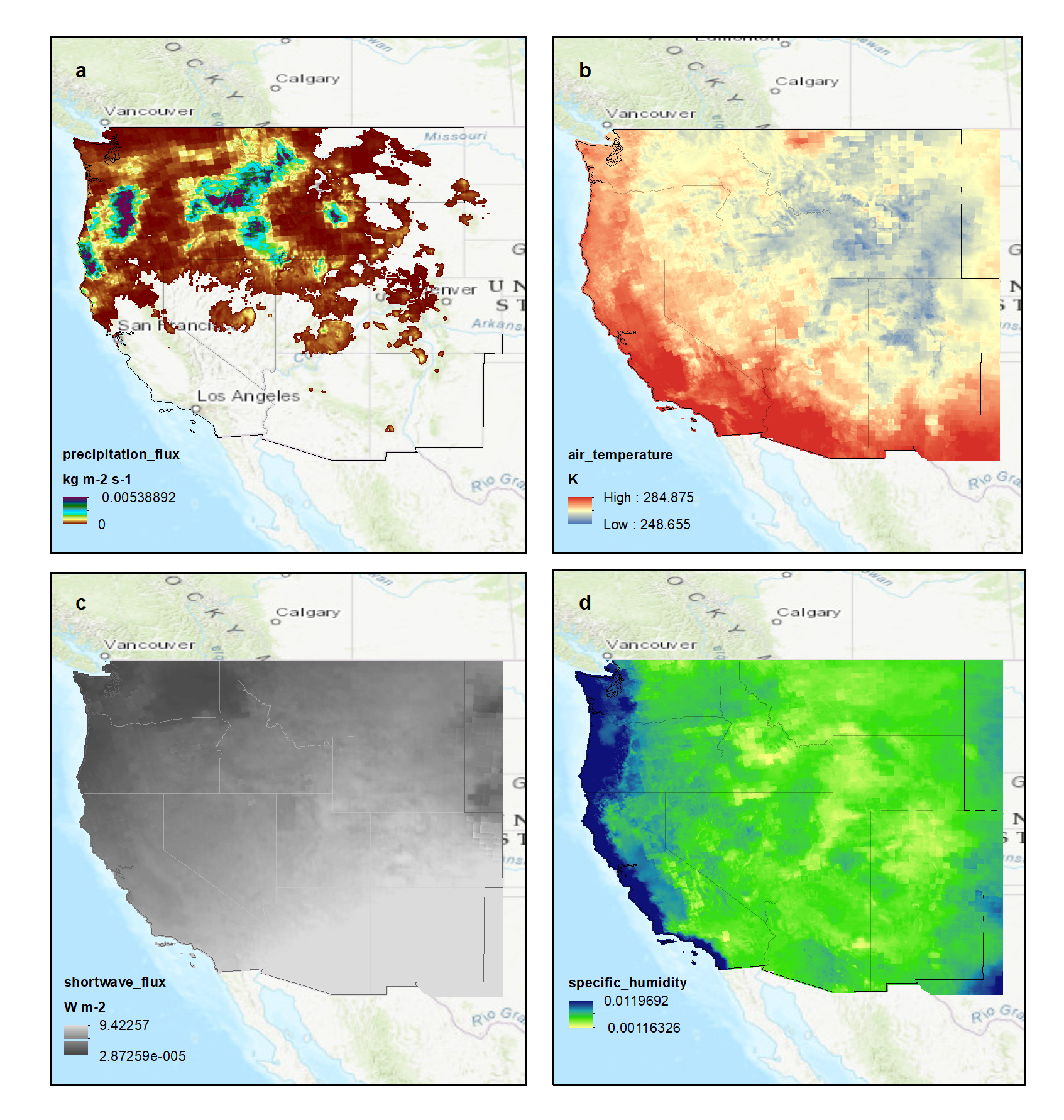
NACP: Climate Data Inputs (3-hourly) for Community Land Model, Western USA, 1979-2015
National Aeronautics and Space Administration —
This dataset provides sub-daily, high-resolution, climate data inputs including temperature, precipitation, near surface specific humidity, incoming short-wave... -
Federal
ISLSCP II Continuous Fields of Vegetation Cover, 1992-1993
National Aeronautics and Space Administration —
The objective of this study was to derive continuous fields of vegetation cover from multi-temporal Advanced Very High Resolution Radiometer (AVHRR) data using all... -
Federal
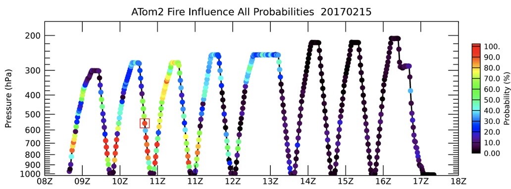
ATom: Back Trajectories and Influences of Air Parcels Along Flight Track, 2016-2018
National Aeronautics and Space Administration —
This dataset contains back trajectories, boundary layer influences, and convective influences of air parcels along NASA DC-8 aircraft's flight tracks during the four... -
Federal
Land Surface Model (LSM 1.0) for Ecological, Hydrological, Atmospheric Studies
National Aeronautics and Space Administration —
The NCAR LSM 1.0 is a land surface model developed by Gordon Bonan to examine biogeophysical and biogeochemical land-atmosphere interactions, especially the effects... -
Federal
LBA-ECO ND-01 Streamwater and Watershed Characteristics, Rondonia, Brazil: 1998-1999
National Aeronautics and Space Administration —
This data set provides the results of (1) synoptic streamwater sampling and analyses from numerous sites across Rondonia and (2) corresponding watershed... -
Federal
Global Soil Profile Data (ISRIC-WISE)
National Aeronautics and Space Administration —
The International Soil Reference and Information Centre-World Inventory of Soil Emission Potentials (ISRIC-WISE) international soil profile data set consists of a... -
Federal
VEMAP 1: U.S. Climate Change Scenarios Based on Models with Increased CO2
National Aeronautics and Space Administration —
The Vegetation/Ecosystem Modeling and Analysis Project (VEMAP) is an ongoing multiinstitutional, international effort addressing the response of biogeography and... -
Federal
LBA-ECO LC-02 Tributary Coordinates, Acre River, Tri-national River Basin: 2003-2004
National Aeronautics and Space Administration —
This data set provides coordinates for points at the mouth of tributaries of the Acre River in the Tri-national River Basin in South America. Three Global Positioning... -
Federal
BOREAS Elevation Contours over the NSA and SSA ARC/Info Generate Format
National Aeronautics and Space Administration —
This data set was prepared by BORIS staff by reformatting the original data into the ARC/INFO Generate format. The original data were received in SIF at a scale of...

Official websites use .gov
A
.gov website belongs to an official government
organization in the United States.
Secure .gov websites use HTTPS
A
lock (
) or https:// means you’ve safely connected to
the .gov website. Share sensitive information only on official,
secure websites.