
-
Federal
SAFARI 2000 TOVS Surface and Atmospheric Parameters, 1-Deg, 1999-2001
National Aeronautics and Space Administration —
NOAA's TIROS (Television Infrared Observation Satellite) Operational Vertical Sounder (TOVS) is a suite of three sensors: the Microwave Sounding Unit (MSU), the High... -
Federal
SAFARI 2000 C-130 Aerosol and Meteorological Data, Dry Season 2000
National Aeronautics and Space Administration —
The Met Office C-130 research aircraft was based at Windhoek, Namibia between September 5-16, 2000, where it conducted a series of flights over Namibia as part of the... -
Federal
Timeseries of Arctic-Boreal Lake Area Derived from CubeSat Imagery, 2017
National Aeronautics and Space Administration —
This dataset provides near-daily lake area timeseries for 85,358 lakes across four study areas in Northern Canada and Alaska, USA, between May 1 and October 1, 2017.... -
Federal
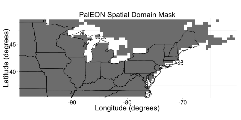
PalEON: Terrestrial Ecosystem Model Drivers for the Northeastern U.S., 0850-2010
National Aeronautics and Space Administration —
This dataset from the PalEON Ecosystem Model Intercomparison Project (PEMIP) provides harmonized regional environmental and meteorological drivers at a resolution of... -
Federal
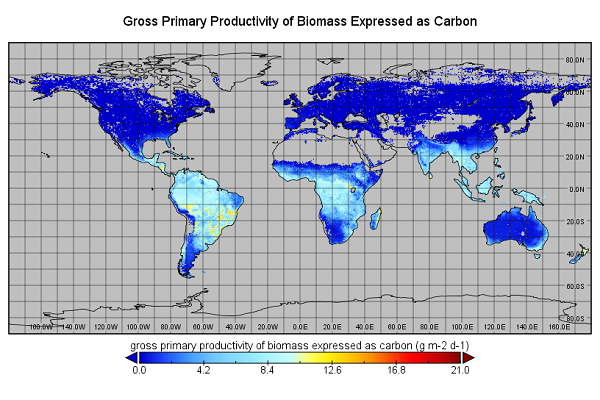
Global Monthly GPP from an Improved Light Use Efficiency Model, 1982-2016
National Aeronautics and Space Administration —
This dataset provides global monthly average gross primary productivity (GPP; g carbon/m2/d) modeled at 8 km spatial resolution for each of the 35 years from... -
Federal
Global 1-degree Maps of Forest Area, Carbon Stocks, and Biomass, 1950-2010
National Aeronautics and Space Administration —
This data set provides global forest area, forest growing stock, and forest biomass data at 1-degree resolution for the period 1950-2010. The data set is based on a... -
Federal
CARVE: L1 Airborne Forward Looking Infrared Radiance Counts, Alaska, 2013-2015
National Aeronautics and Space Administration —
This data set provides earth referenced radiance counts measured by the Forward Looking Infrared (FLIR) camera aboard the CARVE aircraft between April 2013 and... -
Federal
Biomass Allocation and Growth Data of Seeded Plants
National Aeronautics and Space Administration —
This data set of leaf, stem, and root biomass for various plant taxa was compiled from the primary literature of the 20th century with a significant portion derived... -
Federal
BOREAS AES Five-day Averaged Surface Meteorological and Upper Air Data
National Aeronautics and Space Administration —
The Canadian Atmospheric Environment Service (AES) provided BOREAS with hourly and daily surface meteorological data from 23 of the AES meteorological stations... -
Federal
BOREAS TE-07 Dendrology Data
National Aeronautics and Space Administration —
The BOREAS TE-07 team collected data sets in support of its efforts to characterize and interpret information on the sapflow and dendrology of boreal vegetation. This... -
Federal
NPP Multi-Biome: Grassland, Boreal Forest, and Tropical Forest Sites, 1939-1996, R1
National Aeronautics and Space Administration —
This data set contains one data file (.csv format) that provides net primary productivity (NPP) estimates for 34 grasslands, 14 tropical forests, and 5 boreal forest... -
Federal
MODIS-derived Aggregate, Woody and Herbaceous Leaf Area Index for Africa, 2002-2022
National Aeronautics and Space Administration —
This dataset provides leaf area index (LAI) estimates for Sub-Saharan Africa for woody, herbaceous, and aggregate vegetation types. The estimates were derived from... -
Federal
LBA-ECO ND-06 Land Use Effects on Soil Nutrients: A Review of Studies 1950-2001
National Aeronautics and Space Administration —
This data set provides measurements of soil properties compiled from 39 studies on nutrient dynamics in natural forests and forest-derived land uses (pasture,... -
Federal
LBA-ECO LC-02 Biophysical Measurements of Forests, Acre, Brazil: 1999-2002
National Aeronautics and Space Administration —
This data set provides diameter at breast height (DBH) measurements for 1,063 trees located at the Catuaba Experimental Farm, and 812 trees located in the Humaita... -
Federal
LBA-ECO ND-01 Forest and Pasture Soil and Grass Analyses, Rondonia, Brazil: 2003-2004
National Aeronautics and Space Administration —
This data set provides soil physical and chemical properties, and grass nutrient measurements of samples collected from 17 pasture sites located within the state of... -
Federal
LBA-ECO CD-06 Land Use/Land Cover Time Series, Ji-Parana Basin, Brazil: 1986-2001
National Aeronautics and Space Administration —
This data set contains four land use/land cover maps (1986, 1992, 1996 and 2001) for the Ji-Parana River Basin, derived from the digital classification of 8 Landsat... -
Federal
LBA-ECO CD-08 Leaf Carbon, Nitrogen, LAI, and Isotope Data, Manaus, Brazil: 2001
National Aeronautics and Space Administration —
This data set provides measurements for carbon (C), nitrogen (N), leaf area index (LAI), and carbon isotope ratio data (13C and 14C) of leaves sampled at the Manaus... -
Federal
LBA-ECO CD-02 Carbon, Nitrogen, Oxygen Stable Isotopes in Organic Material, Brazil
National Aeronautics and Space Administration —
This data set reports the measurement of stable carbon, nitrogen, and oxygen isotope ratios in organic material (plant, litter and soil samples) in forest canopy... -
Federal
LBA-ECO CD-34 Landsat Fractional Land Cover Analysis, Manaus, Brazil: 2004-2005
National Aeronautics and Space Administration —
This data set provides the results of fractional land cover analysis for nonphotosynthetic vegetation (NPV) from two Landsat images of Manaus, Brazil, for October 14,... -
Federal
Landsat-based Phenology and Tree Ring Characterization, Eastern US Forests, 1984-2013
National Aeronautics and Space Administration —
This data set provides a 30-year record of Landsat TM and ETM+ derived forest phenology and the results of tree ring analyses for annual wood production and nitrogen...

Official websites use .gov
A
.gov website belongs to an official government
organization in the United States.
Secure .gov websites use HTTPS
A
lock (
) or https:// means you’ve safely connected to
the .gov website. Share sensitive information only on official,
secure websites.