
-
Federal
TCSP HIGH ALTITUDE MMIC SOUNDING RADIOMETER (HAMSR) V1
National Aeronautics and Space Administration —
The High Altitude MMIC Sounding Radiometer (HAMSR) is a 25-channel microwave atmospheric sounder operating as a cross-track scanner. There are three bands: an... -
Federal
Tropical Cyclone Intensity (TCI) Hurricane Imaging Radiometer (HIRAD) V2.1
National Aeronautics and Space Administration —
The Tropical Cyclone Intensity (TCI) Hurricane Imaging Radiometer (HIRAD) dataset was created for the TCI field campaign from August 30, 2015 through October 23,... -
Federal
GRIP GOES 13 VISIBLE AND INFRARED IMAGES V1
National Aeronautics and Space Administration —
The GRIP GOES 13 Visible and Infrared Images dataset was produced and archived in near real time at the Global Hydrology Resource Center throughout the Genesis and... -
Federal
GRIP LIDAR ATMOSPHERIC SENSING EXPERIMENT (LASE) V1
National Aeronautics and Space Administration —
The GRIP Lidar Atmospheric Sensing Experiment (LASE) dataset was collected by NASA's Lidar Atmospheric Sensing Experiment (LASE) system, which is an airborne... -
Federal
GRIP LANGLEY AEROSOL RESEARCH GROUP EXPERIMENT (LARGE) V1
National Aeronautics and Space Administration —
The GRIP Langley Aerosol Research Group Experiment (LARGE) dataset was collected by the Langley Aerosol Research Group Experiment (LARGE), which measures ultrafine... -
Federal
GRIP METEOSAT SECOND GENERATION (MSG) IMAGE DATA V1
National Aeronautics and Space Administration —
The GRIP Meteosat Second Generation (MSG) Image Data was collected during the Genesis and Rapid Intensification Processes (GRIP) experiment from August 15, 2010 to... -
Federal
GRIP DC-8 DROPSONDE V3
National Aeronautics and Space Administration —
The GRIP DC-8 Dropsonde V3 dataset consists of atmospheric pressure, dry-bulb temperature, dew point temperature, relative humidity, wind direction, wind speed, and... -
Federal
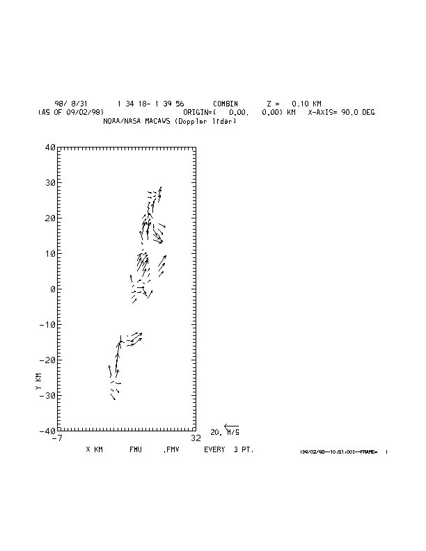
CAMEX-3 MACAWS V1
National Aeronautics and Space Administration —
The Multi-center Airborne Coherent Atmospheric Wind Sensor (MACAWS) was deployed during the Third Convection and Moisture Experiment (CAMEX-3). MACAWS data for the... -
Federal
CAMEX-3 CLOUD AND AEROSOL PARTICLE CHARACTERIZATION (CAPAC) V1
National Aeronautics and Space Administration —
CAPAC is a series of three instruments: the Forward Scattering Spectrometer Probe model 300 (FSSP-300), the Two Dimensional Optical Array Probes [Cloud and... -
Federal
TCSP CLOUD RADAR SYSTEM (CRS) V1
National Aeronautics and Space Administration —
The TCSP Cloud Radar System (CRS) datasets consists of vertically profiled reflectivity and Doppler velocity at aircraft nadir along the flight track. The CRS is a 94... -
Federal
CAMEX-4 NOAA WP-3D RADAR V1
National Aeronautics and Space Administration —
The CAMEX-4 NPAA WP-3D Radar dataset used the NOAA WP-3D Orion aircraft, which has two separate research radars to collect meteorological data. One is mounted on the... -
Federal
Global Hawk Navigation EPOCH
National Aeronautics and Space Administration —
The Global Hawk Navigation EPOCH dataset consists of the real-time navigation and housekeeping data that was acquired by various instruments aboard the Global Hawk... -
Federal
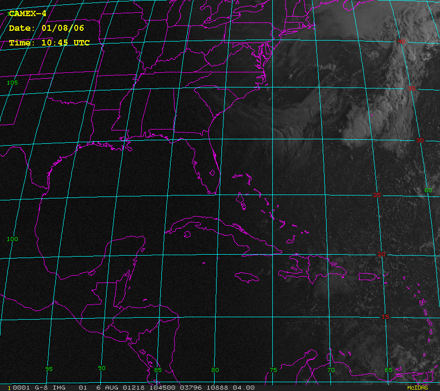
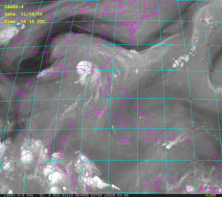
CAMEX-4 GOES-8 PRODUCTS V1
National Aeronautics and Space Administration —
The CAMEX-4 GOES-8 Products dataset was collected during the CAMEX-4 field campaign, which ocused on the study of tropical cyclone (hurricane) development, tracking,... -
Federal
ER-2 X-Band Doppler Radar (EXRAD) EPOCH V1
National Aeronautics and Space Administration —
The ER-2 X-Band Doppler Radar (EXRAD) EPOCH dataset consists of radar reflectivity and Doppler velocity estimates collected by the EXRAD onboard the AV-6 Global Hawk... -
Federal
CAMEX-3 LiDAR Atmospheric Sensing Experiment (LASE) Imagery V1
National Aeronautics and Space Administration —
The CAMEX-3 LiDAR Atmospheric Sensing Experiment (LASE) Imagery dataset is a browse-only dataset that consists of plotted reflectivity data collected by the LiDAR... -
Federal
Hurricane and Severe Storm Sentinel (HS3) Global Modeling and Assimilation Office (GMAO) Dust Aerosol Optical Thickness Imagery V1
National Aeronautics and Space Administration —
The Hurricane and Severe Storm Sentinel (HS3) Global Modeling and Assimilation Office (GMAO) Dust Aerosol Optical Thickness Imagery dataset consists of browse only... -
Federal
ER-2 X-Band Doppler Radar (EXRAD) EPOCH
National Aeronautics and Space Administration —
The ER-2 X-Band Doppler Radar (EXRAD) EPOCH dataset consists of radar reflectivity and Doppler velocity estimates collected by the EXRAD onboard the AV-6 Global Hawk...

Official websites use .gov
A
.gov website belongs to an official government
organization in the United States.
Secure .gov websites use HTTPS
A
lock (
) or https:// means you’ve safely connected to
the .gov website. Share sensitive information only on official,
secure websites.