

3,813 datasets found for "2z텔toadDB☑️♣실시간DBl⊇"
-
Federal
BOREAS Level-1B TIMS Imagery: At Sensor Radiance in BSQ Format
National Aeronautics and Space Administration —
The BOREAS Staff Science Aircraft Data Acquisition Program focused on providing the research teams with the remotely sensed satellite data products they needed to... -
Federal
BOREAS Landsat TM Level-3b Imagery: At-Sensor Radiance in BSQ Format
National Aeronautics and Space Administration —
For BOREAS, the level-3b Landsat TM data, along with the other remotely sensed images, were collected in order to provide spatially extensive information over the... -
Federal
BOREAS Landsat TM Level-3a Imagery: Scaled At-Sensor Radiance in BSQ Format
National Aeronautics and Space Administration —
For BOREAS, the level-3a Landsat TM data, along with the other remotely sensed images, were collected in order to provide spatially extensive information over the... -
Federal
BOREAS HYD-03 Subcanopy Meteorological Data
National Aeronautics and Space Administration —
The BOREAS HYD-03 team collected several data sets related to the hydrology of forested areas. This data set includes measurements of wind speed and direction; air... -
Federal
BOREAS HYD-03 Subcanopy Radiation Data
National Aeronautics and Space Administration —
The BOREAS HYD-03 team collected several data sets related to the hydrology of forested areas. This data set contains solar radiation measurements from several... -
Federal
BOREAS HYD-03 Snow Water Equivalent Data
National Aeronautics and Space Administration —
The BOREAS HYD-03 team collected several data sets related to the hydrology of forested areas. This data set contains measurements of snow depth, snow density in 3-cm... -
Federal
BOREAS HYD-04 Areal Snow Course Survey Data
National Aeronautics and Space Administration —
The BOREAS HYD-04 work was focused on collecting data during the winter field campaign (FFC-W) to improve the understanding of winter processes within the boreal... -
Federal
Blue Carbon-based Natural Climate Solutions, Priority Maps for the U.S., 2006-2011
National Aeronautics and Space Administration —
This dataset contains shapefiles showing location of tidal wetland parcels with the potential for net greenhouse gas removal if restored from current mapped condition... -
Federal
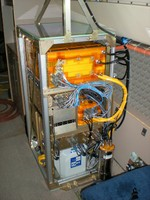
ATom: Measurements from the Quantum Cascade Laser System (QCLS), Version 2
National Aeronautics and Space Administration —
This dataset provides atmospheric concentrations of CO2, CH4, CO, and N2O measured by the Harvard Quantum Cascade Laser System (QCLS) instruments during airborne... -
Federal
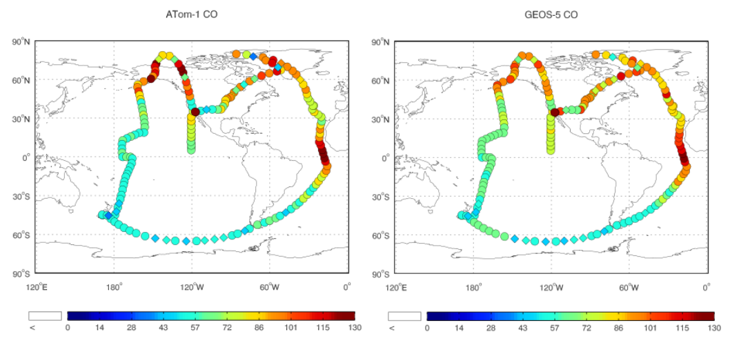
ATom: Observed and GEOS-5 Simulated CO Concentrations with Tagged Tracers for ATom-1
National Aeronautics and Space Administration —
This dataset contains carbon monoxide (CO) observations at 10-second intervals from flights during the ATom-1 campaign in 2016 and simulated CO concentrations from... -
Federal
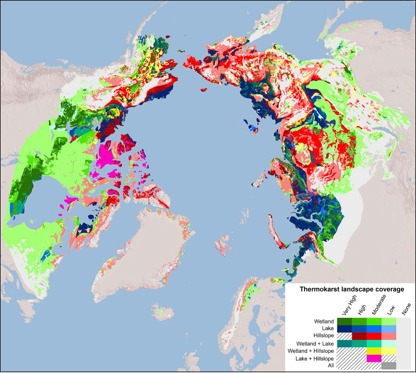
Arctic Circumpolar Distribution and Soil Carbon of Thermokarst Landscapes, 2015
National Aeronautics and Space Administration —
This data set provides the distribution of thermokarst landscapes in the boreal and tundra ecoregions within the northern circumpolar permafrost zones. This dataset... -
Federal
2017 Annual Data Files: Centennial Valley Arctic Grayling Adaptive Management Project, 2011-present
Department of the Interior —
2017's Annual Data files have been uploaded as several digital holdings with data used to support the creation of the Centennial Valley Arctic Grayling Adaptive... -
Federal
2016 Annual Data Files: Centennial Valley Arctic Grayling Adaptive Management Project, 2011-present
Department of the Interior —
2016's Annual Data files have been uploaded as several digital holdings with data used to support the creation of the Centennial Valley Arctic Grayling Adaptive...
3,813 datasets found for "2z텔toadDB☑️♣실시간DBl⊇"