
-
Federal
GPM Ground Validation Doppler on Wheels (DOW) OLYMPEX
National Aeronautics and Space Administration —
The GPM Ground Validation Doppler on Wheels (DOW) OLYMPEX V2 dataset was obtained by a dual-polarization and dual-frequency X-band mobile radar operated by the Center... -
Federal
Cross-track Infrared Sounder (CrIS) Level 2 Earth System Science Profiling Algorithm Ammonia Retrieval Algorithm (ESSPA-NH3) V1 (SNDRSNIL2ESPNH3)
National Aeronautics and Space Administration —
The objective of this limited edition data collection is to examine the ammonia products generated by the ESSPA (Earth System Science Profiling Algorithm) algorithm... -
Federal
MISR Level 3 Component Global Land Regional public Product covering a day V002
National Aeronautics and Space Administration —
MI3DLSR_2 is the Multi-angle Imaging SpectroRadiometer (MISR) Level 3 Component Global Land Regional public Product covering a dayversion 2. It contains a daily... -
Federal
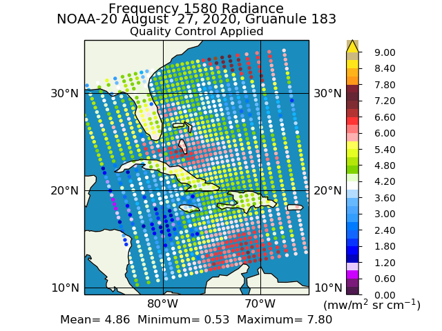
JPSS-1 CrIS Level 1B Full Spectral Resolution V3 (SNDRJ1CrISL1B) at GES DISC
National Aeronautics and Space Administration —
The Cross-track Infrared Sounder (CrIS) Level 1B Full Spectral Resolution (FSR) data files contain radiance measurements along with ancillary spacecraft, instrument,... -
Federal
Tropical Ozone Transport Experiment – Vortex Ozone Transport Experiment (TOTE-VOTE) DC-8 In Situ Aerosol Data
National Aeronautics and Space Administration —
TOTE-VOTE_Aerosol_AircraftInSitu_DC8_Data_1 is the in situ collected onboard the DC-8 aircraft during the Tropical Ozone Transport Experiment – Vortex Ozone Transport... -
Federal
TES/Aura L1B Spectra Nadir V006
National Aeronautics and Space Administration —
TL1BN_6 is the Tropospheric Emission Spectrometer (TES)/Aura L1B Spectra Nadir Version 6 data product. TES was an instrument aboard NASA's Aura satellite and was... -
Federal
Integrated Biosphere Simulator Model (IBIS), Version 2.5
National Aeronautics and Space Administration —
The Integrated Biosphere Simulator (or IBIS) is designed to be a comprehensive model of the terrestrial biosphere; the model represents a wide range of processes,... -
Federal
CALIPSO Lidar Level 2 Aerosol Profile, V4-51
National Aeronautics and Space Administration —
CAL_LID_L2_05kmAPro-Standard-V4-51 is the Cloud-Aerosol Lidar and Infrared Pathfinder Satellite Observations (CALIPSO) Lidar Level 2 Aerosol Profile, Version 4-51... -
Federal
ECCO Ancillary Data (Version 4 Release 4)
National Aeronautics and Space Administration —
This dataset provides ancillary data for the ECCO Version 4 Release 4 (V4r4) ocean and sea-ice state estimate, and is intended for expert users to reproduce the state... -
Federal
GEDI L2A Elevation and Height Metrics Data Global Footprint Level V002
National Aeronautics and Space Administration —
The Global Ecosystem Dynamics Investigation (GEDI) mission aims to characterize ecosystem structure and dynamics to enable... -
Federal
A Global Database of Gas Fluxes from Soils after Rewetting or Thawing, Version 1.0
National Aeronautics and Space Administration —
This database contains information compiled from published studies on gas flux from soil following rewetting or thawing. The resulting database includes 222 field and... -
Federal
MERRA-2 tavg3_3d_cld_Nv: 3d,3-Hourly,Time-Averaged,Model-Level,Assimilation,Cloud Diagnostics 0.625 x 0.5 degree V5.12.4 (M2T3NVCLD) at GES DISC
National Aeronautics and Space Administration —
M2T3NVCLD (or tavg3_3d_cld_Nv) is a 3-dimensional 3-hourly time averaged data collection in Modern-Era Retrospective analysis for Research and Applications version 2... -
Federal
Daily FluxSat GPP of biomass over Land, Based on MODIS Terra and Aqua adjusted reflectance Collection 6.1, on a Global 0.5 by 0.625 Degree Grid, Level 3 Version 2.2
National Aeronautics and Space Administration —
This dataset provides global gridded daily estimates of gross primary production (GPP) and uncertainties at 0.5 deg latitude by 0.625 deg longitude resolution for the... -
Federal
GPM IMERG Early Precipitation L3 Half Hourly 0.1 degree x 0.1 degree V07 (GPM_3IMERGHHE) at GES DISC
National Aeronautics and Space Administration —
Version 07B is the current version of the IMERG data sets. Older versions will no longer be available and have been superseded by Version 07. The Integrated Multi-... -
Federal
Borehole and environmental protection descriptive and numerical data, Yamal Peninsula, Russia, Version 1
National Aeronautics and Space Administration —
This database of selected borehole records from the Yamal Peninsula, Russia, contains environmental descriptions (textual and numerical) of the units on the index... -
Federal
KORUS-AQ Ozonesonde Data
National Aeronautics and Space Administration —
KORUSAQ_Sondes_Data features data collected via ozonesonde launches at Olympic Park and Taehwa during the KORUS-AQ field campaign. Data collection for this product is... -
Federal
Low Earth Orbit Land Surface Temperature Monthly Global Gridded V002
National Aeronautics and Space Administration —
The NASA Making Earth System Data Records for Use in Research Environments (MEaSUREs) LEOLSTCMG30 version 2 Climate Modeling Grid (CMG) product provides Land Surface... -
Federal
Decadal Land Use and Land Cover Classifications across India, 1985, 1995, 2005
National Aeronautics and Space Administration —
This data set provides land use and land cover (LULC) classification products at 100-m resolution for India at decadal intervals for 1985, 1995 and 2005. The data... -
Federal
ASIA-AQ DC-8 In-Situ Cloud Data
National Aeronautics and Space Administration —
ASIA-AQ_Cloud_AircraftInSitu_DC8_Data is the in-situ cloud data collected onboard the DC-8 aircraft during the Airborne and Satellite Investigation of Asian Air...

Official websites use .gov
A
.gov website belongs to an official government
organization in the United States.
Secure .gov websites use HTTPS
A
lock (
) or https:// means you’ve safely connected to
the .gov website. Share sensitive information only on official,
secure websites.