
-
Federal
SMEX03 QuikSCAT/SeaWinds Backscatter Data, Alabama, Version 1
National Aeronautics and Space Administration —
This data set includes data collected over the Soil Moisture Experiment 2003 (SMEX03) areas of Alabama, Georgia, and Oklahoma, USA, and Brazil. The SeaWinds... -
Federal
Sentinel-5P TROPOMI Ozone Profile 1-Orbit L2 30km x 30km V2 (S5P_L2__O3__PR_HiR) at GES DISC
National Aeronautics and Space Administration —
Starting from August 6th in 2019, Sentinel-5P TROPOMI along-track high spatial resolution (~5.5km at nadir) has been implemented. S5P_L2__O3__PR_HiR data collection... -
Federal
SAFARI 2000 Potential Vegetation, 5-min (Ramankutty and Foley)
National Aeronautics and Space Administration —
The data set consists of a southern Africa subset of the 5-min resolution Global Potential Vegetation data set developed by Navin Ramankutty and Jon Foley at the... -
Federal
S-NPP CrIS IMG_COL: Array indices for collocated VIIRS observations V2 (SNDRSNCrISL1BIMGC) at GES DISC
National Aeronautics and Space Administration —
The Cross-track Infrared Sounder (CrIS) Level 1B Normal Spectral Resolution (NSR) data files contain radiance measurements along with ancillary spacecraft,... -
Federal
S-MODE Pre-Pilot Ocean Wave Slope from Visible-Band Polarimetry at the Air-Sea Interaction Tower Version 1
National Aeronautics and Space Administration —
These wave slope data from polarimetry described below are considered preliminary and should not be used for any purpose without consulting Chris Zappa... -
Federal
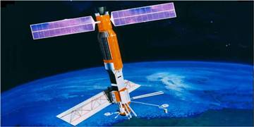
Polar Radiant Energy in the Far InfraRed Experiment (PREFIRE) Satellite 2 Raw Payload R01
National Aeronautics and Space Administration —
Polar Radiant Energy in the Far InfraRed Experiment (PREFIRE) Satellite 2 Raw Payload (PREFIRE_SAT2_0-PAYLOAD) contains the uncurated raw measurements from one of two... -
Federal
NPP Multi-Biome: Global Osnabruck Data, 1937-1981, R1
National Aeronautics and Space Administration —
This data set contains three files. The first file provides net primary productivity (NPP) estimates, vegetation characteristics, and summary climate data for 720... -
Federal
Nimbus-7 SMMR Antenna Temperatures, Version 1
National Aeronautics and Space Administration —
The SMMR Antenna Temperatures (Nimbus-7) data set consists of antenna temperatures from passive microwave radiometers aboard NOAA's Nimbus-7 satellite. The instrument... -
Federal
NASA Water Vapor Project MEaSUREs (NVAP-M) CLIMATE Layered Precipitable Water
National Aeronautics and Space Administration —
NVAP_CLIMATE_Layered-Precipitable-Water data set is designed to provide the most stable water vapor data set over time for use in climate applications. NASA Water... -
Federal
NOAA-20 VIIRS Level-3 Global Mapped Normalized Difference Vegetation Index Data, version R2022.0
National Aeronautics and Space Administration —
The Visible and Infrared Imager/Radiometer Suite (VIIRS) is a multi-disciplinary instrument that is being flown on the Joint Polar Satellite System (JPSS) series of... -
Federal
Sentinel-5P TROPOMI Radiance product band 2 (UV detector) L1B 5.5km x 3.5km V1 (S5P_L1B_RA_BD2_HiR) at GES DISC
National Aeronautics and Space Administration —
Starting from August 6th in 2019, Sentinel-5P TROPOMI along-track high spatial resolution (~5.5km at nadir) has been implemented.For data before August 6th of 2019,... -
Federal
IMAGE RPI Monthly Electron Density Values
National Aeronautics and Space Administration —
The electron density values listed in this file are derived from the IMAGE Radio Plasma Imager (B.W. Reinisch, PI) data using an automatic fitting program written by... -
Federal
2MASS LMC/SMC Calibration Scan Information Table
National Aeronautics and Space Administration —
Photometric calibration for 2MASS was performed using observations of calibration fields made at regular intervals during each night of survey operations.... -
Federal
BeppoSAX High-Energy Large Area Survey (HELLAS) Radio Source Catalog
National Aeronautics and Space Administration —
This table contains results of a complete radio follow-up obtained with the VLA and ATCA radio telescopes down to a 6-cm flux limit of about 0.3 mJy (3-sigma) of all... -
Federal
M 17 Chandra X-Ray Point Source Catalog
National Aeronautics and Space Administration —
This table contains some of the results from a Chandra ACIS observation of the stellar populations in and around the M17 H II region. The field reveals 886 sources... -
Federal
GLIMPSE 3D Epoch 1 Catalog
National Aeronautics and Space Administration —
GLIMPSE3D is the third in a series of large area projects to map selected regions of the Galactic plane using the Spitzer Space Telescope Infrared Array Camera... -
Federal
LIS 0.1 DEGREE VERY HIGH RESOLUTION GRIDDED LIGHTNING ANNUAL CLIMATOLOGY (VHRAC) V1
National Aeronautics and Space Administration —
The LIS 0.1 Degree Very High Resolution Gridded Lightning Annual Climatology (VHRAC) dataset consists of gridded annual climatologies of total lightning flash rates... -
Federal
Chandra Nearby Spiral Galaxies Point Source Catalog
National Aeronautics and Space Administration —
Emission from discrete point sources dominates the X-ray luminosity in spiral galaxies. This table contains the results from a survey of 11 nearby, nearly face-on... -
Federal
M 51 Chandra X-Ray Discrete Source Catalog
National Aeronautics and Space Administration —
This table contains the results of two Chandra observations (separated by 1 year) of the population of X-ray sources in the spiral galaxy M 51 (NGC 5194 and NGC... -
Federal
VIIRS/JPSS2 Day/Night Band 6-Min L1B Swath 750 m V2.1
National Aeronautics and Space Administration —
The VIIRS/JPSS2 Day/Night Band 6-Min L1B Swath 750 m, short-name VJ202DNB, of the Joint Polar-orbiting Satellite System-2 (JPSS-2/NOAA-21; referred to hereafter as...

Official websites use .gov
A
.gov website belongs to an official government
organization in the United States.
Secure .gov websites use HTTPS
A
lock (
) or https:// means you’ve safely connected to
the .gov website. Share sensitive information only on official,
secure websites.