
-
Federal
Genome In A Bottle - v2.0 Genome Stratifications (Deprecated)
Department of Commerce —
These stratification BED files from the Global Alliance for Genomics and Health (GA4GH) Benchmarking Team and the Genome in a Bottle Consortium are intended as a... -
Federal
BOREAS Level-1B MAS Imagery: At-Sensor Radiance, Relative X and Y Coordinates
National Aeronautics and Space Administration —
For BOREAS, the MAS images, along with the other remotely sensed data, were collected to provide spatially-extensive information over the primary study areas. This... -
Federal
SWOT 2019-2020 Prelaunch Oceanography Field Campaign SIO Mooring WireWalker (WW)
National Aeronautics and Space Administration —
This dataset provides the conductivity, temperature and depth (CTD) measurements from the CTD sensors on a WireWalker profiler on a full-depth mooring deployed by the... -
Federal
Sentinel-5P TROPOMI Ozone Profile 1-Orbit L2 30km x 30km V2 (S5P_L2__O3__PR_HiR) at GES DISC
National Aeronautics and Space Administration —
Starting from August 6th in 2019, Sentinel-5P TROPOMI along-track high spatial resolution (~5.5km at nadir) has been implemented. S5P_L2__O3__PR_HiR data collection... -
Federal
Seasonal frost depths, midwestern USA, Version 1
National Aeronautics and Space Administration —
This dataset includes frost tube data from 37 stations in the Upper Midwest (Minnesota, North Dakota, Wisconsin), USA. The responsible agency was the St. Paul... -
Federal
Polar Radiant Energy in the Far InfraRed Experiment (PREFIRE) Satellite 2 Raw Payload R01
National Aeronautics and Space Administration —
Polar Radiant Energy in the Far InfraRed Experiment (PREFIRE) Satellite 2 Raw Payload (PREFIRE_SAT2_0-PAYLOAD) contains the uncurated raw measurements from one of two... -
Federal
MLS/Aura Level 3 Daily Binned Relative Humidity With Respect To Ice (RHI) on Zonal and Similar Grids V004 (ML3DZRHI) at GES DISC
National Aeronautics and Space Administration —
ML3DZRHI is the EOS Aura Microwave Limb Sounder (MLS) daily binned on zonal and assorted vertical grids product for relative humidity with respect to ice (RHI)... -
Federal
GPM PR on TRMM Reflectivity, Precipitation Characteristics and Rate, at Surface and Profile L2 1.5 hours V07 (GPM_2APR) at GES DISC
National Aeronautics and Space Administration —
This is the new, GPM-like, format for TRMM Precipitation Radar L2 data that now incorporates what was known as 2A21, 2A23 and 2A25 datasets.The primary purpose of... -
Federal
GPM PR and TMI on TRMM Combined Convective-Stratiform Latent Heating Profiles L2 1.5 hours 5 km V07 (GPM_2HCSH_TRMM) at GES DISC
National Aeronautics and Space Administration —
This is a new (GPM-formated) TRMM product. The equivalent old TRMM legacy product is TRMM_2H31.Version 07 is the current version of the data set. Older versions will... -
Federal
GPM Ground Validation Weather Research and Forecasting (WRF) Model LPVEx V1
National Aeronautics and Space Administration —
The GPM Ground Validation Weather Research and Forecasting (WRF) Images LPVEx includes model data simulated by the Weather Research and Forecasting (WRF) model for... -
Federal
CAR Clams Chesapeake Lighthouse Aircraft Ocean Measurements L1 V1 (CAR_CLAMS_L1C) at GES DISC
National Aeronautics and Space Administration —
CLAMS is the Chesapeake Lighthouse and Aircraft Measurements for Satellites field campaign sponsored by CERES, MISR, MODIS-Atmospheres and the NASA/GEWEX Global... -
Federal
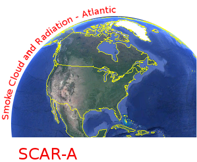
CAR SCAR-A Sulfates, Clouds, and Radiation-Atlantic BRDF Measurements BRDF V2 (CAR_SCARA_BRDF) at GES DISC
National Aeronautics and Space Administration —
The objectives for the SCAR mission are to advance our knowledge of how the physical, chemical and radiative processes in our atmosphere are affected by sulfate... -
Federal
AT Large Area Survey (ATLAS) E-CDF-S 5.5-GHz Components Catalog
National Aeronautics and Space Administration —
Star-forming galaxies are thought to dominate the sub-mJy radio population, but recent work has shown that low-luminosity active galactic nuclei (AGNs) can still make... -
Federal
GLIMPSE 3D Epoch 1 Archive
National Aeronautics and Space Administration —
GLIMPSE3D is the third in a series of large area projects to map selected regions of the Galactic plane using the Spitzer Space Telescope Infrared Array Camera... -
Federal
CGRO/EGRET Third Source Catalog
National Aeronautics and Space Administration —
The Third EGRET Catalog of High-Energy Gamma-Ray Sources is based on data obtained by the Energetic Gamma-Ray Experiment Telescope (EGRET) on board the Compton Gamma-... -
Federal
Americus (AMER) Ground-based Vector Magnetic Field (L2) 0.5 s Data
National Aeronautics and Space Administration —
Americus, KS, Ground-based Vector Magnetic Field Level 2 Data, 0.5 s Time Resolution, Station Code: (AMER), Station Location: (GEO Latitude 38.5, Longitude 263.7),... -
Federal
VIIRS/NPP BRDF/Albedo BSA at Solar Noon Band M4 Daily L3 Global 30ArcSec CMG V001
National Aeronautics and Space Administration —
The VNP43D57 Version 1 data product was decommissioned on July 31, 2025. Users are encouraged to use the VNP43D57 and VJ143D57 Version 2 data products.The NASA/NOAA... -
Federal
VIIRS/JPSS2 Day/Night Band 6-Min L1B Swath SDR 750m NRT
National Aeronautics and Space Administration —
The Near Real Time (NRT) VIIRS Level 1 and Level 2 swath (VJ202DNB_NRT) product is single NASA VIIRS panchromatic Day-Night band (DNB) calibrated radiance product.... -
Federal
Waveglider data for the SPURS-1 N. Atlantic field campaign
National Aeronautics and Space Administration —
The SPURS (Salinity Processes in the Upper Ocean Regional Study) project is an oceanographic process study and associated field program that aim to elucidate key...

Official websites use .gov
A
.gov website belongs to an official government
organization in the United States.
Secure .gov websites use HTTPS
A
lock (
) or https:// means you’ve safely connected to
the .gov website. Share sensitive information only on official,
secure websites.