

326 datasets found
-
Federal
TRMM TMI/PR Combined Precipitation L3 1 month 0.5 degree x 0.5 degree V7 (TRMM_3B31) at GES DISC
National Aeronautics and Space Administration —
This is a combined rainfall product. 3B31 uses the high quality retrievals done for the narrow swath in 2B31 to calibrate the wide swath retrievals generated in 2A12.... -
Federal
AMSR-E/Aqua L2B Global Swath Surface Precipitation GSFC Profiling Algorithm V003
National Aeronautics and Space Administration —
The AMSR-E/Aqua Level-2B precipitation product includes instantaneous surface precipitation rate and type over ice-free/snow-free land and ocean between 89.24 degrees... -
Federal
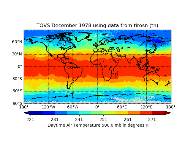
TOVS GLA MONTHLY GRIDS from TIROS-N 02 (TOVSAMTN) at GES DISC
National Aeronautics and Space Administration —
This dataset (TOVSAMTN) contains the TIROS Operational Vertical Sounder (TOVS) level 3 geophysical parameters derived using data from TIROS-N and the physical... -
Federal
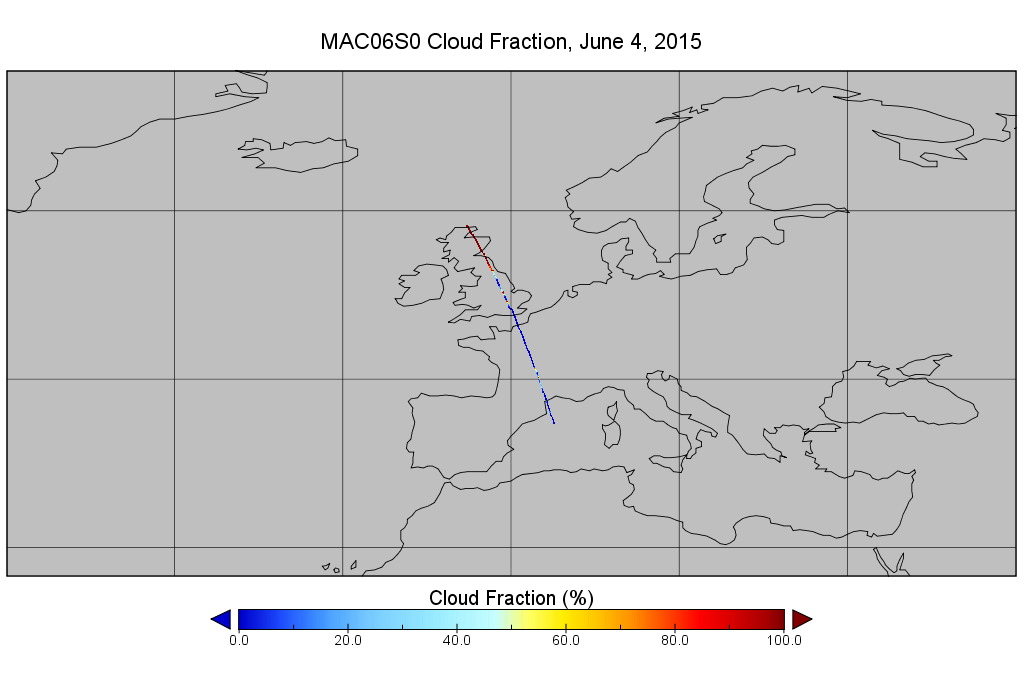
MODIS/Aqua Clouds 1km and 5km 5-Min L2 Narrow Swath Subset along CloudSat V002 (MAC06S0) at GES DISC NGDA
National Aeronautics and Space Administration —
This is the narrow-swath MODIS/Aqua subset along CloudSat field of view track. The goal of the narrow-swath subset is to select and return MODIS data that are within... -
Federal
TRMM Microwave Imager Precipitation Profile L3 1 month 0.5 degree x 0.5 degree V7 (TRMM_3A12) at GES DISC
National Aeronautics and Space Administration —
The new equivalent for this dataset should be searched for as "GPM_3GPROFTRMMTMI_CLIM". This product contains global monthly means of surface precipitation rate, rain... -
Federal
TOVS GLA MONTHLY GRIDS from NOAA-8 02 (TOVSAMNE) at GES DISC
National Aeronautics and Space Administration —
This dataset (TOVSAMNE) contains the TIROS Operational Vertical Sounder (TOVS) level 3 geophysical parameters derived using data from NOAA-8 and the physical...
326 datasets found