
-
Federal
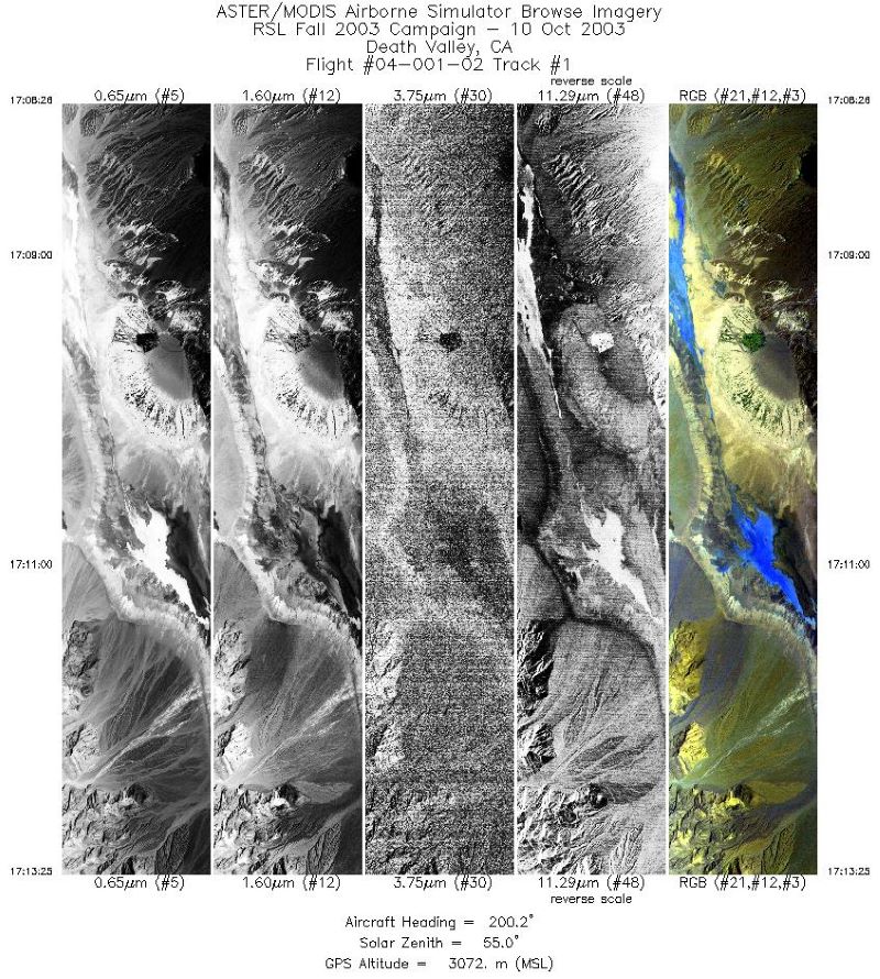
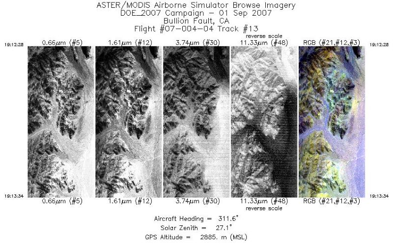
MASTER: Geological fault mapping, California-Nevada, October, 2003
National Aeronautics and Space Administration —
This dataset includes Level 1B (L1B) data products from the MODIS/ASTER Airborne Simulator (MASTER) instrument. The spectral data were collected during six flights... -
Federal
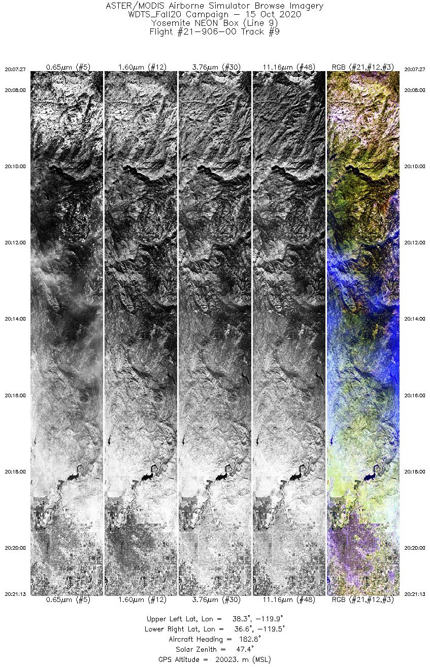
MASTER: Western Diversity Time Series Campaign, WDTS, California, USA, Fall 2020
National Aeronautics and Space Administration —
This dataset includes Level 1B (L1B) and Level 2 (L2) data products from the MODIS/ASTER Airborne Simulator (MASTER) instrument. The spectral data were collected as... -
Federal
MASTER: Tropical Composition, Cloud and Climate Coupling Campaign, 2007
National Aeronautics and Space Administration —
This dataset includes Level 1B (L1B) and Level 2 (L2) data products from the MODIS/ASTER Airborne Simulator (MASTER) instrument. The spectral data were collected... -
Federal
MASTER: Airborne Science, California-Colorado-Central US, 2011
National Aeronautics and Space Administration —
This dataset includes Level 1B (L1B) and Level 2 (L2) data products from the MODIS/ASTER Airborne Simulator (MASTER) instrument. The spectral data were collected... -
Federal
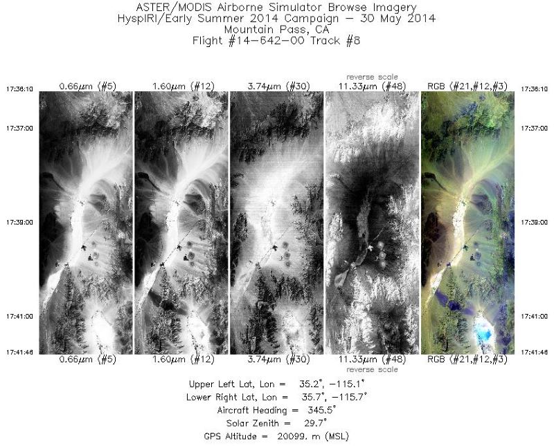
MASTER: HyspIRI Airborne Campaign, California, Late Spring 2014
National Aeronautics and Space Administration —
This dataset includes Level 1B (L1B) and Level 2 (L2) data products from the MODIS/ASTER Airborne Simulator (MASTER) instrument. The spectral data were collected as... -
Federal
MASTER: Airborne Science, California-Nevada, August 2007
National Aeronautics and Space Administration —
This dataset includes Level 1B (L1B) data products from the MODIS/ASTER Airborne Simulator (MASTER) instrument. The spectral data were collected during seven flights... -
Federal
MASTER: Student Airborne Research Program (SARP) Campaign, California, 2009
National Aeronautics and Space Administration —
This dataset includes Level 1B (L1B) data products from the MODIS/ASTER Airborne Simulator (MASTER) instrument collected and developed by the Student Airborne... -
Federal
S-MODE MASS Level 1 Visible Imagery Version 1
National Aeronautics and Space Administration —
This dataset contains airborne visible imagery from the Sub-Mesoscale Ocean Dynamics Experiment (S-MODE) during a pilot campaign conducted approximately 300 km... -
Federal
S-MODE MASS Level 1 LWIR Version 1
National Aeronautics and Space Administration —
NOTICE: This dataset is currently undergoing maintenance to be repackaged as zip files of flight lines. The file count will decrease dramatically when new zip files... -
Federal
Pre-Delta-X: L1 UAVSAR Single Look Complex and Interferograms, MRD, LA, USA, 2016
National Aeronautics and Space Administration —
This Level 1 (L1) dataset includes single look complex (SLC) stack products and co-registered interferograms in the HH (horizontal transmit and horizontal receive)... -
Federal
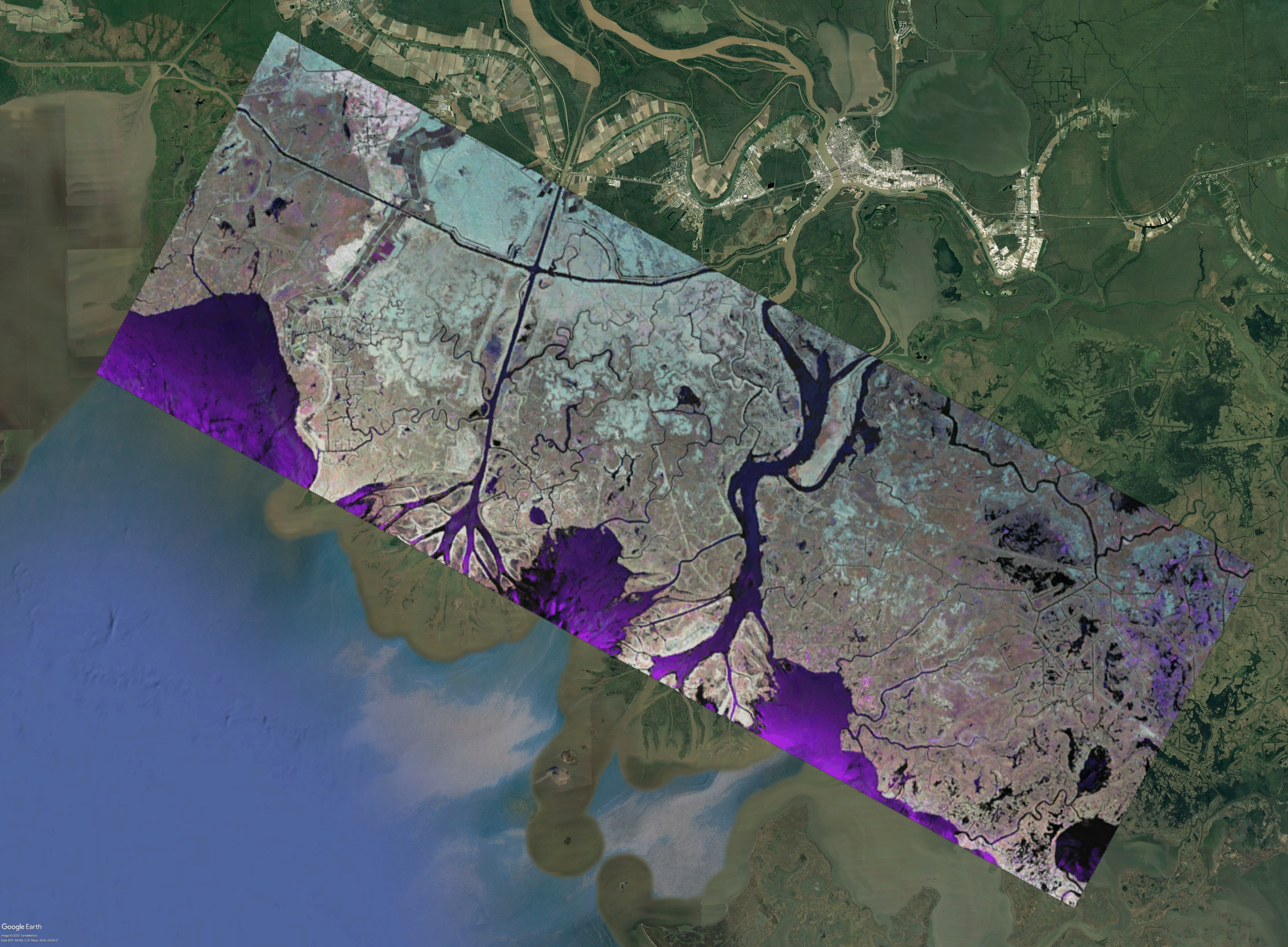
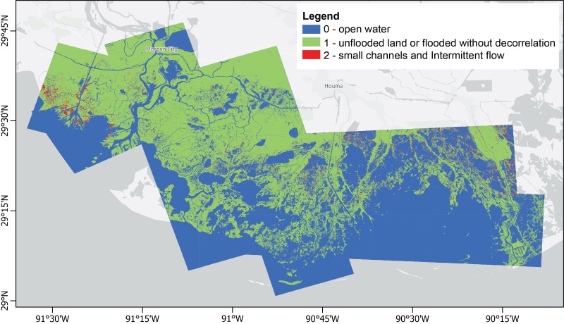
Delta-X: UAVSAR L3 Gridded Open Water Channels, MRD, LA, USA, 2021, V2
National Aeronautics and Space Administration —
This dataset provides gridded estimates of water channels for the Atchafalaya and Terrebonne basins of the Mississippi River Delta in Louisiana, U.S.A. The data show... -
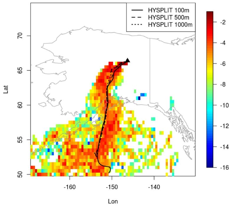
Federal
ABoVE/ASCENDS: Atmospheric Backscattering Coefficient Profiles from CO2 Sounder, 2017
National Aeronautics and Space Administration —
This dataset provides atmospheric backscattering coefficient profiles collected during Active Sensing of CO2 Emissions over Nights, Days, and Seasons (ASCENDS)... -
Federal
ABoVE: Level-4 WRF-STILT Particle Trajectories for Circumpolar Receptors, 2016-2019
National Aeronautics and Space Administration —
This dataset provides Weather Research and Forecasting (WRF) Stochastic Time-Inverted Lagrangian Transport (STILT) particle trajectory files for receptors located at... -
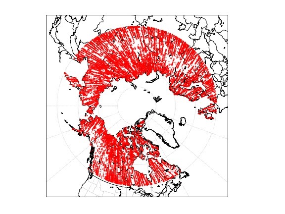
Federal
ABoVE: Level-4 WRF-STILT Footprint Files for Circumpolar Receptors, 2016-2019
National Aeronautics and Space Administration —
This dataset provides Weather Research and Forecasting (WRF) Stochastic Time-Inverted Lagrangian Transport (STILT) Footprint data products for receptors... -
Federal
ATom: Flight Dynamics and Environmental Parameters of the NASA DC-8 Aircraft
National Aeronautics and Space Administration —
This dataset contains flight dynamics and environmental parameters (often referred to as housekeeping) specific to the DC-8 aircraft as collected from an assortment... -
Federal
FIFE CDROM Vol. 3 Contents: NS001 Thematic Mapper Simulator (TMS) Imagery, 1987-1989
National Aeronautics and Space Administration —
This data set provides aircraft-based NS001 Thematic Mapper Simulator (TMS) images of the study area associated with The First ISLSCP (International Satellite Land... -
Federal
Soil Moisture Release Data (FIFE)
National Aeronautics and Space Administration —
This data product was created based on the hypothesis that a variety of ground truth observations of soil moisture could be combined to estimate equal soil moisture... -
Federal
H11546: NOS Hydrographic Survey , Mississippi and Alabama Safety Fairways, Mississippi and Alabama, 2006-12-05
National Oceanic and Atmospheric Administration, Department of Commerce —
The National Oceanic and Atmospheric Administration (NOAA) has the statutory mandate to collect hydrographic data in support of nautical chart compilation for safe... -
Federal
H11209: NOS Hydrographic Survey , Chatham and Sumner Straits, Alaska, 2003-06-27
National Oceanic and Atmospheric Administration, Department of Commerce —
The National Oceanic and Atmospheric Administration (NOAA) has the statutory mandate to collect hydrographic data in support of nautical chart compilation for safe...

Official websites use .gov
A
.gov website belongs to an official government
organization in the United States.
Secure .gov websites use HTTPS
A
lock (
) or https:// means you’ve safely connected to
the .gov website. Share sensitive information only on official,
secure websites.
.jpg)