
-
Federal
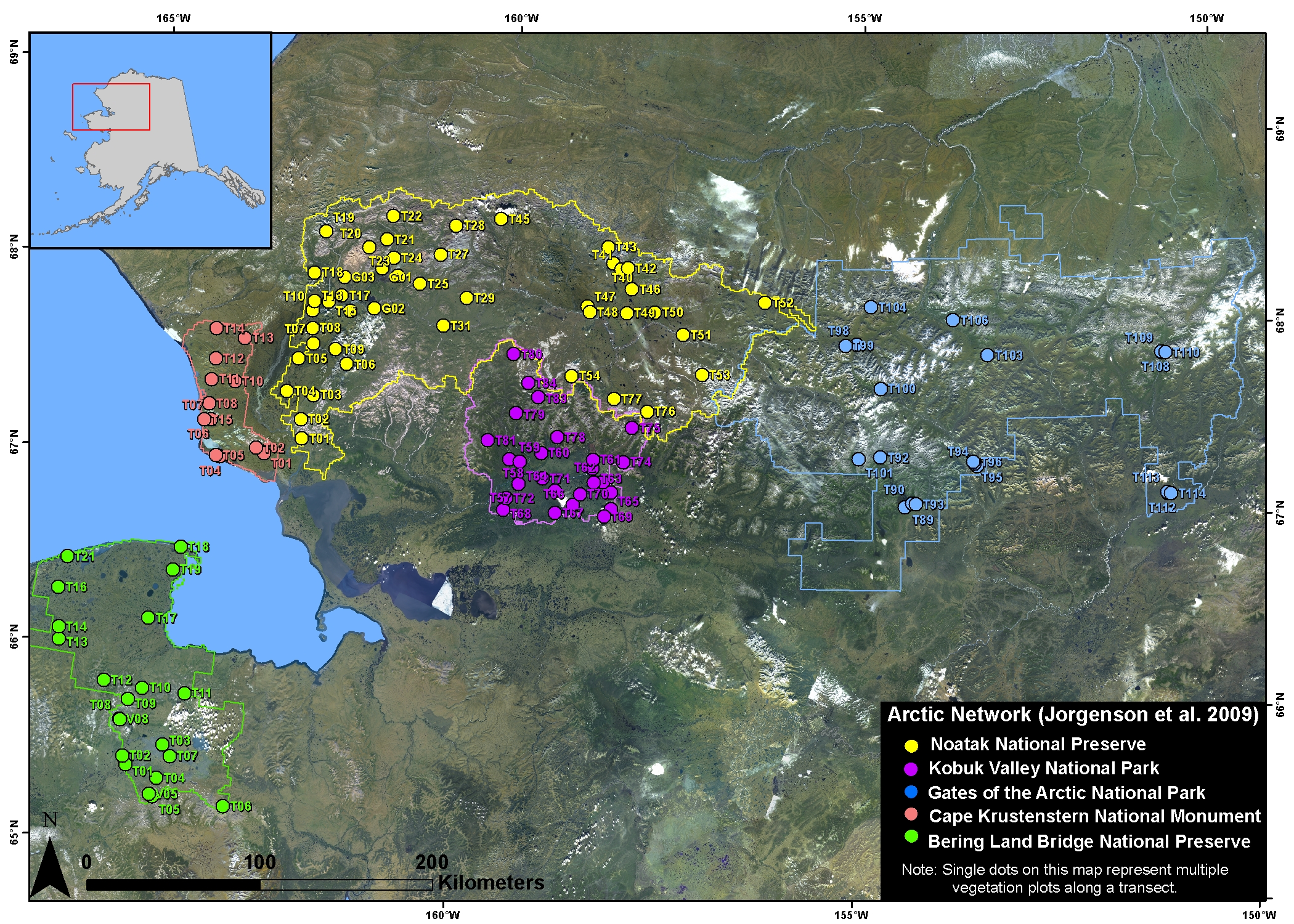
Arctic Vegetation Plots in NPS Arctic Network Parks, Alaska, 2002-2008
National Aeronautics and Space Administration —
This dataset provides environmental, soil, and vegetation data collected at selected locations in the parks and preserves of the National Park Service (NPS) Arctic... -
Federal
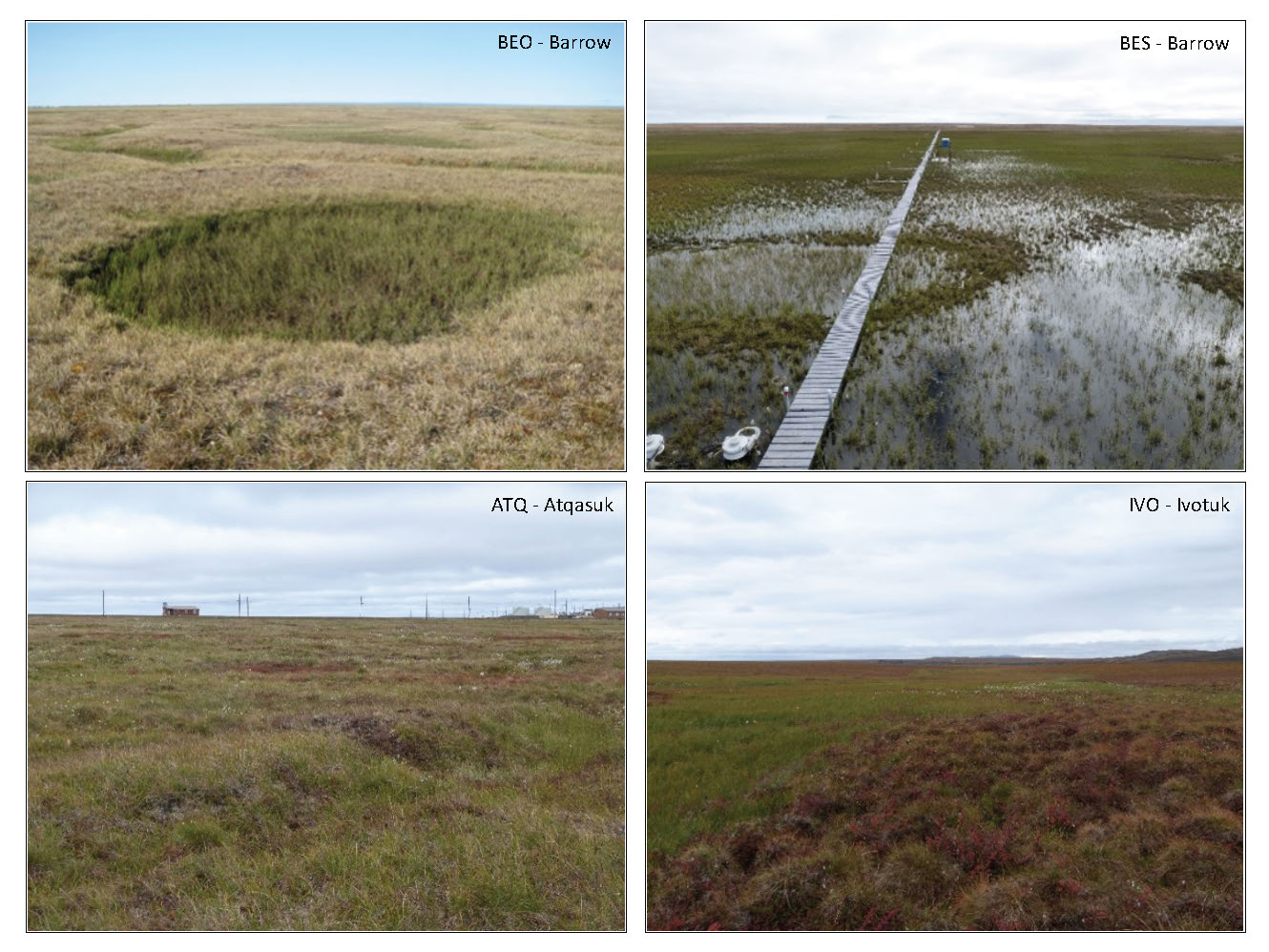
Arctic Vegetation Plots in Flux Tower Footprints, North Slope, Alaska, 2014
National Aeronautics and Space Administration —
This data set provides vegetation, environmental, and soil data collected from plots located in the footprints of eddy covariance flux towers along a 300 km north-... -
Federal
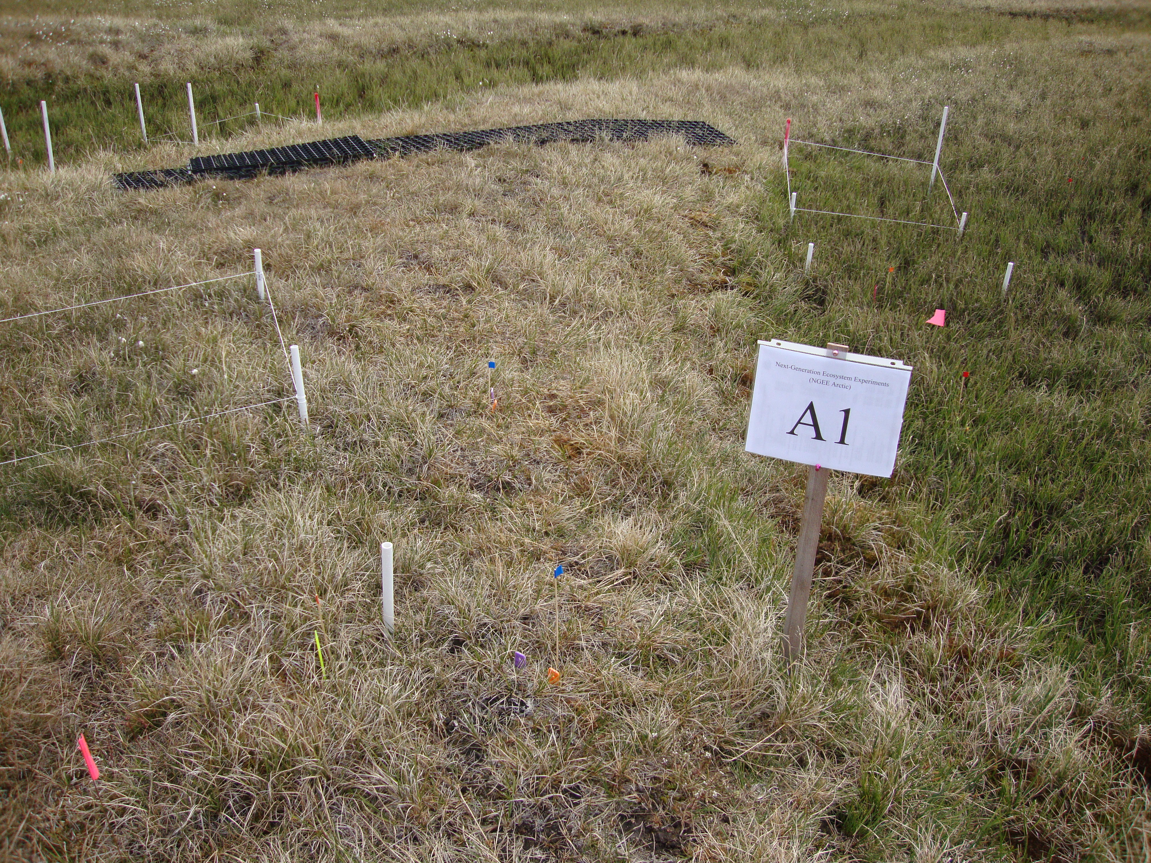
Arctic Vegetation Plots for NGEE-Arctic at Barrow, Alaska, 2012
National Aeronautics and Space Administration —
This data set provides vegetation cover and environmental plot data collected on the Barrow Environmental Observatory (BEO), Barrow, Alaska in 2012. Forty-eight 1 x 1... -
Federal
CAR SKUKUZA BRDF Measurements L1 V2 (CAR_SKUKUZA_BRDF) at GES DISC
National Aeronautics and Space Administration —
CAR mission Skukuza measured bidirectional reflection functions over different natural surfaces and ecosystems in southern Africa. The measurements were conducted to... -
Federal
BOREAS CanSIS Regional Soils Data in Vector Format, V2
National Aeronautics and Space Administration —
This data set contains soils data from the Canada Soil Information System (CanSIS) in ESRI Shapefile format for the provinces of Saskatchewan and Manitoba. They are... -
Federal
CAR Safari BRDF Measurements L1 V2 (CAR_SAFARI_BRDF) at GES DISC
National Aeronautics and Space Administration —
The Southern African Regional Science Initiative (SAFARI) 2000 is an international science field campaign aimed at developing a better understanding of the southern... -
Federal
Arctic Boreal Annual Burned Area, Circumpolar Boreal Forest and Tundra, V2, 2002-2022
National Aeronautics and Space Administration —
This dataset provides annual cumulative end-of-season burned area in circumpolar boreal forests and tundra for the years 2002-2022. The data were generated using the... -
Federal
CRED APEX Drifting Buoy Argos_ID 24963 Data in the NW Hawaiian Islands, 200109-200506 (NODC Accession 0049436)
National Oceanic and Atmospheric Administration, Department of Commerce —
CRED APEX drifter Argos_ID 24963 was deployed in the region of NW Hawaiian Islands to assess ocean currents and sea surface temperature. APEX drifter data files... -
Federal
CRED Cumulative Map of Percent Scleractinian Coral Cover at Pearl and Hermes Atoll, 2002-2004
National Oceanic and Atmospheric Administration, Department of Commerce —
This map displays optical validation observation locations and percent coverage of scleractinian coral overlaid on bathymetry. -
Federal
CRED SVP Drifting Buoy Argos_ID 30147 Data Nihoa, Northwestern Hawaiian Islands, 200209-200501 (NODC Accession 0049436)
National Oceanic and Atmospheric Administration, Department of Commerce —
CRED SVP drifter Argos_ID 30147 was deployed in the region of NW Hawaiian Islands to assess ocean currents and sea surface temperature. SVP drifter data files contain... -
Federal
CRED SVP Drifting Buoy Argos_ID 29100 Data, Guam in the Marianas Archipelago, 200309-200403 (NODC Accession 0067473)
National Oceanic and Atmospheric Administration, Department of Commerce —
CRED SVP drifter Argos_ID 29100 was deployed in the region of Marianas Archipelago to assess ocean currents and sea surface temperature. SVP drifter data files... -
Federal
CRED Cumulative Map of Percent Scleractinian Coral Cover at Guam, 2003
National Oceanic and Atmospheric Administration, Department of Commerce —
This map displays optical validation observation locations and percent coverage of scleractinian coral overlaid on bathymetry. -
Federal
CRED SVP Drifting Buoy Argos_ID 24666 Data in the American Samoa, 200309-200503 (NODC Accession 0067474)
National Oceanic and Atmospheric Administration, Department of Commerce —
CRED SVP drifter Argos_ID 24666 was deployed in the region of American Samoa to assess ocean currents and sea surface temperature. SVP drifter data files contain... -
Federal
CRED SVP Drifting Buoy Argos_ID 35647 Data Tutuila, American Samoa, 200202-200307 (NODC Accession 0067474)
National Oceanic and Atmospheric Administration, Department of Commerce —
CRED SVP drifter Argos_ID 35647 was deployed in the region of American Samoa to assess ocean currents and sea surface temperature. SVP drifter data files contain... -
Federal
CRED SVP Drifting Buoy Argos_ID 30350 Data near Laysan Island in the NW Hawaiian Islands, 200209-200412 (NODC Accession 0049436)
National Oceanic and Atmospheric Administration, Department of Commerce —
CRED SVP drifter Argos_ID 30350 was deployed in the region of NW Hawaiian Islands to assess ocean currents and sea surface temperature. SVP drifter data files contain... -
Federal
CRED SVP Drifting Buoy Argos_ID 24953 Data at Laysan/Pioneer Bank in the NW Hawaiian Islands, 200110-200504 (NODC Accession 0049436)
National Oceanic and Atmospheric Administration, Department of Commerce —
CRED SVP drifter Argos_ID 24953 was deployed in the region of NW Hawaiian Islands to assess ocean currents and sea surface temperature. SVP drifter data files contain... -
Federal
CRED SVP Drifting Buoy Argos_ID 44770 Data, NW Tutuila in the American Samoa, 200402-200503 (NODC Accession 0067474)
National Oceanic and Atmospheric Administration, Department of Commerce —
CRED SVP drifter Argos_ID 44770 was deployed in the region of American Samoa to assess ocean currents and sea surface temperature. SVP drifter data files contain... -
Federal
CRED SVP Drifting Buoy Argos_ID 24946 Data, north of Niihau, in the NW Hawaiian Islands, 200110-200209 (NODC Accession 0049436)
National Oceanic and Atmospheric Administration, Department of Commerce —
CRED SVP drifter Argos_ID 24946 was deployed in the region of NW Hawaiian Islands to assess ocean currents and sea surface temperature. SVP drifter data files contain... -
Federal
CRED Cumulative Map of Percent Scleractinian Coral Cover at Baker Island, 2002-2004
National Oceanic and Atmospheric Administration, Department of Commerce —
This map displays optical validation observation locations and percent coverage of scleractinian coral overlaid on bathymetry. -
Federal
CRED SVP Drifting Buoy Argos_ID 24755 Data, 5nm West of Tutuila in American Samoa, 200307-200501 (NODC Accession 0067474)
National Oceanic and Atmospheric Administration, Department of Commerce —
CRED SVP drifter Argos_ID 24755 was deployed in the region of American Samoa to assess ocean currents and sea surface temperature. SVP drifter data files contain...

Official websites use .gov
A
.gov website belongs to an official government
organization in the United States.
Secure .gov websites use HTTPS
A
lock (
) or https:// means you’ve safely connected to
the .gov website. Share sensitive information only on official,
secure websites.