
-
Federal
unit_191-20150711T2000
National Oceanic and Atmospheric Administration, Department of Commerce —
Shipboard observations of marine mammal distribution and habitat are expensive and logistically challenging to collect in Arctic waters. Port facilities are minimal... -
Federal
SG663-20240710T1312
National Oceanic and Atmospheric Administration, Department of Commerce —
Underwater glider data gathered by the National Oceanic and Atmospheric Administration (NOAA) in partnership with several national and international institutions.... -
Federal
unit_595-20170713T1730-delayed
National Oceanic and Atmospheric Administration, Department of Commerce —
Shipboard observations of marine mammal distribution and habitat are expensive and logistically challenging to collect in Arctic waters. Port facilities are minimal... -
Federal
unit_191-20150105T1443
National Oceanic and Atmospheric Administration, Department of Commerce —
The purpose of this glider mission is to do along canyon transects of Palmer Deep within the operating CODAR fields off of Anvers Island. This multi-platform field... -
Federal
unit_4-20140910T1800
National Oceanic and Atmospheric Administration, Department of Commerce —
Shipboard observations of marine mammal distribution and habitat are expensive and logistically challenging to collect in Arctic waters. Port facilities are minimal... -
Federal
SG630-20240713T1103
National Oceanic and Atmospheric Administration, Department of Commerce —
Underwater glider data gathered by the National Oceanic and Atmospheric Administration (NOAA) in partnership with several national and international institutions.... -
Federal
J04 CTD Buoy Sensor 2m, 17m, 25m (Machias Bay)
National Oceanic and Atmospheric Administration, Department of Commerce —
Ocean observation data from the Northeastern Regional Association of Coastal & Ocean Observing Systems (NERACOOS). The NERACOOS region includes the northeast... -
Federal
SNAPPER CREEK NO.5 ABV WATER PIPE NR S. MIAMI, FL (USGS 254157080213800)
National Oceanic and Atmospheric Administration, Department of Commerce —
Timeseries data from 'SNAPPER CREEK NO.5 ABV WATER PIPE NR S. MIAMI, FL (USGS 254157080213800)' (gov_usgs_nwis_254157080213800) -
Federal
H01475A: NOS Hydrographic Survey
National Oceanic and Atmospheric Administration, Department of Commerce —
The National Oceanic and Atmospheric Administration (NOAA) has the statutory mandate to collect hydrographic data in support of nautical chart compilation for safe... -
Federal
H10812: NOS Hydrographic Survey , Lynn Canal, Alaska, 1998-06-20
National Oceanic and Atmospheric Administration, Department of Commerce —
The National Oceanic and Atmospheric Administration (NOAA) has the statutory mandate to collect hydrographic data in support of nautical chart compilation for safe... -
Federal
H10038: NOS Hydrographic Survey , Orca Inlet, Alaska, 1982-09-08
National Oceanic and Atmospheric Administration, Department of Commerce —
The National Oceanic and Atmospheric Administration (NOAA) has the statutory mandate to collect hydrographic data in support of nautical chart compilation for safe... -
Federal
CDDIS MEaSUREs SESES products Weekly Coseismic Offset Time Series
National Aeronautics and Space Administration —
Making Earth System Data Records for Use in Research Environments (MEaSUREs) empowers the research community to participate in developing and generating data products... -
Federal
VIIRS/NPP Thermal Anomalies/Fire 6-Min L2 Swath 750m V002
National Aeronautics and Space Administration —
The Visible Infrared Imaging Radiometer Suite (VIIRS) Thermal Anomalies (VNP14) Version 2 product is produced in 6-minute temporal satellite increments (swaths) at... -
Federal
VIIRS/NPP BRDF/Albedo Parameter 1 Band M5 Daily L3 Global 30 ArcSec CMG V002
National Aeronautics and Space Administration —
The NASA/NOAA Suomi National Polar-orbiting Partnership (Suomi NPP) Visible Infrared Imaging Radiometer Suite (VIIRS) Bidirectional Reflectance Distribution Function... -
Federal
VIIRS/NPP BRDF/Albedo Parameter 2 Band M10 Daily L3 Global 30 ArcSec CMG V002
National Aeronautics and Space Administration —
The NASA/NOAA Suomi National Polar-orbiting Partnership (Suomi NPP) Visible Infrared Imaging Radiometer Suite (VIIRS) Bidirectional Reflectance Distribution Function... -
Federal
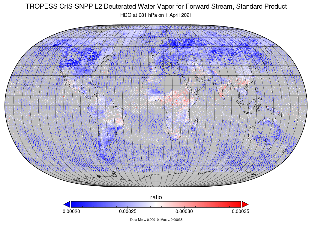
TROPESS CrIS-SNPP L2 Deuterated Water Vapor for Forward Stream, Standard Product V1 (TRPSDL2HDOCRSFS) at GES DISC
National Aeronautics and Space Administration —
The TROPESS CrIS-SNPP L2 Deuterated Water Vapor for Forward Stream, Standard Product contains the vertical distribution of the retrieved atmospheric state of semi-... -
Federal
H11082: NOS Hydrographic Survey , Mobile Bay Entrance Artificial Reef, Alabama, 2002-09-21
National Oceanic and Atmospheric Administration, Department of Commerce —
The National Oceanic and Atmospheric Administration (NOAA) has the statutory mandate to collect hydrographic data in support of nautical chart compilation for safe... -
Federal
H01765: NOS Hydrographic Survey
National Oceanic and Atmospheric Administration, Department of Commerce —
The National Oceanic and Atmospheric Administration (NOAA) has the statutory mandate to collect hydrographic data in support of nautical chart compilation for safe... -
Federal
H00078: NOS Hydrographic Survey , 1838-12-31
National Oceanic and Atmospheric Administration, Department of Commerce —
The National Oceanic and Atmospheric Administration (NOAA) has the statutory mandate to collect hydrographic data in support of nautical chart compilation for safe... -
Federal
H00101: NOS Hydrographic Survey , 1840-12-31
National Oceanic and Atmospheric Administration, Department of Commerce —
The National Oceanic and Atmospheric Administration (NOAA) has the statutory mandate to collect hydrographic data in support of nautical chart compilation for safe...

Official websites use .gov
A
.gov website belongs to an official government
organization in the United States.
Secure .gov websites use HTTPS
A
lock (
) or https:// means you’ve safely connected to
the .gov website. Share sensitive information only on official,
secure websites.