

256 datasets found for "Confined Animal Operations"
-
Federal
Vulnerability of shallow ground water and drinking-water wells to nitrate in the United States: Model of predicted nitrate concentration in U.S. ground water used for drinking (simulation depth 50 meters) -- Input data set for fresh surface water withdrawal (gwava-dw_swus)
Department of the Interior —
This data set represents the amount of fresh surface water withdrawal for irrigation, in megaliters per day, in the conterminous United States. The data set was used... -
Federal
Radar Image Data from the Ivanpah Solar Electric Generating System (ISEGS) Facility Recorded by the USGS during Spring and Fall 2014
Department of the Interior —
In this observational pilot study, we worked at the largest existing solar tower facility in the world (Ivanpah Solar Electric Generating System - ISEGS) to assess... -
Federal
EK80 Water Column Sonar Data Collected During PC2406_Leg1
National Oceanic and Atmospheric Administration, Department of Commerce —
The Ecosystem Monitoring surveys contribute to stock assessments, protected species assessments, ecosystem assessments, and climate assessments. As such, the surveys... -
Federal
BIA OJS District IV
Department of the Interior —
The mission of the Office of Justice Services (OJS) is to uphold Tribal sovereignty and provide for the safety of Indian communities by ensuring the protection of... -
Federal
BIA OJS District VII
Department of the Interior —
The mission of the Office of Justice Services (OJS) is to uphold Tribal sovereignty and provide for the safety of Indian communities by ensuring the protection of... -
Federal
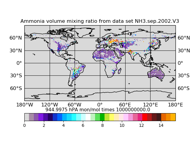
Atmospheric Composition Ammonia Volume Mixing Ratio L3 (AIRSAC3MNH3 V3) from AIRS/AMSU on NASA Aqua at GES DISC
National Aeronautics and Space Administration —
The mass concentration ammonia in the atmosphere, consists of products generated for the study of atmospheric ammonia. Atmospheric ammonia is an important component... -
Federal
Vulnerability of shallow ground water and drinking-water wells to nitrate in the United States: Model of predicted nitrate concentration in U.S. ground water used for drinking (simulation depth 50 meters) -- Input data set for semiconsolidated sand aquifers (gwava-dw_semc)
Department of the Interior —
This data set represents the presence or absence of semiconsolidated sand aquifers in the conterminous United States. The data set was used as an input data layer for... -
Federal
Vulnerability of shallow ground water and drinking-water wells to nitrate in the United States: Model of predicted nitrate concentration in shallow, recently recharged ground water -- Input data set for confined manure (gwava-s_conf)
Department of the Interior —
This data set represents the average annual nitrogen input from confined animal manure, 1992 and 1997, in kilograms per hectare, in the conterminous United States.... -
Federal
Application of manure nitrogen generated at cattle animal feeding operations to nearby farmland within the Pacific drainages of the United States (2012)
Department of the Interior —
The U.S. Geological Survey (USGS) is developing SPARROW models (SPAtially Related Regressions On Watershed Attributes) to assess the transport of contaminants (e.g.,... -
Federal
MODFLOW-2005 and MODPATH models in support of groundwater flow model investigation of water resources at Chaco Culture National Historical Park
Department of the Interior —
Situated in a remote corner of northwestern New Mexico, Chaco Culture National Historical Park (CCNHP) was once the center of a sophisticated social, political and... -
Federal
Application of manure phosphorus generated at cattle animal feeding operations to nearby farmland within the Pacific drainages of the United States (2012)
Department of the Interior —
The U.S. Geological Survey (USGS) is developing SPARROW models (SPAtially Related Regressions On Watershed Attributes) to assess the transport of contaminants (e.g.,... -
Federal
Vulnerability of shallow ground water and drinking-water wells to nitrate in the United States: Model of predicted nitrate concentration in shallow, recently recharged ground water -- Input data set for glacial till (gwava-s_gtil)
Department of the Interior —
This data set represents the presence or absence of poorly sorted glacial till east of the Rocky Mountains in the conterminous United States. The data set was used as... -
Federal
Characteristics of Bacteria and Water Quality along the Buffalo National River 2017-2018
Department of the Interior —
A National Park Service Partnership Program project was conducted in 2017 - 2019 on water quality parameters up-stream and downstream of a confined animal feeding... -
Federal
Count of Sockeye Salmon (Oncorhynchus nerka), River Temperature, and River Height in the Pilgrim River, Nome, Alaska, 2003-2014
Department of the Interior —
The dataset is the daily count of Sockeye Salmon (Oncorhynchus nerka) passing through a fish counting weir on the Pilgrim River from 2003 to 2014. Also, included in... -
Federal
Warming Tolerances for 34 Species of Anurans Native to the Southeast United States
Department of the Interior —
Identifying how close species are to their current upper thermal limits estimates species sensitivity to climate change (or the species ability to persist in place... -
Federal
Vulnerability of shallow ground water and drinking-water wells to nitrate in the United States: Model of predicted nitrate concentration in shallow, recently recharged ground water -- Input data set for irrigation tailwater recovery (gwava-s_twre)
Department of the Interior —
This data set represents the area of National Resources Inventory irrigation system, tailwater recovery conservation practice, in square kilometers, in the...
256 datasets found for "Confined Animal Operations"