
-
Federal
BOREAS Follow-On HMet-01 Merged SSM/I and Rain Gauge Precipitation Data
National Aeronautics and Space Administration —
A gridded data set has been assembled over the BOREAS hydro-meteorological study region that combines a precipitation data set based on a rain gauge network with... -
Federal
BOREAS TF-03 Automated Chamber CO2 Flux Data from the NSA-OBS
National Aeronautics and Space Administration —
The BOREAS TF-03 and TGB-01 teams collected automated CO2 chamber flux data in their efforts to fully describe the CO2flux at the NSA-OBS site. This data set contains... -
Federal
BOREAS TE-05 Soil Respiration Data
National Aeronautics and Space Administration —
The BOREAS group TE-05 collected measurements in the NSA and SSA on gas exchange, gas composition and tree growth. Soil respiration data collected in the BOREAS NSA... -
Federal
BOREAS Daedalus TMS Level-0 Imagery: Digital Counts in BIL Format
National Aeronautics and Space Administration —
The level-0 Daedalus TMS imagery, along with the other remotely sensed images, was collected to provide spatially extensive information about radiant energy over the... -
Federal
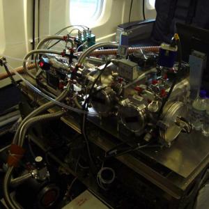
ATom: L2 In Situ Peroxyacetyl Nitrate (PAN) Measurements from Georgia Tech CIMS
National Aeronautics and Space Administration —
This dataset provides measurements of two important components of photochemical smog - peroxyacetyl nitrate (PAN) and peroxyl propionyl nitrate (PPN)- measured by the... -
Federal
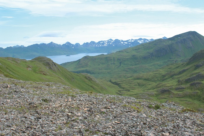
Arctic Vegetation Plots on Unalaska Island, Aleutian Islands, Alaska, 2007
National Aeronautics and Space Administration —
This data set provides environmental, soil, and vegetation data collected during August 2007 from 69 study plots at the Unalaska Island research site, and one plot on... -
Federal
BOREAS/SRC AMS Suite B Surface Meteorological and Radiation Data: 1994
National Aeronautics and Space Administration —
The Saskatchewan Research Council (SRC) collected surface meteorological and radiation data from December, 1993 until Decemb er 1996. The data set is comprised of the... -
Federal
BOREAS Level-1B TIMS Imagery: At Sensor Radiance in BSQ Format
National Aeronautics and Space Administration —
The BOREAS Staff Science Aircraft Data Acquisition Program focused on providing the research teams with the remotely sensed satellite data products they needed to... -
Federal
BOREAS Landsat TM Level-3b Imagery: At-Sensor Radiance in BSQ Format
National Aeronautics and Space Administration —
For BOREAS, the level-3b Landsat TM data, along with the other remotely sensed images, were collected in order to provide spatially extensive information over the... -
Federal
BOREAS HYD-04 Areal Snow Course Survey Data
National Aeronautics and Space Administration —
The BOREAS HYD-04 work was focused on collecting data during the winter field campaign (FFC-W) to improve the understanding of winter processes within the boreal... -
Federal
JERS-1 Synthetic Aperture Radar, 100-m Mosaics, South America: 1995-1996, R1
National Aeronautics and Space Administration —
This data set provides ~100-m resolution image mosaics of South America acquired during the low flood season between September and December 1995 and during the high... -
Federal
ISLSCP II Globalview: Atmospheric CO2 Concentrations
National Aeronautics and Space Administration —
The GlobalView Carbon Dioxide (CO2) data product contains synchronized and smoothed time series of atmospheric CO2 concentrations at selected sites that were created... -
Federal
AVIRIS-Classic: L1B Calibrated Radiance, Facility Instrument Collection, V1
National Aeronautics and Space Administration —
This dataset contains Level 1B (L1B) orthocorrected, scaled radiance image files as well as files of observational geometry and illumination parameters and supporting... -
Federal
ACT-America: L1 Raw, Uncalibrated In-Situ CO2, CO, and CH4 Mole Fractions from Towers
National Aeronautics and Space Administration —
This dataset provides Level 1 (L1) in situ atmospheric carbon dioxide (CO2), carbon monoxide (CO), and methane (CH4) concentrations as measured on a network of... -
Federal
Arctic Boreal Annual Burned Area, Circumpolar Boreal Forest and Tundra, V2, 2002-2022
National Aeronautics and Space Administration —
This dataset provides annual cumulative end-of-season burned area in circumpolar boreal forests and tundra for the years 2002-2022. The data were generated using the... -
Federal
BOREAS TF-08 NSA-OJP Tower Flux, Meteorological, and Soil Temperature Data
National Aeronautics and Space Administration —
The BOREAS TF-08 team collected energy, CO2, and water vapor flux data at the BOREAS NSA-OJP site during the growing season of 1994 and most of the year for 1996.

Official websites use .gov
A
.gov website belongs to an official government
organization in the United States.
Secure .gov websites use HTTPS
A
lock (
) or https:// means you’ve safely connected to
the .gov website. Share sensitive information only on official,
secure websites.