
-
Federal
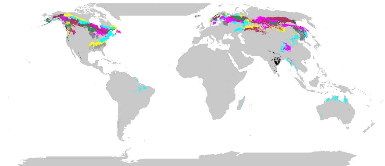
GLIMS Glacier Database, Version 1
National Aeronautics and Space Administration —
Global Land Ice Measurements from Space (GLIMS) is an international initiative with the goal of repeatedly surveying the world's estimated 200,000 glaciers. GLIMS... -
Federal
IPAB Antarctic Drifting Buoy Data, Version 1
National Aeronautics and Space Administration —
Through participating research organizations in various countries, the World Climate Research Programme's (WCRP) International Programme for Antarctic Buoys (IPAB)... -
Federal
LiDAR-based Biomass Estimates, Boreal Forest Biome, Eurasia, 2005-2006
National Aeronautics and Space Administration —
This data set provides estimates of aboveground biomass (AGB) for defined land cover types within World Wildlife Fund (WWF) ecoregions across the boreal biome of... -
Federal
MODIS/Aqua Calibrated Radiances 5-Min L1B Swath 500m
National Aeronautics and Space Administration —
The MODIS/Aqua Calibrated Radiances 5Min L1B Swath 500m data set contains calibrated and geolocated at-aperture radiances for 7 discrete bands located in the 0.45 to... -
Federal
MODIS/Aqua Calibrated Radiances 5-Min L1B Swath 1km
National Aeronautics and Space Administration —
The MODIS/Aqua Calibrated Radiances 5Min L1B Swath 1km data set contains calibrated and geolocated at-aperture radiances for 36 discrete bands located in the 0.4 to... -
Federal
Rarotonga 1 arc-second Coastal Digital Elevation Model
National Oceanic and Atmospheric Administration, Department of Commerce —
NOAA's National Centers for Environmental Information is building high-resolution digital elevation models (DEMs) for select U.S. coastal regions. These integrated... -
Federal
Randolph Glacier Inventory - A Dataset of Global Glacier Outlines, Version 7
National Aeronautics and Space Administration —
The Randolph Glacier Inventory (RGI) is a global set of glacier outlines intended as a snapshot of the world’s glaciers outside of ice sheets. It provides a single... -
Federal
Society Islands (Leeward), French Polynesia Digital Elevation Model - 1 arc-second
National Oceanic and Atmospheric Administration, Department of Commerce —
NOAA's National Centers for Environmental Information is building high-resolution digital elevation models (DEMs) for select U.S. coastal regions. These integrated... -
Federal
Phenoregions For Monitoring Vegetation Responses to Climate Change
National Aeronautics and Space Administration —
The overall purpose in this research was to identify the regions of the world best suited for long-term monitoring of biospheric responses to climate change, i.e.... -
Federal
2014 Environmental Performance Index (EPI)
National Aeronautics and Space Administration —
The 2014 Environmental Performance Index (EPI) ranks 178 countries on 20 performance indicators in the following 9 policy categories: health impacts, air quality,... -
Federal
PhenoCam Dataset v3.0: Vegetation Phenology from Digital Camera Imagery, 2000-2023
National Aeronautics and Space Administration —
This dataset provides vegetation phenological observations for 738 sites across diverse ecosystems of the world (mostly North America) from 2000 to 2023. The... -
Federal
Global Flood Proportional Economic Loss Risk Deciles
National Aeronautics and Space Administration —
The Global Flood Proportional Economic Loss Risk Deciles is a 2.5 minute grid of flood hazard economic loss as proportions of Gross Domestic Product (GDP) per... -
Federal
Bar Harbor, Maine 1/3 Arc-second MHW Coastal Digital Elevation Model
National Oceanic and Atmospheric Administration, Department of Commerce —
NOAA's National Geophysical Data Center (NGDC) is building high-resolution digital elevation models (DEMs) for select U.S. coastal regions. These integrated... -
Federal
Panama City, Florida 1/3 arc-second NAVD 88 Coastal Digital Elevation Model
National Oceanic and Atmospheric Administration, Department of Commerce —
NOAA's National Geophysical Data Center (NGDC) is building high-resolution digital elevation models (DEMs) for select U.S. coastal regions in the Gulf of Mexico.... -
Federal
Marine Trackline Geophysical Database for M77 Data NGDA
National Oceanic and Atmospheric Administration, Department of Commerce —
Marine Trackline Geophysical data represented by the M77 tag are inclusive of singlebeam bathymetry, marine magnetic, and gravity data and were collected during... -
Federal
Midway Atoll 3 arc-second MHW Coastal Digital Elevation Model
National Oceanic and Atmospheric Administration, Department of Commerce —
NOAA's National Geophysical Data Center (NGDC) is building high-resolution digital elevation models (DEMs) for select U.S. coastal regions. These integrated... -
Federal
Ocean City, Maryland 1/3 arc-second MHW Coastal Digital Elevation Model
National Oceanic and Atmospheric Administration, Department of Commerce —
NOAA's National Geophysical Data Center (NGDC) is building high-resolution digital elevation models (DEMs) for select U.S. coastal regions. These integrated... -
Federal
Port Alberni, Canada 1/3 arc-second NAVD 88 Coastal Digital Elevation Model
National Oceanic and Atmospheric Administration, Department of Commerce —
NOAA's National Centers for Environmental Information is building high-resolution digital elevation models (DEMs) for select U.S. coastal regions. These integrated... -
Federal
Global Landslide Mortality Risks and Distribution
National Aeronautics and Space Administration —
The Global Landslide Mortality Risks and Distribution is a 2.5 minute grid of global landslide mortality risks. Gridded Population of the World, Version 3 (GPWv3)... -
Federal
West Africa Coastal Vulnerability Mapping: GPW Version 4 Population Density, Preliminary Release 1, 2010
National Aeronautics and Space Administration —
The West Africa Coastal Vulnerability Mapping: GPW Version 4 Population Density, Preliminary Release 1, 2010, represents the number of persons per square kilometer,...

Official websites use .gov
A
.gov website belongs to an official government
organization in the United States.
Secure .gov websites use HTTPS
A
lock (
) or https:// means you’ve safely connected to
the .gov website. Share sensitive information only on official,
secure websites.