
-
County
Housing Market Value Analysis - Allegheny County Economic Development
Allegheny County / City of Pittsburgh / Western PA Regional Data Center —
In 2017, the County Department of Economic Development, in conjunction with Reinvestment Fund, completed the 2016 Market Value Analysis (MVA) for Allegheny County. A... -
Federal
Ag and Food Statistics: Charting the Essentials
Department of Agriculture —
A collection of over 75 charts and maps presenting key statistics on the farm sector, food spending and prices, food security, rural communities, the interaction of... -
Federal
NASA-SSH IOD Sea Surface Height Indicator
National Aeronautics and Space Administration —
This file contains an indicator for the Indian Ocean Dipole (IOD), based on satellite observations of sea surface height anomaly, measured by radar altimeter missions... -
Federal
LBA-ECO ND-07 Carbon and Nitrogen in Cerrado Plants and Soils, Brasilia: 1999-2000
National Aeronautics and Space Administration —
This data set provides (1) delta 15N ratios and nitrogen concentrations for foliar samples and (2) delta 13C and delta 15N ratios as well as carbon and nitrogen... -
Federal
LBA-ECO ND-07 Nitric Oxide Flux from Cerrado Soils, Brasilia, Brazil: 2004
National Aeronautics and Space Administration —
This data set reports the results of soil nitric oxide (NO) flux, soil moisture, and soil nitrate (NO3) and ammonium (NH4) concentration measurements on Cerrado soils... -
Federal
NPP Multi-Biome: Summary Data from Intensive Studies at 125 Sites, 1936-2006
National Aeronautics and Space Administration —
This data set, NPP Multi-Biome: Summary Data from Intensive Studies at 125 Sites, 1936-2006, contains a single shapefile that provides site-level summary statistics... -
Federal
PhenoCam Dataset v2.0: Vegetation Phenology from Digital Camera Imagery, 2000-2018
National Aeronautics and Space Administration —
This data set provides a time series of vegetation phenological observations for 393 sites across diverse ecosystems of the world (mostly North America) from... -
Federal
NASA-SSH ENSO Sea Surface Height Indicator
National Aeronautics and Space Administration —
This file contains an indicator for the El Nino-Southern Oscillation (ENSO), based on satellite observations of sea surface height anomaly, measured by radar... -
Federal
Aircraft Flux-Filtered: U of Wy. (FIFE)
National Aeronautics and Space Administration —
The University of Wyoming (UW) King Air atmospheric boundary layer measurement missions were flown in 1987 during IFCs 3 and 4. This Boundary Layer Fluxes data set... -
Federal
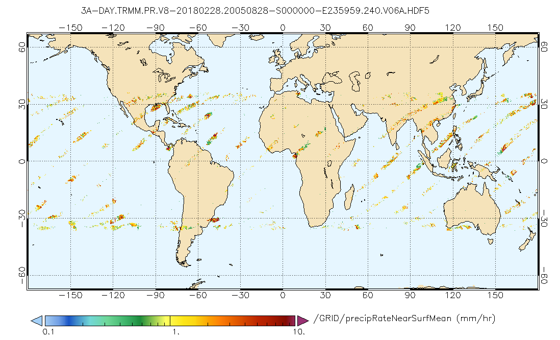
GPM PR on TRMM Precipitation Statistics, at Surface and Fixed Heights 1 day 0.25x0.25 degree V07 (GPM_3PRD) at GES DISC
National Aeronautics and Space Administration —
This a new (GPM-formated) TRMM product. There is no equivalent in the old TRMM suite of products.Version 07 is the current version of the data set. Older versions... -
Federal
Effects of as-built surface with varying number of contour passes on high-cycle fatigue behavior of additively manufactured nickel alloy 718
National Institute of Standards and Technology —
Abstract (from the manuscript): High cycle fatigue life of laser-powder bed fusion (L-PBF) parts depends on several factors; as-built surfaces, when present, are a... -
Federal
OMI/Aura and MODIS/Aqua Merged Cloud Product 1-Orbit L2 Swath 13x24 km V003 (OMMYDCLD) at GES DISC NGDA
National Aeronautics and Space Administration —
The OMI/Aura and MODIS/Aqua Merged Cloud Product 1-Orbit L2 Swath 13x24 km (OMMYDCLD) is a Level-2 orbital product that combines cloud parameters retrieved by the... -
Federal
SBUV2/NOAA-11 Ozone (O3) Profile and Total Column Ozone 1 Month Zonal Mean L3 Global 5.0 degree Latitude Zones V1 (SBUV2N11L3zm) at GES DISC
National Aeronautics and Space Administration —
The Solar Backscattered Ultraviolet (SBUV) from NOAA-11 Level-3 monthly zonal mean (MZM) product (SBUV2N11L3zm) is derived from the Level-2 retrieved ozone profiles.... -
Federal
Characterization data on the effects of micro-computed tomography-based x-ray radiation on vinyl nitrile foam
National Institute of Standards and Technology —
This dataset contains information from investigating the effects of micro-computed tomographic imaging irradiation on vinyl nitrile foam and code for a finite element... -
Federal
Spatio-temporal Characteristics of Rainfall in Africa, 0.25 degrees, from 1998-2012
National Aeronautics and Space Administration —
This data set describes rainfall distribution statistics over the African continent, including Madagascar. The rainfall estimates are based on data from the NASA... -
Federal
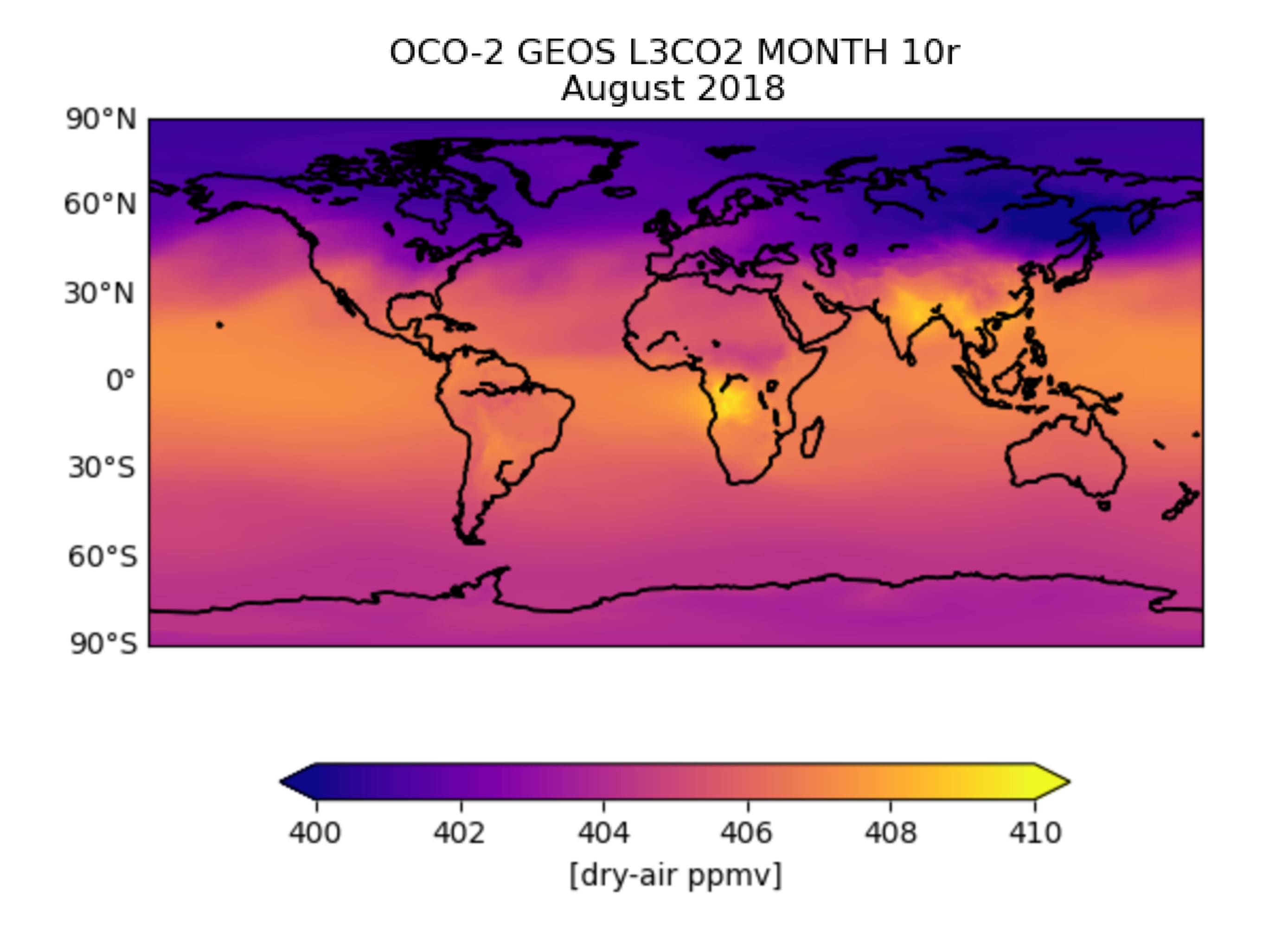
OCO-2 GEOS Level 3 monthly, 0.5x0.625 assimilated CO2 V10r (OCO2_GEOS_L3CO2_MONTH) at GES DISC
National Aeronautics and Space Administration —
This is the Gridded Monthly OCO-2 Carbon Dioxide assimilated dataset. The OCO-2 mission provides the highest quality space-based XCO2 retrievals to date. However, the... -
Federal
Soil Organic Carbon Stock Estimates with Uncertainty across Latin America
National Aeronautics and Space Administration —
This dataset provides 5 x 5 km gridded estimates of soil organic carbon (SOC) across Latin America that were derived from existing point soil characterization data... -
Federal
Global Gridded Surfaces of Selected Soil Characteristics (IGBP-DIS)
National Aeronautics and Space Administration —
The Global Gridded Surfaces of Selected Soil Characteristics (IGBP-DIS) data set contains 7 data surfaces: soil-carbon density, total nitrogen density, field... -
Federal
JPSS-2 CrIS IMG_COL: Array indices for collocated VIIRS observations V3.0 (SNDRJ2CrISL1BIMGC) at GES DISC
National Aeronautics and Space Administration —
The Cross-track Infrared Sounder (CrIS) Level 1B Full Spectral Resolution (FSR) data files contain radiance measurements along with ancillary spacecraft, instrument,...

Official websites use .gov
A
.gov website belongs to an official government
organization in the United States.
Secure .gov websites use HTTPS
A
lock (
) or https:// means you’ve safely connected to
the .gov website. Share sensitive information only on official,
secure websites.