
-
Federal
LBA-ECO CD-01 Meteorological Data, Tapajos and Amazon Rivers, Santarem, Brazil: 2001
National Aeronautics and Space Administration —
This data set contains meteorological data collected around the confluence of the Tapajos River with the Amazon River in the Amazon Basin near Santarem, Brazil, in... -
Federal
Wind Profile Data: LIDAR - NOAA (FIFE)
National Aeronautics and Space Administration —
The aim of this wind profile study was to derive wind profiles and momentum fluxes from the National Oceanic and Atmospheric Administration (NOAA)/Wave Propagation... -
Federal
Aircraft Flux-Filtered: U of Wy. (FIFE)
National Aeronautics and Space Administration —
The University of Wyoming (UW) King Air atmospheric boundary layer measurement missions were flown in 1987 during IFCs 3 and 4. This Boundary Layer Fluxes data set... -
Federal
BOREAS AFM-02 Wyoming King Air 1994 Aircraft Sounding Data
National Aeronautics and Space Administration —
The BOREAS AFM-02 team used the University of Wyoming King Air aircraft during IFCs 1, 2, and 3 in 1994 to collected pass-by-pass fluxes (and many other statistics)... -
Federal
BOREAS/AES MARS-II 15-minute Surface Meteorological Data: 1994
National Aeronautics and Space Administration —
Canadian AES personnel collected several data sets related to surface and atmospheric meteorological conditions over the BOREAS region. This data set contains... -
Federal
BOREAS Follow-On HMet-03 Hourly Meteorological Data at Flux Towers, 1994-1996
National Aeronautics and Space Administration —
Point data developed from in situ observations at four flux tower sites were combined to produce continuous, above the canopy, meteorological forcing data sets. Data... -
Federal
BOREAS Follow-On HMet-02 Area and Regional Hourly Gridded Met. Data, 1994-1996
National Aeronautics and Space Administration —
Phase II and III gridded data sets have been generated by an objective analysis scheme using all of the surface meteorological station data over BOREAS region for... -
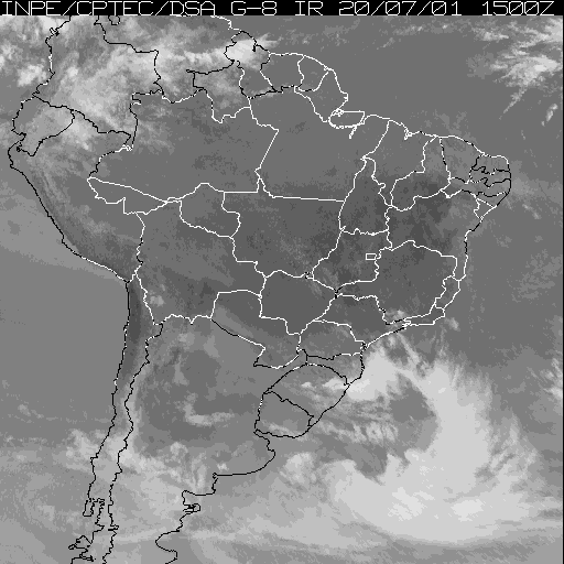
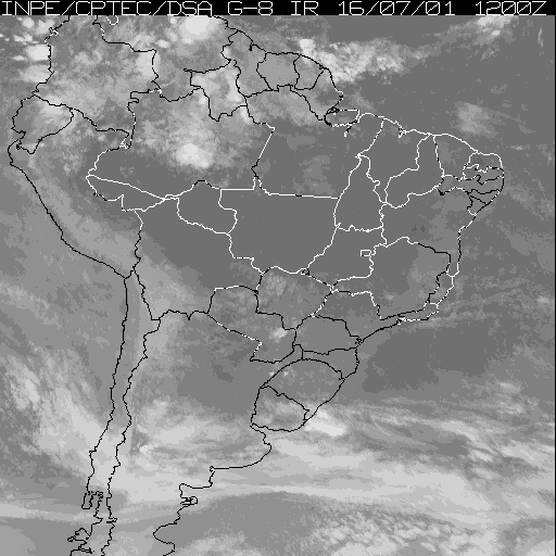
Federal
LBA-ECO CD-03 Nocturnal Meteorological Data, Forest and Pasture Sites, Para, Brazil
National Aeronautics and Space Administration —
This data set contains measurements of nocturnal meteorological profiles collected from tethered balloon platforms during July 2001, October 2001, and November 2003.... -
Federal
BOREAS AFM-01 NOAA/ATDD Long-EZ Aircraft Flux Data over the SSA
National Aeronautics and Space Administration —
This data set contains measurements from the NOAA/ATDD Long-EZ Aircraft collected during the 1994 IFCs at the SSA. These measurements were made from various... -
Federal
LBA-ECO LC-02 Daily Meteorological Data, Rio Branco, Acre, Brazil: 1970-2001
National Aeronautics and Space Administration —
This data set provides meteorological measurements collected from 3 different meteorological stations within a radius of 8 km in Rio Branco, Acre Brazil, for the... -
Federal
SAFARI 2000 Upper Air Meteorological Profiles, South Africa, Dry Season 2000
National Aeronautics and Space Administration —
The University of Wyoming has a series of balloonborne radiosonde measurements from all around the world, from the surface to 30 km. This data set contains upper air... -
Federal
SAFARI 2000 Meteorological Tower Measurements, Kruger National Park, 2000-2002
National Aeronautics and Space Administration —
An eddy covariance system mounted on a tower near the Skukuza Camp in Kruger National Park, South Africa, has been operating continuously since early 2000.... -
Federal
Wind Profile Data: Radiosonde (FIFE)
National Aeronautics and Space Administration —
The wind profile data described in this document were derived from the raw radiosonde data collected during FIFE by Dr. Wilfred H. Brutsaert during the summer and... -
Federal
Aircraft Flux-Filtered: NRCC (FIFE)
National Aeronautics and Space Administration —
The purpose of this study was to develop alternatives to ground-based measurements in order to obtain information required to predict the effects of soil and land use... -
Federal
Aircraft Flux-Detrended: NRCC (FIFE)
National Aeronautics and Space Administration —
The purpose of this study was to develop alternatives to ground-based measurements in order to obtain information required to predict the effects of soil and land use... -
Federal
AMAZE-08 Aerosol Characterization and Meteorological Data, Central Amazon Basin: 2008
National Aeronautics and Space Administration —
This data set provides measurements from the Amazonian Aerosol Characterization Experiment (AMAZE-08) carried out during the wet season from February 4 to March 21,... -
Federal
CMS: Fire Weather Indices for Interior Alaska, 2001-2010
National Aeronautics and Space Administration —
This dataset provides daily fire weather indices for interior Alaska during the active fire seasons from 2001 to 2010. Data are gridded at 60-m resolution. The active... -
Federal
Burned and Unburned Field Site Data, Noatak, Seward, and North Slope, AK, 2016-2018
National Aeronautics and Space Administration —
This dataset includes field measurements from unburned and burned 10 m x 10 m and 1 m x 1 m plots in the Noatak, Seward, and North Slope regions of the Alaskan tundra... -
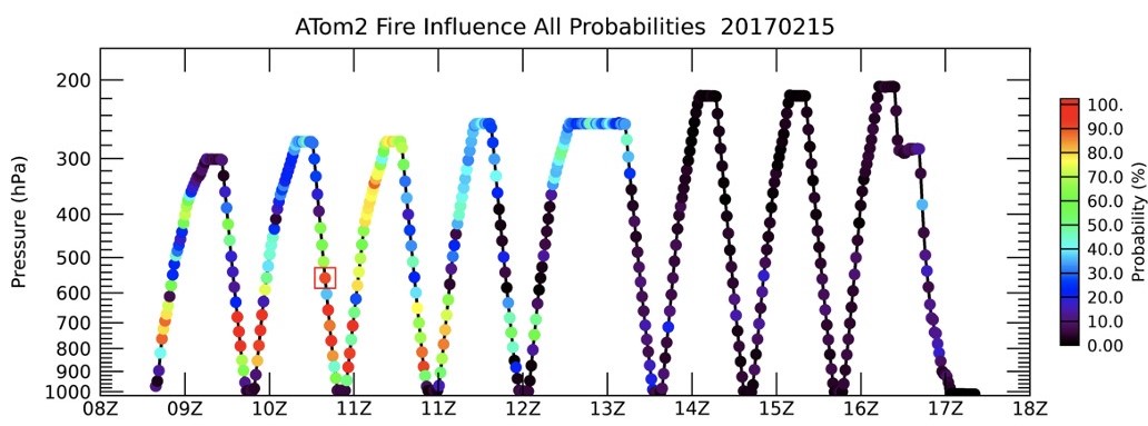
Federal
ATom: Back Trajectories and Influences of Air Parcels Along Flight Track, 2016-2018
National Aeronautics and Space Administration —
This dataset contains back trajectories, boundary layer influences, and convective influences of air parcels along NASA DC-8 aircraft's flight tracks during the four... -
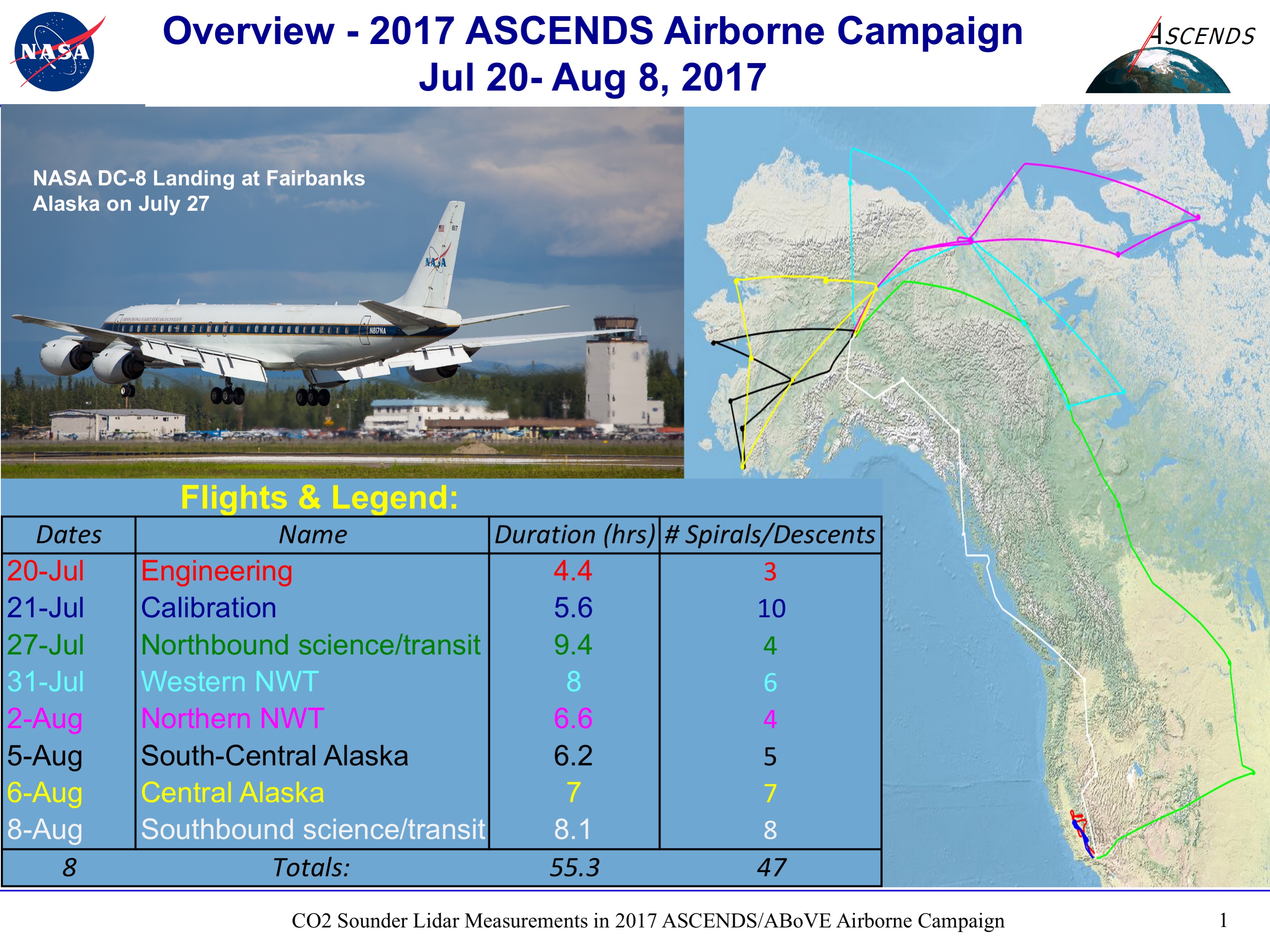
Federal
ABoVE/ASCENDS: Merged Atmospheric CO2, CH4, and Meteorological Data, 2017
National Aeronautics and Space Administration —
This dataset provides in situ airborne measurements of atmospheric carbon dioxide (CO2), methane (CH4), water vapor concentrations, air temperature, pressure, and...

Official websites use .gov
A
.gov website belongs to an official government
organization in the United States.
Secure .gov websites use HTTPS
A
lock (
) or https:// means you’ve safely connected to
the .gov website. Share sensitive information only on official,
secure websites.