

3 datasets found
-
Federal
Pre-LBA CABARE Mapped Land Surface and Vegetation Characteristics, Rondonia, Brazil
National Aeronautics and Space Administration —
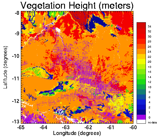
Surface parameter digital maps of vegetation, soil, and topography were obtained for Rondonia, Brazil, covering the 5x5 degree region bounded by 13-8 degrees S and... -
Federal
JERS-1 Synthetic Aperture Radar, 100-m Mosaics, South America: 1995-1996, R1
National Aeronautics and Space Administration —
This data set provides ~100-m resolution image mosaics of South America acquired during the low flood season between September and December 1995 and during the high... -
Federal
BOREAS Follow-On DSP-01 NBIOME Level-4 AVHRR Land Cover, Canada, Ver. 1.1, 1995
National Aeronautics and Space Administration —
This land cover product was produced by NBIOME to generate an up-to-date, spatially and temporally consistent land cover map of the landmass of Canada for use by...
3 datasets found