
-
Federal
UARS Correlative UKMO Daily Gridded Stratospheric Assimilated Data V001 (UARZCUKM) at GES DISC recent views
National Aeronautics and Space Administration —
The UARS Correlative assimilation data from the U.K. Meteorological Office (UKMO) consists of daily model runs at 12:00 GMT as a means of providing an independent... -
Federal
Aircraft Flux-Detrended: NRCC (FIFE) recent views
National Aeronautics and Space Administration —
Detrended boundary layer fluxes recorded on aircraft flights over the Konza -
Federal
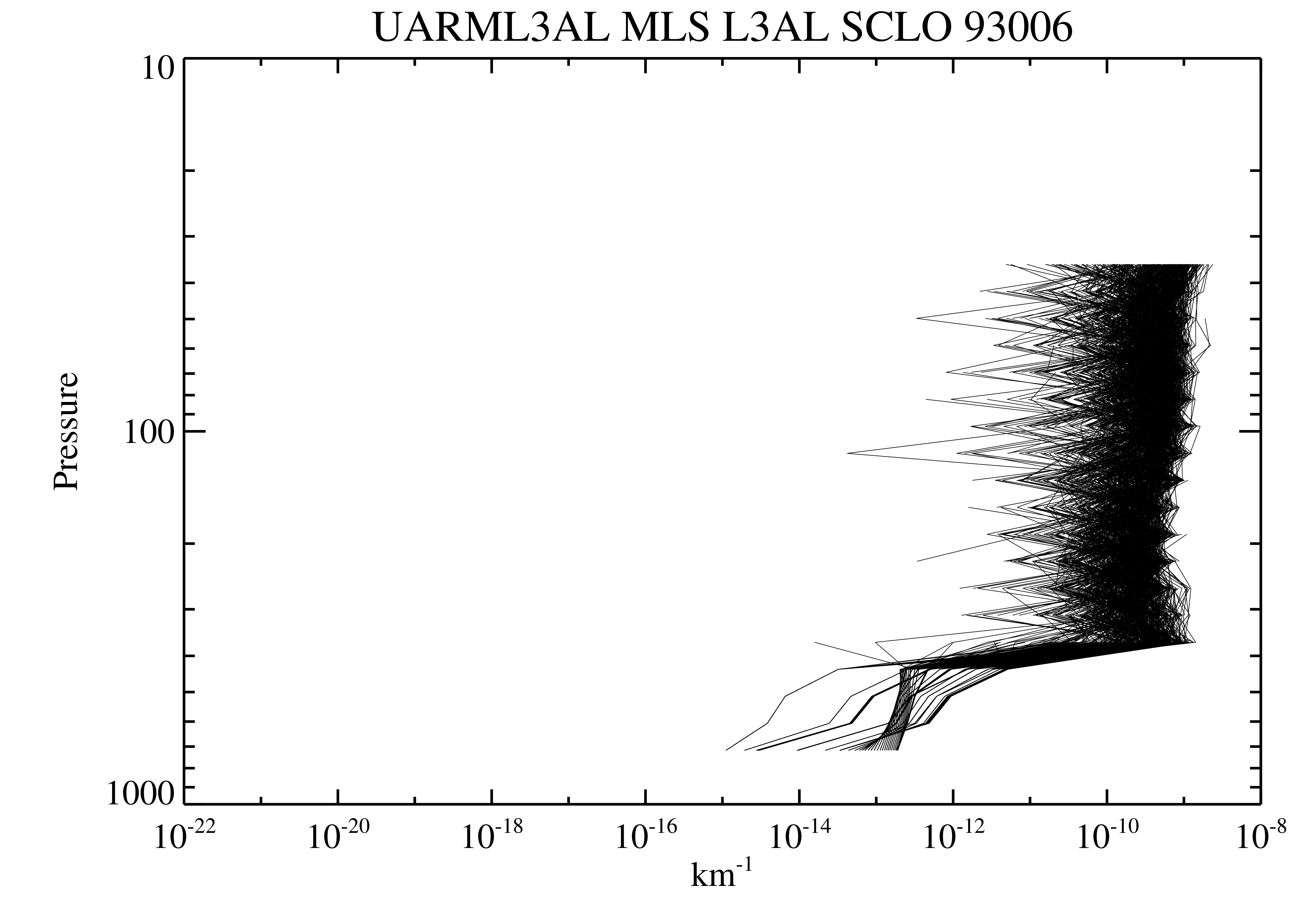
UARS Microwave Limb Sounder (MLS) Level 3AL V005 (UARML3AL) at GES DISC recent views
National Aeronautics and Space Administration —
The Microwave Limb Sounder (MLS) Level 3AL data product consists of daily, 4 degree increment latitude-ordered vertical profiles of temperature, geopotential height,... -
Federal
BOREAS AFM-06 Boundary Layer Height Data recent views
National Aeronautics and Space Administration —
Contains AFM-06 hourly inversion height measurements. -
Federal
UARS Microwave Limb Sounder (MLS) Level 3AT V005 (UARML3AT) at GES DISC recent views
National Aeronautics and Space Administration —
The Microwave Limb Sounder (MLS) Level 3AT data product consists of daily, 4 degree increment latitude-ordered vertical profiles of temperature, geopotential height,... -
Federal
UARS Correlative NMC Daily Gridded Stratospheric Assimilated Data V001 (UARZCNMC) at GES DISC recent views
National Aeronautics and Space Administration —
The UARS Correlative assimilation data from NOAA's National Meteorological Center (NMC) consists of daily model runs at 12 GMT as a means of providing an independent... -
Federal
NMC Upper Air Derived Data (FIFE) recent views
National Aeronautics and Space Administration —
NMC interpolated upper air condition data received from NESDIS -
Federal
Boundary Layer Heights: LIDAR (FIFE) recent views
National Aeronautics and Space Administration —
Height of the mixed layer gas for each LIDAR shot in volume scan, then averaged -
Federal
Radiosonde Data: NOAA (FIFE) recent views
National Aeronautics and Space Administration —
NOAA radiosonde data from the two stations near FIFE -
Federal
Atmos. Profile: Radiosonde - NCDC (FIFE) recent views
National Aeronautics and Space Administration —
NCDC radiosonde atmospheric profile data from stations near FIFE -
Federal
Boundary Layer Heights: SODAR (FIFE) recent views
National Aeronautics and Space Administration —
Inversion heights as measured using a Sodar by R.L. Coulter & M.L. Wesely -
Federal
Aircraft Flux-Raw: Univ. Col. (FIFE) recent views
National Aeronautics and Space Administration —
Raw (unmodified) boundary layer fluxes recorded on aircraft flights over Konza -
Federal
Aircraft Flux-Raw: U of Wy. (FIFE) recent views
National Aeronautics and Space Administration —
Raw (unmodified) boundary layer fluxes recorded on aircraft flights over Konza -
Federal
Aircraft Flux-Raw: NRCC (FIFE) recent views
National Aeronautics and Space Administration —
Raw (unmodified) boundary layer fluxes recorded on aircraft flights over Konza -
Federal
Aircraft Flux-Filtered: Univ. Col. (FIFE) recent views
National Aeronautics and Space Administration —
Filtered boundary layer fluxes recorded on aircraft flights over the Konza -
Federal
Aircraft Flux-Filtered: NRCC (FIFE) recent views
National Aeronautics and Space Administration —
Filtered boundary layer fluxes recorded on aircraft flights over the Konza -
Federal
Aircraft Flux-Detrended: U of Wy. (FIFE) recent views
National Aeronautics and Space Administration —
Detrended boundary layer fluxes recorded on aircraft flights over the Konza -
Federal
Aircraft Flux-Detrended: Univ. Col. (FIFE) recent views
National Aeronautics and Space Administration —
Detrended boundary layer fluxes recorded on aircraft flights over the Konza -
Federal
Aircraft Flux-Filtered: U of Wy. (FIFE) recent views
National Aeronautics and Space Administration —
Filtered boundary layer fluxes recorded on aircraft flights over the Konza

Official websites use .gov
A
.gov website belongs to an official government
organization in the United States.
Secure .gov websites use HTTPS
A
lock (
) or https:// means you’ve safely connected to
the .gov website. Share sensitive information only on official,
secure websites.