

17 datasets found for ""Hydrologic Units""
-
Federal
Forests to Faucets 2.0
Department of Agriculture —
Forests to Faucets 2.0 builds upon the national Forests to Faucets(2011) by updating base data and adding new threats including wildfire, invasive pests, and future... -
Federal
Southern Great Plains 1997 (SGP97) Hydrology: United States Geological Survey (USGS) Stream Flow Data
Department of Agriculture —
The United States Geological Survey (USGS) stream flow dataset is one of various datasets provided for the Southern Great Plains 1997 (SGP97) project. This dataset... -
Federal
NorWeST Stream Temperatures 2040s (Feature Layer)
Department of Agriculture —
This layer represents modeled stream temperatures derived from the NorWeST point feature class (NorWest_TemperaturePoints). NorWeST summer stream temperature... -
Federal
NorWeST Observed Stream Temperature Points (Feature Layer)
Department of Agriculture —
This layer indicates the location of the observed stream temperature records used for the NorWeST database summaries. NorWeST summer stream temperature scenarios were... -
Federal
Essential Fish Habitat, Pacific Salmon GIS Data
National Oceanic and Atmospheric Administration, Department of Commerce —
This file represents salmonid freshwater and estuarine Essential Fish Habitat (EFH) in the western United States. Congress, through the Magnuson-Stevens Act, defined... -
Federal
Sediment Export to Nearshore Waters - Hawaii
National Oceanic and Atmospheric Administration, Department of Commerce —
This raster data layer represents sediment plumes originating from stream mouths and coastal pour points. The Integrated Valuation of Ecosystem Services and Tradeoffs... -
Federal
NorWeST Stream Temperatures 1993-2011 (Feature Layer)
Department of Agriculture —
This layer represents modeled stream temperatures derived from the NorWeST point feature class (NorWest_TemperaturePoints). NorWeST summer stream temperature... -
Federal
DASH Slow Strain Rates from Brady Hot Springs Geothermal Field during PoroTomo Deployment Period
Department of Energy —
This submission contains slow strain rates summed to radians over 30 second intervals [rad/s] derived from horizontal distributed acoustic sensing measurements (DASH)... -
Federal
Agricultural Conservation Planning Framework (ACPF) Toolbox
Department of Agriculture —
Spatial data on soils, land use, and topography combined with knowledge of conservation effectiveness can be used to reduce nutrient discharge from small watersheds.... -
Federal
Land use and beach closure 2004-2013 in the United States
U.S. Environmental Protection Agency —
The dataset contains the beach closure data and land use information around each beach in 2006 and 2011 in the United States. The original data are created by EPA and... -
Federal
Wetland Salinity Maps of Select Estuary Sites in the United States, 2020
National Aeronautics and Space Administration —
This dataset provides gridded average annual wetland salinity concentrations in practical salinity units (PSU) at 30-meter resolution within 24 coastal estuary sites... -
Federal
2002/2003 IfSAR data for Southern California: Radar Reflectance Image
National Oceanic and Atmospheric Administration, Department of Commerce —
This metadata document describes the collection and processing of topographic elevation point data derived from Interferometric Synthetic Aperture Radar (IfSAR)... -
Federal
2002/2003 IfSAR data for Southern California: Digital Elevation Model (NAVD88)
National Oceanic and Atmospheric Administration, Department of Commerce —
This metadata document describes the collection and processing of topographic elevation point data derived from Interferometric Synthetic Aperture Radar (IfSAR)... -
Federal
NLET - National Load Estimating Tool
Department of Agriculture —
NLET (National Load Estimating Tool), a component of the USDA/ARS Soil and Water Hub, is a web-based tool for estimating pollutant loads in watersheds across the... -
Federal
NorWeST Stream Temperatures 2080s (Feature Layer)
Department of Agriculture —
This layer represents modeled stream temperatures derived from the NorWeST point feature class (NorWest_TemperaturePoints). NorWeST summer stream temperature... -
Federal
Southern Great Plains 1997 (SGP97) Hydrology: United States Geological Survey (USGS) Daily Reservoir Data
Department of Agriculture —
The United States Geological Survey (USGS) Reservoir dataset is one of various hydrological datasets provided for the Southern Great Plains 1997 (SGP97) project. This... -
Federal
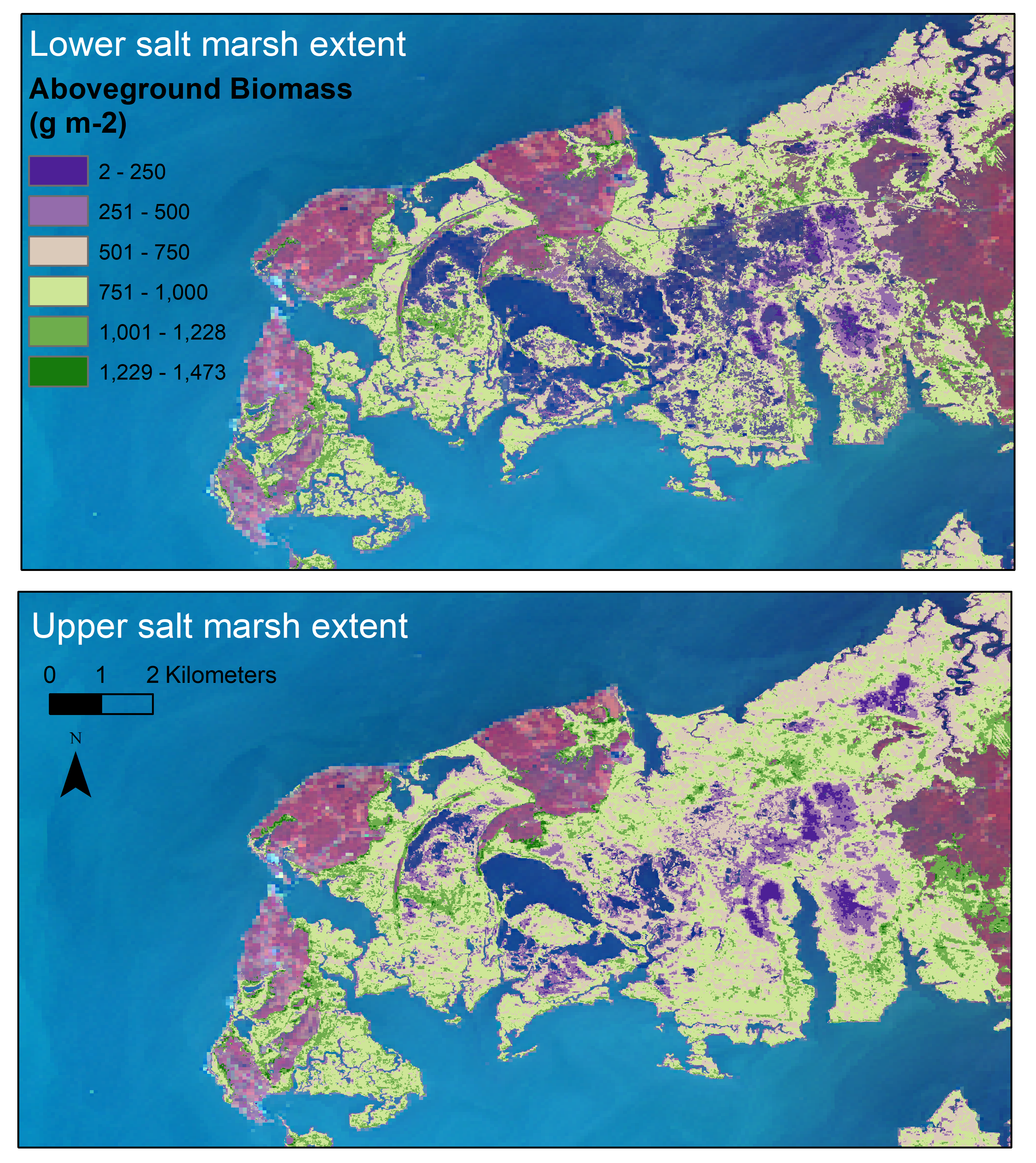
Aboveground Biomass Estimates for Salt Marsh for the Contiguous United States, 2020
National Aeronautics and Space Administration —
This dataset provides estimates of aboveground biomass (AGB) and salt marsh extent in the contiguous United States for 2020 and includes all coastal watersheds across...
17 datasets found for ""Hydrologic Units""