

177 datasets found
-
Federal
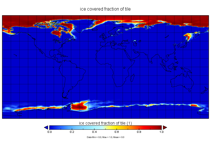
Greenland Ice Sheet Melt Characteristics Derived from Passive Microwave Data, Version 1
National Aeronautics and Space Administration —
The Greenland ice sheet melt extent data, acquired as part of the NASA Program for Arctic Regional Climate Assessment (PARCA), is a daily (or every other day, prior... -
Federal
Glacier Photograph Collection, Version 1
National Aeronautics and Space Administration —
The Glacier Photograph Collection is a database of digital photographs of glaciers from around the world, some dating back to the mid-19th century, that provide an... -
Federal
Antarctic 5-km Digital Elevation Model from ERS-1 Altimetry, Version 1
National Aeronautics and Space Administration —
This data set provides a Digital Elevation Model (DEM) for Antarctica to 81.5 degrees south latitude, at a resolution of 5 km. Approximately twenty million data... -
Federal
SENTINEL-1A_SLC
National Aeronautics and Space Administration —
Sentinel-1A slant-range product -
Federal
MERRA-2 tavgU_2d_ocn_Nx: 2d,diurnal,Time-Averaged,Single-Level,Assimilation,Ocean Surface Diagnostics 0.625 x 0.5 degree V5.12.4 (M2TUNXOCN) at GES DISC
National Aeronautics and Space Administration —
M2TUNXOCN (or tavgU_2d_ocn_Nx) is a time-averaged 2-dimensional monthly diurnal means data collection in Modern-Era Retrospective analysis for Research and... -
Federal
Snowmelt Timing Maps Derived from MODIS for North America, Version 2, 2001-2018 NGDA
National Aeronautics and Space Administration —
This data set provides snowmelt timing maps (STMs), cloud interference maps, and a map with the count of calculated snowmelt timing values for North America. The STMs... -
Federal
International Satellite Cloud Climatology Project (ISCCP) Ice Snow Product in Native Data Format
National Aeronautics and Space Administration —
ISCCP_ICESNOW_NAT_1 is the International Satellite Cloud Climatology Project (ISCCP) Ice Snow Product in Native Data Format data set. It is a merged product... -
Federal
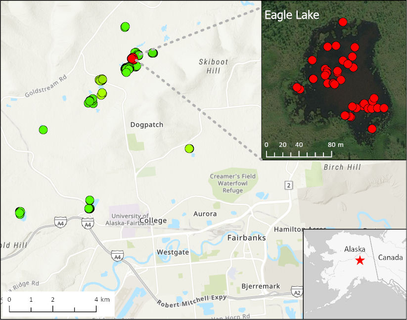
ABoVE: Methane Ebullition Hotspots in Frozen Lakes near Fairbanks, Alaska, Oct 2014
National Aeronautics and Space Administration —
This dataset includes maps of the locations and number of methane ebullition hotspots in 15 frozen lakes in the southern portion of the Goldstream Valley and the... -
Federal
SnowEx21 Time Series Snow Pits V001
National Aeronautics and Space Administration —
The data set is a time-series of snow pit measurements obtained by the SnowEx community during the 2021 field campaign. etween November 2020 and May 2021 data from... -
Federal
AMSR-E/AMSR2 Unified L3 Global Daily 25 km EASE-Grid Snow Water Equivalent V001
National Aeronautics and Space Administration —
This AMSR-E/AMSR2 Unified Level-3 (L3) data set provides daily estimates of Snow Water Equivalent (SWE). SWE was derived from brightness temperature measurements... -
Federal
AMSR-E/AMSR2 Unified L3 Global 5-Day 25 km EASE-Grid Snow Water Equivalent V001
National Aeronautics and Space Administration —
This AMSR-E/AMSR2 Unified Level-3 (L3) data set provides 5-day maximum estimates of Snow Water Equivalent (SWE). SWE was derived from brightness temperature... -
Federal
Continuous Records of Shallow Soil Temperature and Moisture in the Noatak River Basin, Alaska
Department of the Interior —
Soil moisture and temperature were measured at four shallow depths in multiple locations within tundra and forested landscapes of the Agashashok River basin. The... -
Federal
Lund-Potsdam-Jena Wetland Hydrology and Methane DGV Model (LPJ-WHyMe v1.3.1)
National Aeronautics and Space Administration —
This model product provides the Fortran 77 source code for the Lund-Potsdam-Jena (LPJ) Wetland Hydrology and Methane Dynamic Global Vegetation Model (LPJ-WHyMe... -
Federal
Seasonal frost and soil temperature data, Western Cape Mountains, South Africa, Version 1
National Aeronautics and Space Administration —
Micro-climatic monitoring of air and ground was started in 1990 to evaluate climatic controls on the present-day diurnal soil frost environment in the Western Cape...
177 datasets found