
-
Federal
BOREAS RSS-20 POLDER Helicopter-Mounted Measurements of Surface BRDF
National Aeronautics and Space Administration —
This data set contains measurements of surface BRDF made by the POLDER instrument over several sites (pine, spruce, fen) of the BOREAS study areas during 1994.... -
Federal
BOREAS RSS-17 Xylem Flux Density Measurements at the SSA-OBS Site
National Aeronautics and Space Administration —
As part of its efforts to determine environmental and phenological states from radar imagery, the BOREAS RSS-17 team collected in situ tree xylem flow measurements... -
Federal
CLPX-Satellite: MODIS Radiances, Reflectances, Snow Cover and Related Grids, Version 1
National Aeronautics and Space Administration —
This data set provides Moderate Resolution Imaging Spectroradiometer (MODIS) data as part of the Cold Land Processes Field Experiment (CLPX). Parameters include... -
Federal
CLPX-Satellite: AVHRR/HRPT Brightness Temperatures and Reflectances, Version 1
National Aeronautics and Space Administration —
This data set includes AVHRR/HRPT (Advanced Very High Resolution Radiometer/High Resolution Picture Transmission) brightness temperatures and reflectances over the... -
Federal
BOREAS RSS-08 Snow Maps Derived from Landsat TM Imagery
National Aeronautics and Space Administration —
The BOREAS RSS-08 team utilized Landsat TM images to perform mapping of snow extent over the SSA. This data set consists of two Landsat TM images which were used to... -
Federal
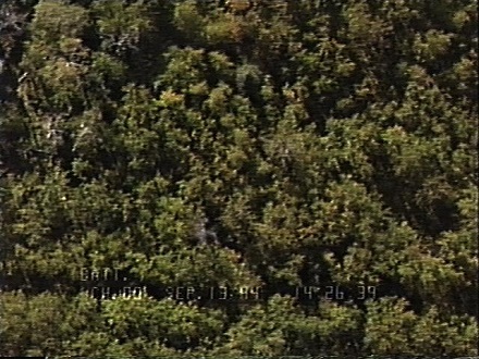
BOREAS RSS-03 Imagery and Snapshots from a Helicopter-Mounted Video Camera
National Aeronautics and Space Administration —
This data set provides images of boreal forests in central Canada collected over numerous tower and auxiliary sites during the BOREAS Intensive Field Campaigns (IFCs)... -
Federal
BOREAS Level-3S SPOT Imagery: Scaled At-Sensor Radiance in LGSOWG Format
National Aeronautics and Space Administration —
For BOREAS, the level-3s SPOT data, along with the other remotely sensed images, were collected in order to provide spatially extensive information over the primary... -
Federal
BOREAS Level-3b AVHRR-LAC Imagery: Scaled At-Sensor Radiance in LGSOWG Format
National Aeronautics and Space Administration —
The BOREAS Staff Science Satellite Data Acquisition Program focused on providing the research teams with the remotely sensed satellite data products they needed to... -
Federal
BOREAS Level-1B MAS Imagery: At-Sensor Radiance, Relative X and Y Coordinates
National Aeronautics and Space Administration —
For BOREAS, the MAS images, along with the other remotely sensed data, were collected to provide spatially-extensive information over the primary study areas. This... -
Federal
BOREAS Landsat TM Level-3p Imagery: Geocoded and Scaled At-Sensor Radiance
National Aeronautics and Space Administration —
For BOREAS, the level-3p Landsat TM data were used to supplement the level-3s Landsat TM products. Along with the other remotely sensed images, the Landsat TM images... -
Federal
BOREAS NS001 TMS Level-0 Images in BIL Format
National Aeronautics and Space Administration —
For BOREAS, the NS001 TMS imagery, along with the other remotely sensed images, was collected in order to provide spatially extensive information over the primary... -
Federal
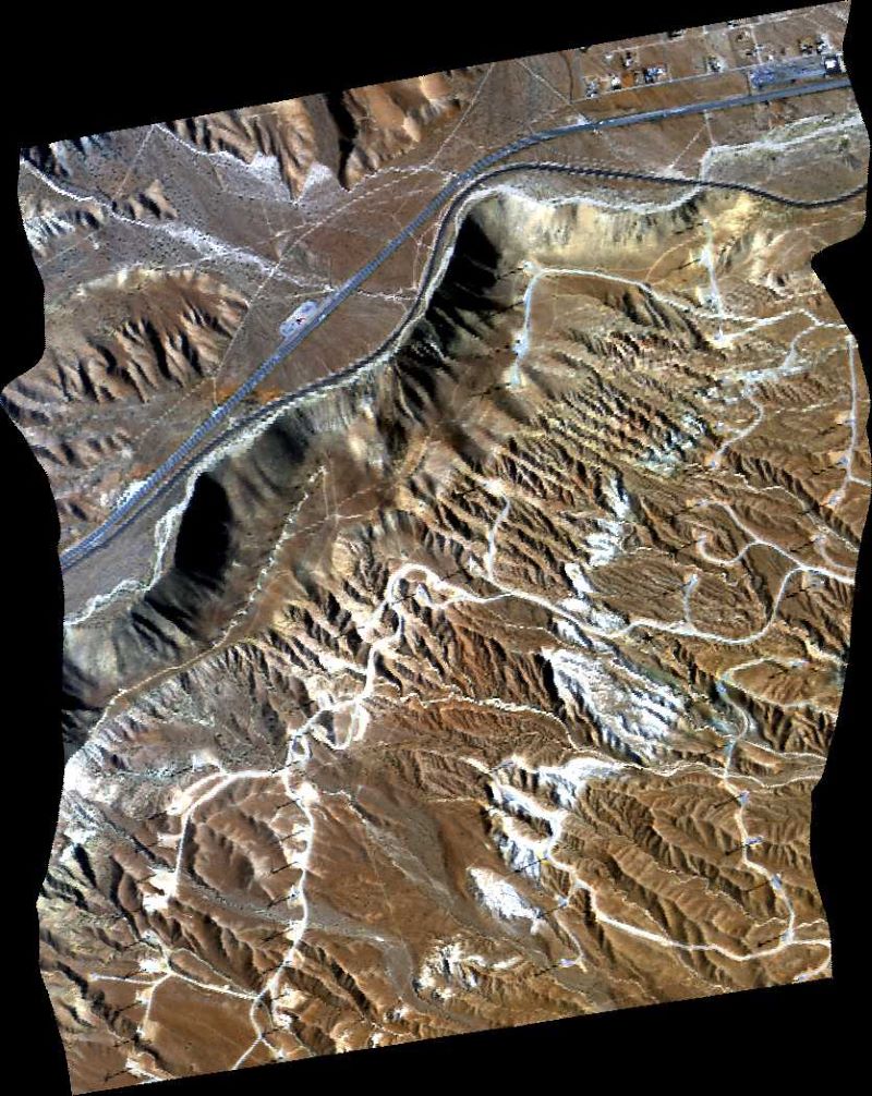
ASTER Expedited L1A Reconstructed Unprocessed Instrument Data V003
National Aeronautics and Space Administration —
The Advanced Spaceborne Thermal Emission and Reflection Radiometer (ASTER) Expedited Level 1A Reconstructed Unprocessed Instrument Data (AST_L1AE) global product... -
Federal
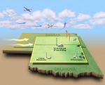
CAR CLASIC Cloud and Land Surface Measurements L1 V1 (CAR_CLASIC_L1C) at GES DISC
National Aeronautics and Space Administration —
CLASIC (Cloud and Land Surface Interaction Campaign) focuses on advancing the understanding of how land surface processes influence cumulus convection. The CAR flew... -
Federal
CAR CLASIC BRDF Measurements V2 (CAR_CLASIC_BRDF) at GES DISC
National Aeronautics and Space Administration —
CLASIC (Cloud and Land Surface Interaction Campaign) focuses on advancing the understanding of how land surface processes influence cumulus convection. CLASIC was... -
Federal
BOREAS Follow-On DSP-08 POLDER Atmospherically Corrected Surface Parameters, SSA
National Aeronautics and Space Administration —
This data set contains maps of surface reflectance and ve getation parameters derived from imagery collected by the POLDER instrument over BOREAS conifer tower sites... -
Federal
AVIRIS-Classic: L1B Calibrated Radiance, Facility Instrument Collection, V1
National Aeronautics and Space Administration —
This dataset contains Level 1B (L1B) orthocorrected, scaled radiance image files as well as files of observational geometry and illumination parameters and supporting... -
Federal
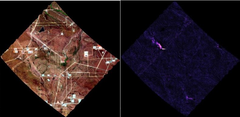
AVIRIS-3 L2B Greenhouse Gas Enhancements, Facility Instrument Collection
National Aeronautics and Space Administration —
This dataset contains Level 2B (L2b) enhancements of greenhouse gasses (GHG) derived from imagery collected by the Airborne Visible / Infrared Imaging Spectrometer-3... -
Federal
AVIRIS-NG L1B Calibrated Radiance, Facility Instrument Collection, V1
National Aeronautics and Space Administration —
This dataset contains Level 1B (L1B) orthocorrected, scaled radiance image files as well as files of observational geometry and illumination parameters and supporting... -
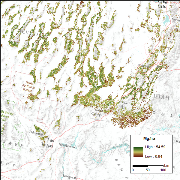
Federal
CMS: Pinyon-Juniper Forest Live Aboveground Biomass, Great Basin, USA, 2000-2016
National Aeronautics and Space Administration —
This dataset provides annual maps of live aboveground tree biomass (Mg/ha) for pinyon-juniper forests across the Great Basin of the Western USA for the years...

Official websites use .gov
A
.gov website belongs to an official government
organization in the United States.
Secure .gov websites use HTTPS
A
lock (
) or https:// means you’ve safely connected to
the .gov website. Share sensitive information only on official,
secure websites.