
-
Federal
MERRA-2 tavg3_3d_rad_Np: 3d,3-Hourly,Time-Averaged,Pressure-Level,Assimilation,Radiation Diagnostics 0.625 x 0.5 degree V5.12.4 (M2T3NPRAD) at GES DISC
National Aeronautics and Space Administration —
M2T3NPRAD (or tavg3_3d_rad_Np) is a 3-dimensional 3-hourly time averaged data collection in Modern-Era Retrospective analysis for Research and Applications version 2... -
Federal
GLDAS Noah Land Surface Model L4 3 hourly 0.25 x 0.25 degree V2.0 (GLDAS_NOAH025_3H) at GES DISC
National Aeronautics and Space Administration —
NASA Global Land Data Assimilation System Version 2 (GLDAS-2) has three components: GLDAS-2.0, GLDAS-2.1, and GLDAS-2.2. GLDAS-2.0 is forced entirely with the... -
Federal
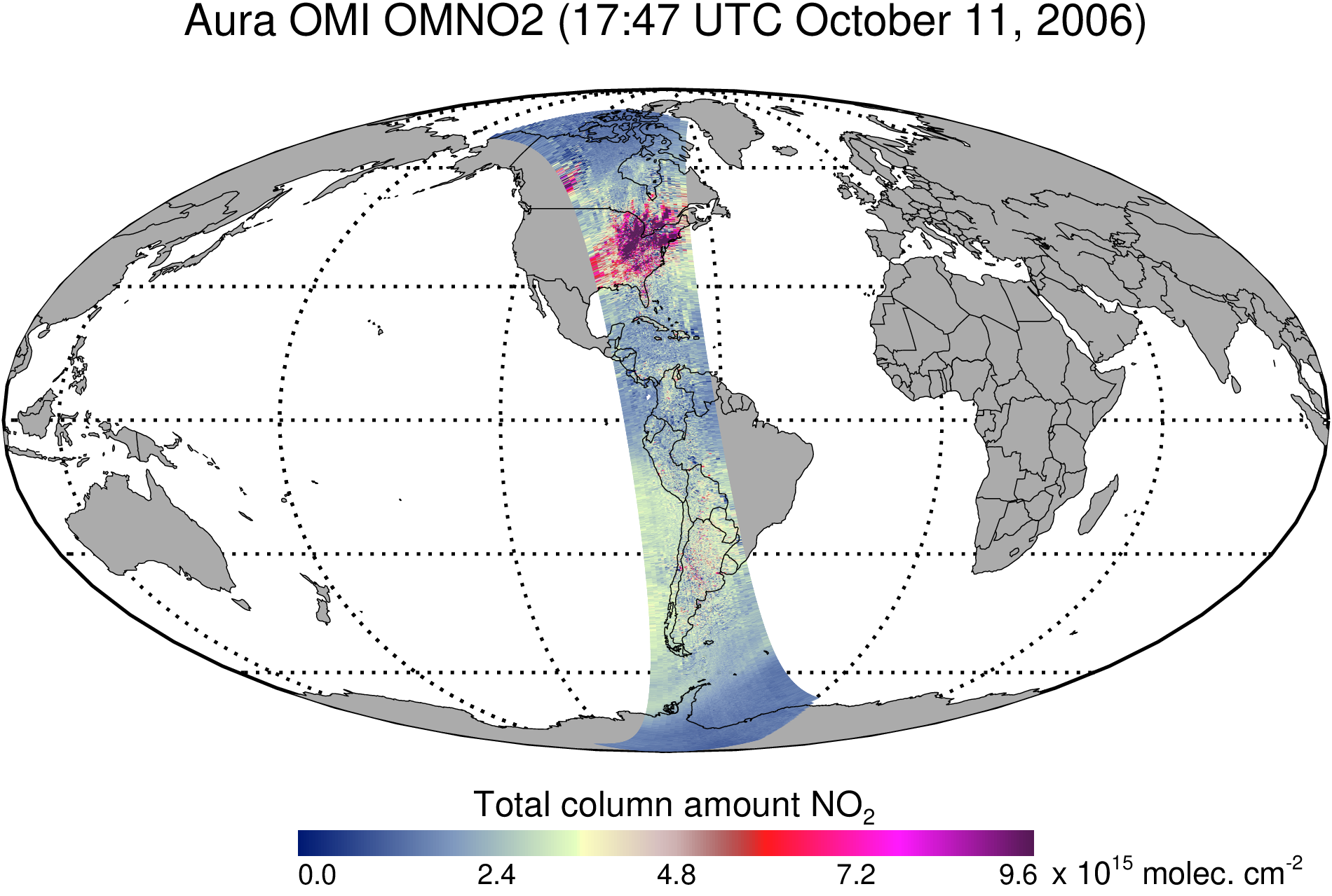
OMI/Aura Nitrogen Dioxide (NO2) Total and Tropospheric Column 1-orbit L2 Swath 13x24 km V003 (OMNO2) at GES DISC
National Aeronautics and Space Administration —
The Version 4.0 Aura Ozone Monitoring Instrument (OMI) Nitrogen Dioxide (NO2) Standard Product (OMNO2) is now available from the NASA Goddard Earth Sciences Data and... -
Federal
NCEP/CPC L3 Half Hourly 4km Global (60S - 60N) Merged IR V1 (GPM_MERGIR) at GES DISC
National Aeronautics and Space Administration —
These data originate from NOAA/NCEP. The NOAA Climate Prediction Center/NCEP/NWS is making the data available originally in binary format, in a weekly rotating... -
Federal
VEMAP 2: Annual Ecosystem Model Responses to U.S. Climate Change, 1994-2100
National Aeronautics and Space Administration —
Phase 2 of the VEMAP Project developed historical (1895-1993) gridded data sets of climate (temperature, precipitation, solar radiation, humidity, and wind speed) and... -
Federal
GLDAS Catchment Land Surface Model L4 daily 0.25 x 0.25 degree V2.0 (GLDAS_CLSM025_D) at GES DISC
National Aeronautics and Space Administration —
NASA Global Land Data Assimilation System Version 2 (GLDAS-2) has three components: GLDAS-2.0, GLDAS-2.1, and GLDAS-2.2. GLDAS-2.0 is forced entirely with the... -
Federal
FLDAS Noah Land Surface Model L4 Global Monthly 0.1 x 0.1 degree (MERRA-2 and CHIRPS) V001 (FLDAS_NOAH01_C_GL_M) at GES DISC
National Aeronautics and Space Administration —
This dataset contains a series of land surface parameters simulated from the Noah 3.6.1 model in the Famine Early Warning Systems Network (FEWS NET) Land Data... -
Federal
Global Maps of Atmospheric Nitrogen Deposition, 1860, 1993, and 2050
National Aeronautics and Space Administration —
This data set provides global gridded estimates of atmospheric deposition of total inorganic nitrogen (N), NHx (NH3 and NH4+), and NOy (all oxidized forms of nitrogen... -
Federal
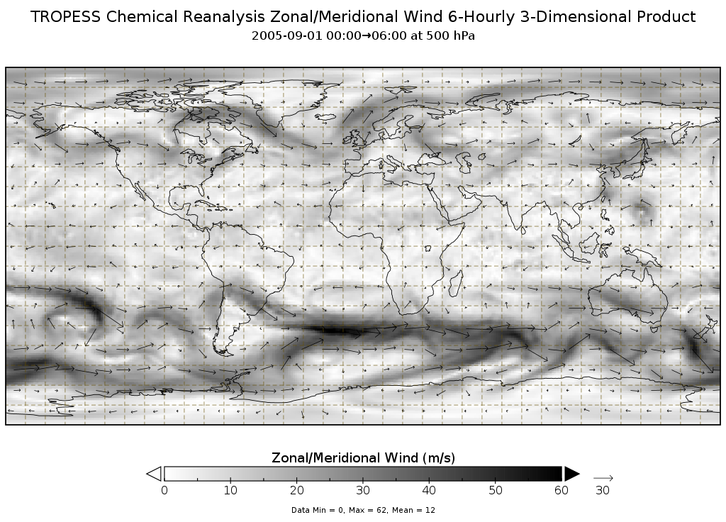
TROPESS Chemical Reanalysis Zonal Wind 6-Hourly 3-dimensional Product V1 (TRPSCRU6H3D) at GES DISC
National Aeronautics and Space Administration —
The TROPESS Chemical Reanalysis Zonal Wind 6-Hourly 3-dimensional Product contains vertical zonal wind component (u vector) values, a meteorological field. The data... -
Federal
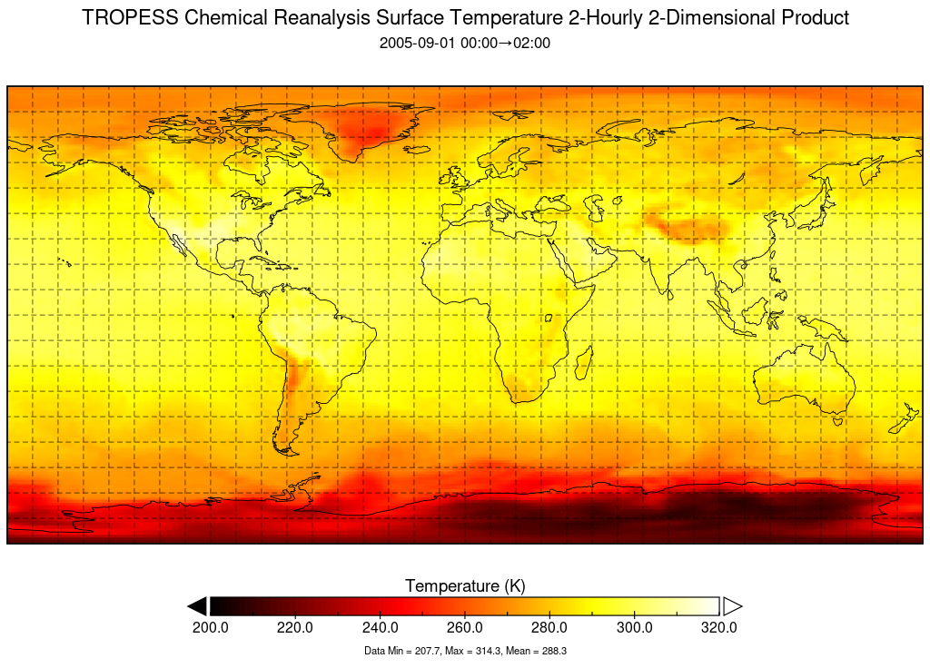
TROPESS Chemical Reanalysis Surface Temperature 2-Hourly 2-dimensional Product V1 (TRPSCRT2H2D) at GES DISC
National Aeronautics and Space Administration —
The TROPESS Chemical Reanalysis Surface Temperature 2-Hourly 2-dimensional Product contains surface temperature values, a meteorological field. The data are part of... -
Federal
Sentinel-5P TROPOMI Total Ozone Column 1-Orbit L2 7km x 3.5km V1 (S5P_L2__O3_TOT) at GES DISC
National Aeronautics and Space Administration —
Starting from August 6th in 2019, Sentinel-5P TROPOMI along-track high spatial resolution (~5.5km at nadir) has been implemented. Starting from July 13th in 2020,... -
Federal
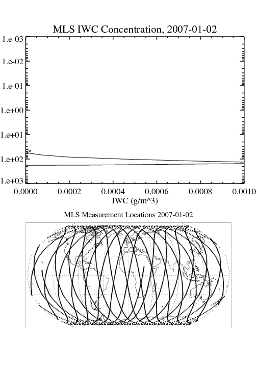
MLS/Aura Level 3 Daily Binned Cloud Ice (IWC) on Assorted Grids V005 (ML3DBIWC) at GES DISC
National Aeronautics and Space Administration —
ML3DBIWC is the EOS Aura Microwave Limb Sounder (MLS) daily binned on various vertical grids product for cloud ice water content (IWC) derived from radiances measured... -
Federal
SBUV2/NOAA-9 Ozone (O3) Profile and Total Column Ozone 1 Month Zonal Mean L3 Global 5.0 degree Latitude Zones V1 (SBUV2N09L3zm) at GES DISC
National Aeronautics and Space Administration —
The Solar Backscattered Ultraviolet (SBUV) from NOAA-9 Level-3 monthly zonal mean (MZM) product (SBUV2N17L3zm) is derived from the Level-2 retrieved ozone profiles.... -
Federal
TRMM Radar Rain Distributions L3 1 month 5 degree x 5 degree V7 (TRMM_3A26) at GES DISC
National Aeronautics and Space Administration —
The new version of these data is in GPM-like format (consistent with the GPM Dual-frequency Radar data format), and can be found under the name GPM_3PR. This dataset... -
Federal
MLS/Aura Level 3 Daily Binned Relative Humidity With Respect To Ice (RHI) on Assorted Grids V005 (ML3DBRHI) at GES DISC
National Aeronautics and Space Administration —
ML3DBRHI is the EOS Aura Microwave Limb Sounder (MLS) daily binned on various vertical grids product for relative humidity with respect to ice (RHI) derived from... -
Federal
GPM SAPHIR on MT1 (PRPS) Climate-based Radiometer Precipitation Profiling L3 1 day 0.25 x 0.25 degree V06 (GPM_3PRPSMT1SAPHIR_DAY_CLIM) at GES DISC
National Aeronautics and Space Administration —
The "CLIM" products differ from their "regular" counterparts (without the "CLIM" in the name) by the ancillary data they use. They are Climate-Reference products,... -
Federal
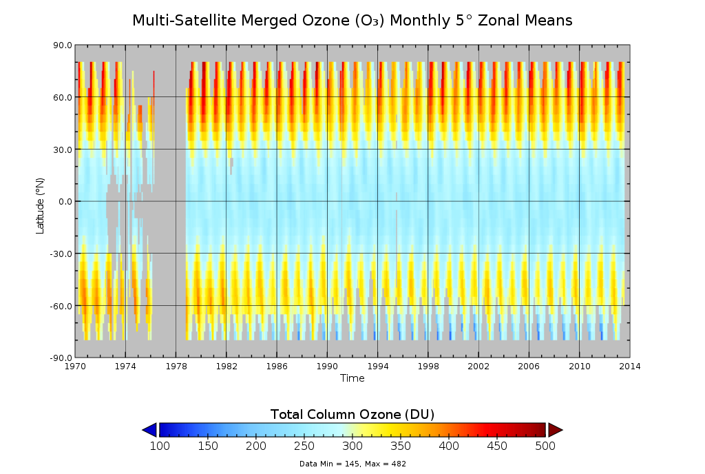
Multi-Satellite Merged Ozone (O3) Profile and Total Column 1 Month Zonal Mean L3 Global 5.0 degree Latitude Zones V1 (MSO3L3zm5) at GES DISC
National Aeronautics and Space Administration —
The merged-satellite Solar Backscattered Ultraviolet (SBUV) Level-3 monthly zonal mean (MZM) product (MSO3L3zm5) contains 1 month zonal means for profile layer and... -
Federal
SBUV2/NOAA-9 Level 2 Daily Ozone Profile and Total Column from CD-ROM V008 (SBUV2N09O3) at GES DISC
National Aeronautics and Space Administration —
The version 8 SBUV/2 NOAA-9 ozone data were first released at the 2004 Quadrennial Ozone Symposium on DVD. The DVD contained all of the SBUV/2 data from NOAA-9,... -
Federal
ASCENDS: Active Sensing of CO2 With AVOCET, California and Nevada, 2016
National Aeronautics and Space Administration —
This dataset provides in situ airborne measurements of atmospheric carbon dioxide (CO2) over California and Nevada on February 10-11, 2016. Measurements were taken... -
Federal
MLS/Aura Level 2 Cloud Ice Product V004 (ML2IWC) at GES DISC
National Aeronautics and Space Administration —
ML2IWC is the EOS Aura Microwave Limb Sounder (MLS) standard product for cloud ice water content derived from radiances measured by the 240 GHz radiometer. The data...

Official websites use .gov
A
.gov website belongs to an official government
organization in the United States.
Secure .gov websites use HTTPS
A
lock (
) or https:// means you’ve safely connected to
the .gov website. Share sensitive information only on official,
secure websites.