

2,048 datasets found for "Infrastructure"
-
Federal
Elwha PlaneCam - aerial imagery and derivatives from Elwha River (WA) flight on October 2nd, 2019
Department of the Interior —
This is a set of 642 primarily near-nadir aerial photogrammetric images and their derivatives, collected from the Elwha River, WA, with an intervalometer-triggered... -
Federal
Elwha PlaneCam - aerial imagery and derivatives from Elwha River (WA) flight on December 12th, 2017
Department of the Interior —
This is a set of 642 primarily near-nadir aerial photogrammetric images and their derivatives, collected from the Elwha River, WA, with an intervalometer-triggered... -
Federal
Elwha PlaneCam - aerial imagery and derivatives from Elwha River (WA) flight on November 29th, 2017
Department of the Interior —
This is a set of 642 primarily near-nadir aerial photogrammetric images and their derivatives, collected from the Elwha River, WA, with an intervalometer-triggered... -
Federal
Elwha PlaneCam - aerial imagery and derivatives from Elwha River (WA) flight on October 12th, 2017
Department of the Interior —
This is a set of 642 primarily near-nadir aerial photogrammetric images and their derivatives, collected from the Elwha River, WA, with an intervalometer-triggered... -
Federal
Elwha PlaneCam - aerial imagery and derivatives from Elwha River (WA) flight on December 24th, 2012
Department of the Interior —
This is a set of 642 primarily near-nadir aerial photogrammetric images and their derivatives, collected from the Elwha River, WA, with an intervalometer-triggered... -
Federal
Elwha PlaneCam - aerial imagery and derivatives from Elwha River (WA) flight on December 15th, 2014
Department of the Interior —
This is a set of 642 primarily near-nadir aerial photogrammetric images and their derivatives, collected from the Elwha River, WA, with an intervalometer-triggered... -
Federal
Elwha PlaneCam - aerial imagery and derivatives from Elwha River (WA) flight on November 14th, 2014
Department of the Interior —
This is a set of 642 primarily near-nadir aerial photogrammetric images and their derivatives, collected from the Elwha River, WA, with an intervalometer-triggered... -
Federal
Elwha PlaneCam - aerial imagery and derivatives from Elwha River (WA) flight on June 1st, 2016
Department of the Interior —
This is a set of 642 primarily near-nadir aerial photogrammetric images and their derivatives, collected from the Elwha River, WA, with an intervalometer-triggered... -
Federal
Elwha PlaneCam - aerial imagery and derivatives from Elwha River (WA) flight on July 14th, 2016
Department of the Interior —
This is a set of 642 primarily near-nadir aerial photogrammetric images and their derivatives, collected from the Elwha River, WA, with an intervalometer-triggered... -
Federal
First finished floor elevation data collected in seven Alaska communities, state plane coordinate system
Department of the Interior —
First finished floor elevation data, as well as ground survey points for critical infrastructure, for example bridges, fuel farms, and power generators, were... -
Federal
Elwha PlaneCam - aerial imagery and derivatives from Elwha River (WA) flight on November 21st, 2015
Department of the Interior —
This is a set of 642 primarily near-nadir aerial photogrammetric images and their derivatives, collected from the Elwha River, WA, with an intervalometer-triggered... -
Federal
Elwha PlaneCam - aerial imagery and derivatives from Elwha River (WA) flight on August 12th, 2014
Department of the Interior —
This is a set of 642 primarily near-nadir aerial photogrammetric images and their derivatives, collected from the Elwha River, WA, with an intervalometer-triggered... -
Federal
Elwha PlaneCam - aerial imagery and derivatives from Elwha River (WA) flight on April 29th, 2014
Department of the Interior —
This is a set of 642 primarily near-nadir aerial photogrammetric images and their derivatives, collected from the Elwha River, WA, with an intervalometer-triggered... -
Federal
LBA-ECO LC-24 Historical Roads of the Legal Amazon: 1968-1993
National Aeronautics and Space Administration —
Understanding the impact of road investments on deforestation is part of a complete evaluation of the expansion of infrastructure for development.We find evidence of... -
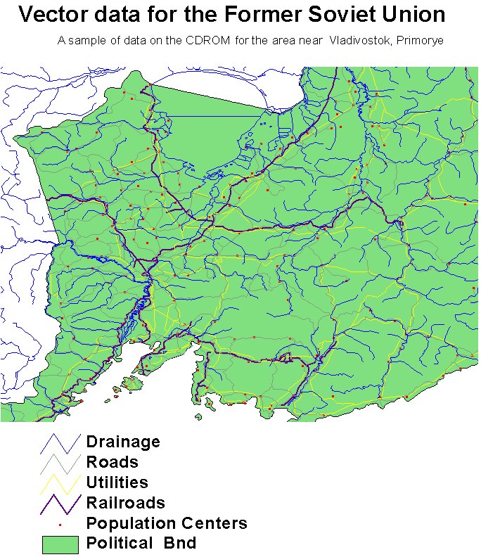
Federal
RLC Selected Infrastructure Data for the Former Soviet Union, 1993
National Aeronautics and Space Administration —
This data set consists of roads, drainage, railroads, utilities, and population center information in readily usable vector format for the land area of the Former... -
Federal
RAMP AMM-1 SAR Image Mosaic of Antarctica, Version 2
National Aeronautics and Space Administration —
The mosaic provides a detailed look at ice sheet morphology, rock outcrops, research infrastructure, the coastline, and other features of Antarctica, as well as... -
Federal
Elwha PlaneCam - aerial imagery and derivatives from Elwha River (WA) flight on February 25th, 2020
Department of the Interior —
This is a set of 642 primarily near-nadir aerial photogrammetric images and their derivatives, collected from the Elwha River, WA, with an intervalometer-triggered... -
Federal
Unprocessed aerial imagery from 18 December 2017 coastal survey of Central California.
Department of the Interior —
This is a set of 2948 oblique aerial photogrammetric images and their derivatives, collected from San Francisco to Monterey with a fixed-lens digital camera from a... -
Federal
Shoreline Electrical Resistivity Tomography (ERT) and Frequency Domain Electromagnetic (FDEM) Data along the Sinclair Inlet at the Bremerton Naval Complex, WA, June 2023
Department of the Interior —
This data release contains electrical resistivity tomography (ERT) and frequency domain electromagnetic (FDEM) data collected in areas of unwalled shoreline at the... -
Federal
Elwha PlaneCam - aerial imagery and derivatives from Elwha River (WA) flight on April 26th, 2016
Department of the Interior —
This is a set of 642 primarily near-nadir aerial photogrammetric images and their derivatives, collected from the Elwha River, WA, with an intervalometer-triggered...
2,048 datasets found for "Infrastructure"