

4 datasets found for "Tides"
-
Federal
High Resolution Empirical Tide Prediction Software Version 14
National Aeronautics and Space Administration —
This dataset provides sea surface height and ocean surface currents associated with the predictable astronomical tide at the M2, S2, N2, K1, and O1 frequencies. The... -
Federal
Harmonic Constants for Baroclinic Tide Prediction
National Aeronautics and Space Administration —
This dataset of Harmonic Constants for Baroclinic Tide Prediction was produced by Edward Zaron (Oregon State University) and Shane Elipot (University of Miami). It... -
Federal
Relative Tidal Marsh Elevation Maps with Uncertainty for Conterminous USA, 2010
National Aeronautics and Space Administration —
This dataset provides maps of the elevation of coastal wetlands relative to tidal ranges for the conterminous United States (CONUS) at 30 m resolution for 2010. It... -
Federal
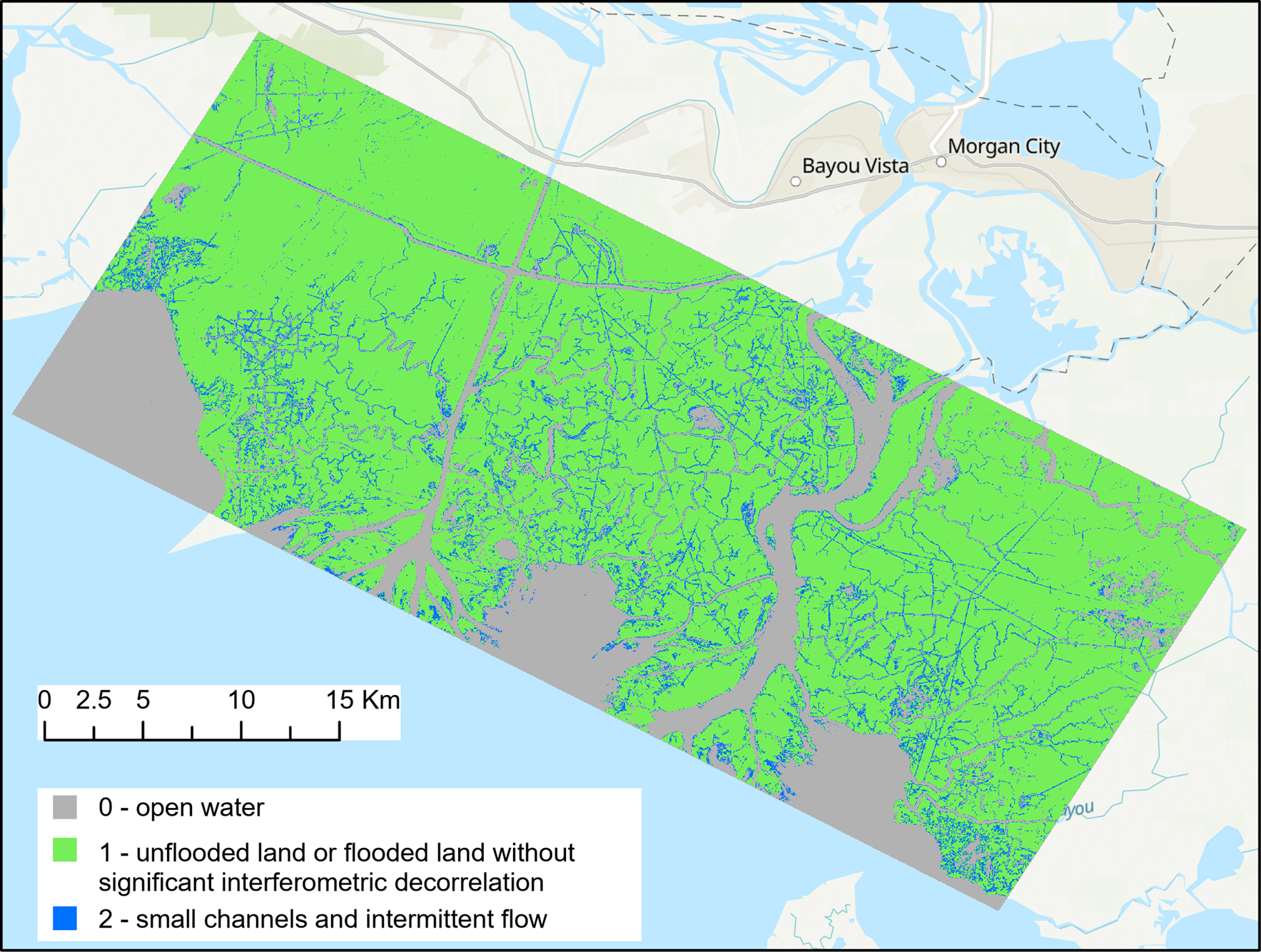
Pre-Delta-X: UAVSAR Georeferenced Channel Maps, Atchafalaya Basin, LA, USA, 2016, V2
National Aeronautics and Space Administration —
This dataset provides spatial data on water channels in the estuary of the Atchafalaya Basin of the Mississippi River Delta of coastal Louisiana. These Level-3 (L3)...
4 datasets found for "Tides"