

6 datasets found for "SpringBoot高校体质检测平台源码带本地搭建教程✅项目合作 二开均可 TG:saolei44✅.DbrGaMnYSLK"
-
Federal
HLS Sentinel-2 Multi-spectral Instrument Surface Reflectance Daily Global 30m v2.0
National Aeronautics and Space Administration —
The Harmonized Landsat Sentinel-2 (HLS) project provides consistent surface reflectance data from the Operational Land Imager (OLI) aboard the joint NASA/USGS Landsat... -
Federal
MASTER: Geological Earth Mapping Experiment (GEMx), Spring 2024
National Aeronautics and Space Administration —
This dataset includes Level 1B (L1B) data products from the MODIS/ASTER Airborne Simulator (MASTER) instrument. The spectral data were collected during 26 flights... -
Federal
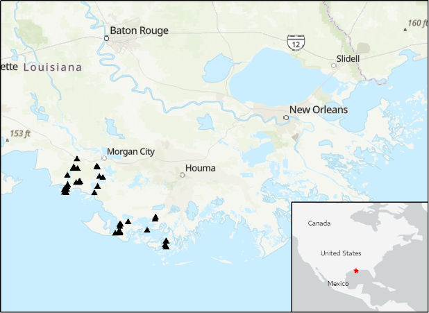
Delta-X: Acoustic Doppler Current Profiler Channel Surveys, MRD, Louisiana, 2021, V2
National Aeronautics and Space Administration —
This dataset provides river discharge measurements collected at selected locations in the Atchafalaya and Terrebonne Basins within the Mississippi River Delta (MRD)... -
Federal
ABoVE: Passive Microwave-derived Annual Snowpack Main Melt Onset Date Maps, 1988-2018
National Aeronautics and Space Administration —
This dataset provides the annual date of snowpack seasonal beginning melt (i.e., main melt onset date, MMOD) across northwest Canada; Alaska, U.S.; and parts of far... -
Federal
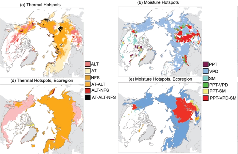
Trends of Thermal, Wetness, and Vegetative Change in the Circumpolar Arctic
National Aeronautics and Space Administration —
This dataset provides estimates of trends in temperature, moisture, and vegetation changes over the circumpolar Arctic. Time series trends were measured by the Theil-... -
Federal
SMODE Shipboard Windcube LiDAR Observations Version 1
National Aeronautics and Space Administration —
This dataset contains shipboard windcube data from the Sub-Mesoscale Ocean Dynamics Experiment (S-MODE) conducted approximately 300 km offshore of San Francisco...
6 datasets found for "SpringBoot高校体质检测平台源码带本地搭建教程✅项目合作 二开均可 TG:saolei44✅.DbrGaMnYSLK"