

15 datasets found for "Planning"
-
Federal
NASA Financial Budget Documents, Strategic Plans and Performance Reports 1999: NASA Budget Graphic
National Aeronautics and Space Administration —
NASA Financial Budget Documents, Strategic Plans and Performance Reports for fiscal year 1999. -
Federal
Country-Level Population and Downscaled Projections Based on the SRES A1, B1, and A2 Scenarios, 1990-2100
National Aeronautics and Space Administration —
The Country-Level Population and Downscaled Projections Based on Special Report on Emissions Scenarios (SRES) A1, B1, and A2 Scenarios, 1990-2100, were adopted in... -
Federal
CAR ARCTAS Arctic Research of the Composition of the Troposphere from Aircraft and Satellites L1 V1 (CAR_ARCTAS_L1C) at GES DISC
National Aeronautics and Space Administration —
ARCTAS focuses on advancing understanding of the factors driving current changes in the Arctic region including transport of mid-latitude pollution, boreal forest... -
Federal
COWVR STP-H8 Antenna and Microwave Brightness Temperatures Version 10.0
National Aeronautics and Space Administration —
This data set includes satellite-based observations of calibrated, geo-located antenna temperature and brightness temperatures, along with the sensor telemetry used... -
Federal
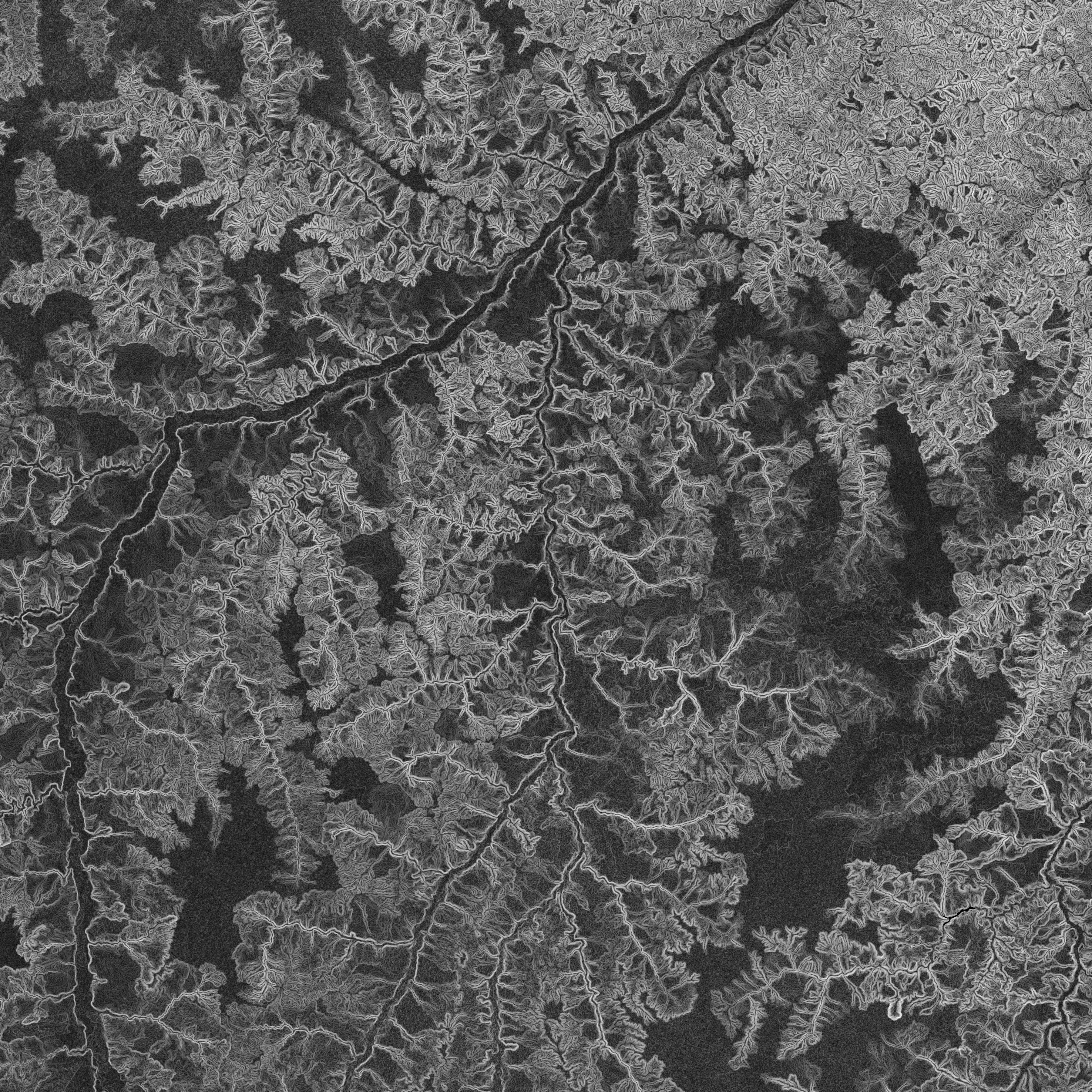
NASADEM Slope and Curvation Global 1 arc second V001
National Aeronautics and Space Administration —
The Land Processes Distributed Active Archive Center (LP DAAC) is responsible for the archive and distribution of NASA Making Earth System Data Records for Use in... -
Federal
Annual Global High-Resolution Extreme Heat Estimates (GEHE), 1983-2016
National Aeronautics and Space Administration —
The Annual Global High-Resolution Extreme Heat Estimates (GEHE), 1983-2016 data set provides global 0.05 degrees (~5 km) gridded annual counts of the number of days... -
Federal
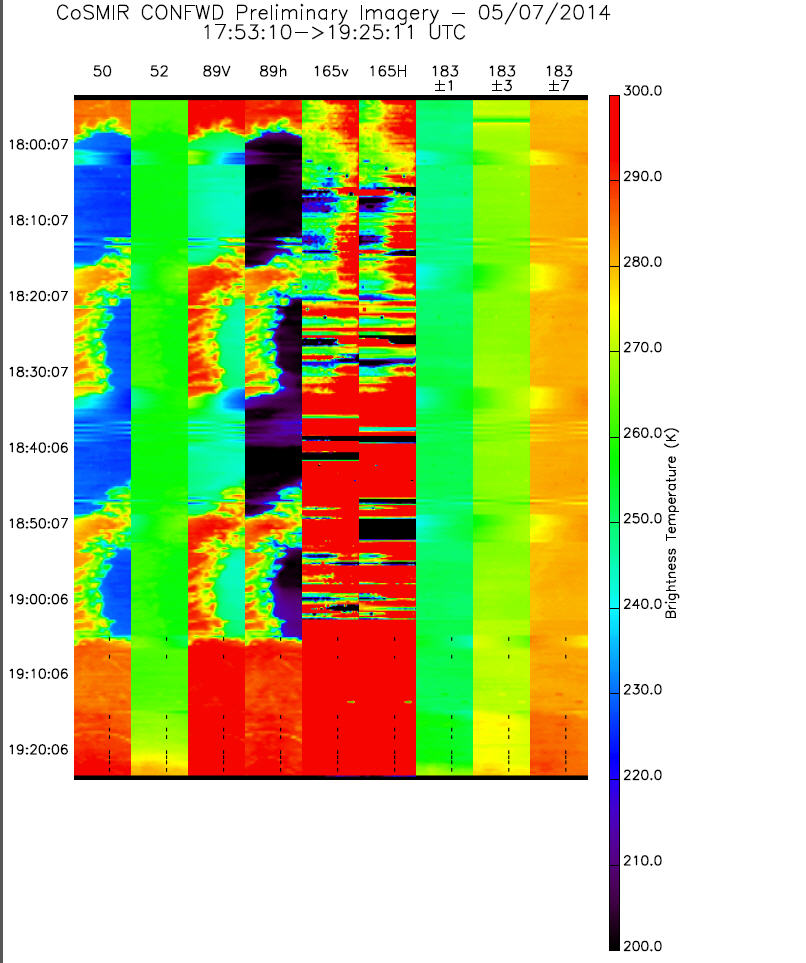
GPM GROUND VALIDATION CONICAL SCANNING MILLIMETER-WAVE IMAGING RADIOMETER (COSMIR) IPHEx V1
National Aeronautics and Space Administration —
The GPM Ground Validation Conical Scanning Millimeter-wave Imaging Radiometer (CoSMIR) IPHEx dataset consists of brightness temperatures from 9 channels as measured... -
Federal
Methane Emissions from Dairy Sources (Vista-CA), State of California, USA, 2019
National Aeronautics and Space Administration —
This dataset provides estimates of methane (CH4) emissions from dairies in California at a resolution of 0.1 degrees (~ 10 km x 10 km) for the year 2019. The mapped... -
Federal
Dar es Salaam Land Use and Informal Settlement Data Set
National Aeronautics and Space Administration —
The Dar es Salaam Land Use and Informal Settlement Data Set represents urban land use and consolidation of informal settlements for the years 1982, 1992, 1998, and... -
Federal
CAR ARCTAS BRDF Measurements V2 (CAR_ARCTAS_BRDF) at GES DISC
National Aeronautics and Space Administration —
ARCTAS focuses on advancing understanding of the factors driving current changes in the Arctic region including transport of mid-latitude pollution, boreal forest... -
Federal
CAR Clams Chesapeake Lighthouse Aircraft Ocean Measurements L1 V1 (CAR_CLAMS_L1C) at GES DISC
National Aeronautics and Space Administration —
CLAMS is the Chesapeake Lighthouse and Aircraft Measurements for Satellites field campaign sponsored by CERES, MISR, MODIS-Atmospheres and the NASA/GEWEX Global... -
Federal
TEMPEST STP-H8 Antenna and Microwave Brightness Temperatures Version 10.0
National Aeronautics and Space Administration —
This dataset includes satellite-based observations of calibrated, geo-located antenna temperature and brightness temperatures, along with the sensor telemetry used to... -
Federal
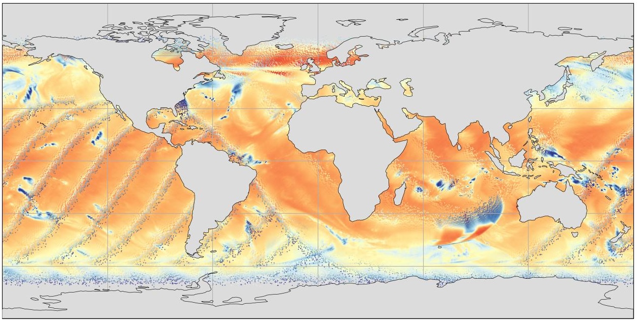
GHRSST NOAA/STAR ACSPO v2.80 0.02 degree L3S Dataset from mid-Morning LEO Satellites (GDS v2)
National Aeronautics and Space Administration —
NOAA STAR produces two lines of gridded 0.02 degree super-collated L3S LEO sub-skin Sea Surface Temperature (SST) datasets, one from the NOAA afternoon JPSS... -
Federal
Methane Plumes Derived from AVIRIS-NG over Point Sources across California, 2016-2017
National Aeronautics and Space Administration —
This dataset provides maps of methane (CH4) plumes along flight lines over identified methane point-source emitting infrastructure across the State of California, USA... -
Federal
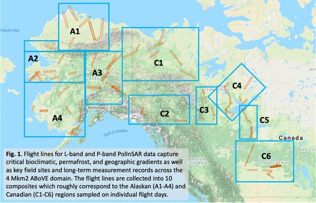
Summary of the ABoVE L-band and P-band Airborne SAR Surveys, 2012-2022
National Aeronautics and Space Administration —
This dataset contains tables containing Airborne flight metadata from synthetic aperture radar (SAR) surveys from 2012 to 2022 in Alaska and Canada. NASA's Arctic...
15 datasets found for "Planning"