
-
Federal
GLDAS Noah Land Surface Model L4 monthly 0.25 x 0.25 degree V2.1 (GLDAS_NOAH025_M) at GES DISC
National Aeronautics and Space Administration —
NASA Global Land Data Assimilation System Version 2 (GLDAS-2) has three components: GLDAS-2.0, GLDAS-2.1, and GLDAS-2.2. GLDAS-2.0 is forced entirely with the... -
Federal
Sentinel-5P TROPOMI Methane CH4 1-Orbit L2 7km x 7km V1 (S5P_L2__CH4___) at GES DISC
National Aeronautics and Space Administration —
Starting from August 6th in 2019, Sentinel-5P TROPOMI along-track high spatial resolution (~5.5km at nadir) has been implemented. For data after August 6th of 2019,... -
Federal
SWOT Level 2 Water Mask Raster Image 100m Data Product, Version D
National Aeronautics and Space Administration —
The SWOT Level 2 KaRIn High Rate Raster Product (SWOT_L2_HR_Raster_D) provides rasterized estimates of water surface elevation, inundation extent, and radar... -
Federal
LBA-ECO ND-11 Pre-harvest Forest Tree and Liana Biomass, NW Mato Grosso, Brazil: 2003
National Aeronautics and Space Administration —
The purpose of this study was to determine if spatially-explicit commercial timber inventories (CTI) could be used in conjunction with satellite imagery to improve... -
Federal
LBA Regional Hydrographic Data, 1-Degree, Release 2.2 (Cogley)
National Aeronautics and Space Administration —
This subset of the Global Hydrographic data set (GGHYDRO) Release 2.2 for the study area of the Large Scale Biosphere-Atmosphere Experiment in Amazonia (LBA) in South... -
Federal
GLDAS Noah Land Surface Model L4 monthly 1.0 x 1.0 degree V2.1 (GLDAS_NOAH10_M) at GES DISC
National Aeronautics and Space Administration —
NASA Global Land Data Assimilation System Version 2 (GLDAS-2) has three components: GLDAS-2.0, GLDAS-2.1, and GLDAS-2.2. GLDAS-2.0 is forced entirely with the... -
Federal
GLDAS Catchment Land Surface Model L4 monthly 1.0 x 1.0 degree V2.1 (GLDAS_CLSM10_M) at GES DISC
National Aeronautics and Space Administration —
NASA Global Land Data Assimilation System Version 2 (GLDAS-2) has three components: GLDAS-2.0, GLDAS-2.1, and GLDAS-2.2. GLDAS-2.0 is forced entirely with the... -
Federal
GLDAS VIC Land Surface Model L4 monthly 1.0 x 1.0 degree V2.1 (GLDAS_VIC10_M) at GES DISC
National Aeronautics and Space Administration —
NASA Global Land Data Assimilation System Version 2 (GLDAS-2) has three components: GLDAS-2.0, GLDAS-2.1, and GLDAS-2.2. GLDAS-2.0 is forced entirely with the... -
Federal
COWVR STP-H8 Antenna and Microwave Brightness Temperatures Version 10.0
National Aeronautics and Space Administration —
This data set includes satellite-based observations of calibrated, geo-located antenna temperature and brightness temperatures, along with the sensor telemetry used... -
Federal
TEMPEST STP-H8 Antenna and Microwave Brightness Temperatures Version 10.0
National Aeronautics and Space Administration —
This dataset includes satellite-based observations of calibrated, geo-located antenna temperature and brightness temperatures, along with the sensor telemetry used to... -
Federal
Digital SAR Mosaic and Elevation Map of the Greenland Ice Sheet, Version 1
National Aeronautics and Space Administration —
The Digital SAR Mosaic and Elevation Map of the Greenland Ice Sheet combines the most detailed synthetic aperture radar (SAR) image mosaic available with the best... -
Federal
GLDAS Noah Land Surface Model L4 3 hourly 1.0 x 1.0 degree V2.1 (GLDAS_NOAH10_3H) at GES DISC
National Aeronautics and Space Administration —
NASA Global Land Data Assimilation System Version 2 (GLDAS-2) has three components: GLDAS-2.0, GLDAS-2.1, and GLDAS-2.2. GLDAS-2.0 is forced entirely with the... -
Federal
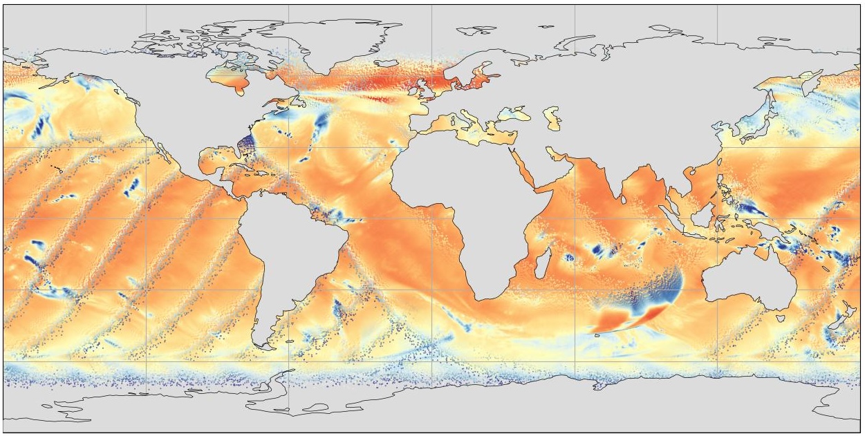
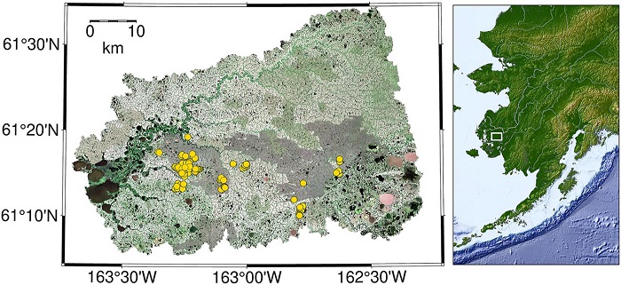
CO2 and CH4 Fluxes from Waterbodies, Yukon-Kuskokwim Delta, Alaska, 2016-2019
National Aeronautics and Space Administration —
This dataset provides estimates of carbon dioxide (CO2) and methane (CH4) diffusive fluxes from waterbodies, and watershed landcover data for the central-interior of... -
Federal
HOMAGE Monthly Time series of global average steric height anomalies and ocean heat content estimates from gridded in-situ ocean observations version 01
National Aeronautics and Space Administration —
The [HOMAGE_STERIC_OHC_TIME_SERIES_v01] dataset contains monthly global mean ocean heat content (OHC) anomalies as well as thermosteric, halosteric and total steric... -
Federal
COWVR STP-H8 Surface Wind Vector and Column-Integrated Atmospheric Water Measurements Version 10.0
National Aeronautics and Space Administration —
This dataset includes satellite-based observations of geolocated surface wind vectors, precipitable water vapor, and integrated cloud liquid water, as well as the... -
Federal
Vehicle-Level Reasoning Systems: Integrating System-Wide data to Estimate Instantaneous Health State
National Aeronautics and Space Administration —
One of the primary goals of Integrated Vehicle Health Management (IVHM) is to detect, diagnose, predict, and mitigate adverse events during the flight of an aircraft,... -
Federal
LBA-ECO ND-01 Streamwater and Watershed Characteristics, Rondonia, Brazil: 1998-1999
National Aeronautics and Space Administration —
This data set provides the results of (1) synoptic streamwater sampling and analyses from numerous sites across Rondonia and (2) corresponding watershed... -
Federal
Sentinel-5P TROPOMI Methane CH4 1-Orbit L2 5.5km x 7km V2 (S5P_L2__CH4____HiR) at GES DISC
National Aeronautics and Space Administration —
Starting from August 6th in 2019, Sentinel-5P TROPOMI along-track high spatial resolution (~5.5km at nadir) has been implemented.For data before August 6th of 2019,... -
Federal
Algorithms for Spectral Decomposition with Applications
National Aeronautics and Space Administration —
The analysis of spectral signals for features that represent physical phenomenon is ubiquitous in the science and engineering communities. There are two main... -
Federal
Sentinel-5P TROPOMI Methane CH4 1-Orbit L2 7km x 7km V1 (S5P_L2__CH4___) at GES DISC
National Aeronautics and Space Administration —
Starting from August 6th in 2019, Sentinel-5P TROPOMI along-track high spatial resolution (~5.5km at nadir) has been implemented.For data after August 6th of 2019,...

Official websites use .gov
A
.gov website belongs to an official government
organization in the United States.
Secure .gov websites use HTTPS
A
lock (
) or https:// means you’ve safely connected to
the .gov website. Share sensitive information only on official,
secure websites.