

11 datasets found for "69f유흥디비업체⊇텔WB7000☑️_"
-
Federal
HIRS/Nimbus-6 Level 1 Calibrated Radiances for the Global Atmospheric Research Program (GARP) V001 (HIRSN6L1GARP) at GES DISC
National Aeronautics and Space Administration —
The Nimbus-6 High Resolution Infrared Radiometer (HIRS) Level 1 Calibrated Radiances for the Global Atmospheric Research Program (GARP) data product contains daily... -
Federal
SARP 2024 Data
National Aeronautics and Space Administration —
SARP_2024_Data is the data collected onboard the NASA P-3B and the Dynamic Aviation B200 aircrafts during the 2024 deployment of the Student Airborne Research Program... -
Federal
VISSR/SMS-2 Level 1 Atmospheric and Oceanographic Image Processing System (AOIPS) Data V001 (VISSRSMS2L1AOIPS) at GES DISC
National Aeronautics and Space Administration —
VISSRSMS2L1AOIPS is the Visible Infrared Spin-Scan Radiometer (VISSR) Level 1 Atmospheric and Oceanographic Image Processing System (AOIPS) data product from the... -
Federal
MRIR/Nimbus-3 Level 1 Meteorological Radiation Data V001 (MRIRN3L1) at GES DISC
National Aeronautics and Space Administration —
MRIRN3L1 is the Nimbus-3 Medium-Resolution Infrared Radiometer (MRIR) Level 1 Meteorological Radiance Data product and contain radiances expressed as equivalent... -
Federal
LIMS/Nimbus-7 Level 1 Profiles of Radiance Data V001 (LIMSN7L1PROFILER) at GES DISC
National Aeronautics and Space Administration —
LIMSN7L1PROFILER is the Nimbus-7 Limb Infrared Monitor of the Stratosphere (LIMS) Level-1 Profiles of Radiance Data product and contains selected daily vertical... -
Federal
SARP 2014 Data
National Aeronautics and Space Administration —
SARP_2014_Data is the data collected onboard the NASA DC-8 aircraft during the 2014 deployment of the Student Airborne Research Program (SARP) mission. Data... -
Federal
SAFARI 2000 ER-2 Color-IR Aerial Photography, Dry Season 2000
National Aeronautics and Space Administration —
Aerial photography from the NASA ER-2 high altitude aircraft was collected to provide detailed and spatially extensive documentation over parts of the SAFARI study... -
Federal
THIR/Nimbus-6 Level 1 Meteorological Radiation Data at 6.7 microns V001 (THIRN6L1CH67) at GES DISC
National Aeronautics and Space Administration —
THIRN6L1CH67 is the Nimbus-6 Temperature-Humidity Infrared Radiometer (THIR) Level 1 Meteorological Radiation Data at 6.7 microns product and contains radiances... -
Federal
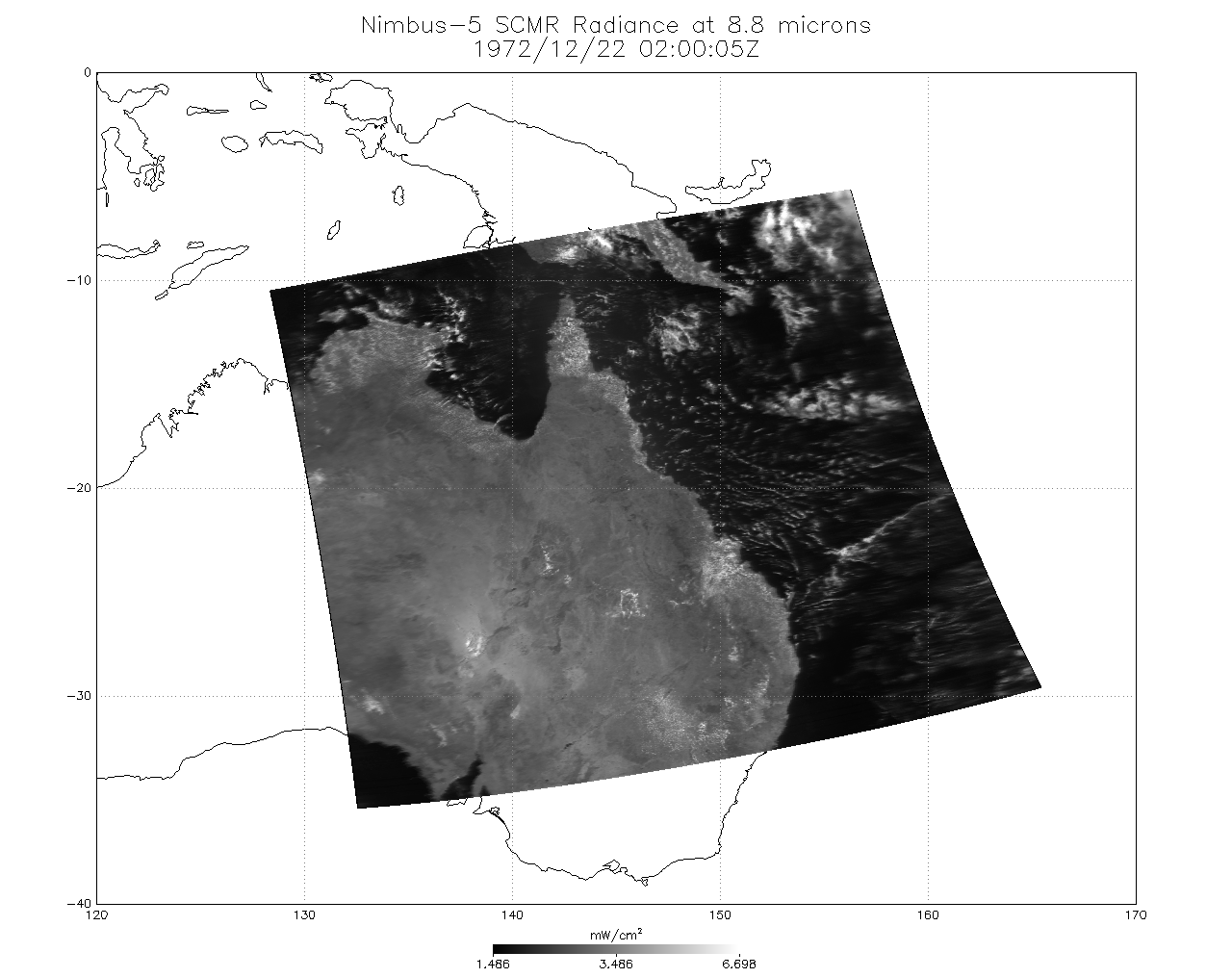
SCMR/Nimbus-5 Level 1 Calibrated and Geolocated Radiances V001 (SCMRN5L1RAD) at GES DISC
National Aeronautics and Space Administration —
SCMRN5L1RAD is the Nimbus-5 Surface Composition Mapping Radiometer (SCMR) Level 1 Calibrated and Geolocated Radiances data product. SCMR measured (1) terrestrial... -
Federal
HRIR/Nimbus-3 Level 1 Meteorological Radiation Data V001 (HRIRN3L1) at GES DISC
National Aeronautics and Space Administration —
HRIRN3L1 is the High Resolution Infrared Radiometer (HRIR) Nimbus-3 Level 1 Meteorological Radiance Data (NMRT) product and contains infrared radiances converted to... -
Federal
LRIR/Nimbus-6 Level 2 Inverted Profiles of Temperature and Ozone V001 (LRIRN6L2IPAT) at GES DISC
National Aeronautics and Space Administration —
LRIRN6L2IPAT is the Nimbus-6 Limb Radiance Inversion Radiometer (LRIR) Level 2 Inverted Profiles of Temperature and Ozone data product. The product contains daily...
11 datasets found for "69f유흥디비업체⊇텔WB7000☑️_"