
-
Federal
Mars orbital image (HiRISE) labeled data set version 3
National Aeronautics and Space Administration —
This data set contains a total of 73,031 landmarks. 10,433 landmarks were detected and extracted from 180 HiRISE browse images, and 62,598 landmarks were augmented... -
Federal
Global Population Density Grid Time Series Estimates
National Aeronautics and Space Administration —
The Global Population Density Grid Time Series Estimates provide a back-cast time series of population density grids based on the year 2000 population grid from... -
Federal
MODIS/Terra Land Water Mask Derived from MODIS and SRTM L3 Global 250m SIN Grid V006
National Aeronautics and Space Administration —
The MOD44W Version 6 data product was decommissioned on July 18, 2024. Users are encouraged to use the MOD44W Version 6.1 data product... -
Federal
Multi-Global Navigation Satellite System (GNSS) Broadcast Ephemeris Data (daily files) from NASA CDDIS
National Aeronautics and Space Administration —
This dataset consists of ground-based multi-GNSS (Global Navigation Satellite System) Broadcast Ephemeris Data. GNSS satellites provide autonomous geo-spatial... -
Federal
AIRSAR_TOPSAR_C-BAND_DEM_AND_STOKES
National Aeronautics and Space Administration —
AIRSAR topographic SAR digital elevation model C_Stokes product -
Federal
Extra-vehicular Activity (EVA)-US and Russia API
National Aeronautics and Space Administration —
Activities done by an astronaut or cosmonaut outside a spacecraft beyond the Earth's appreciable atmosphere. -
Federal
A Global Database of Field-observed Leaf Area Index in Woody Plant Species, 1932-2011
National Aeronautics and Space Administration —
This data set provides global leaf area index (LAI) values for woody species. The data are a compilation of field-observed data from 1,216 locations obtained from 554... -
Federal
Global Vegetation Greenness (NDVI) from AVHRR GIMMS-3G+, 1981-2022
National Aeronautics and Space Administration —
This dataset holds the Global Inventory Modeling and Mapping Studies-3rd Generation V1.2 (GIMMS-3G+) data for the Normalized Difference Vegetation Index (NDVI). NDVI... -
Federal
VIIRS NOAA-20 (JPSS-1) 375m, I-Band Active Fire Product NRT (Vector Data)
National Aeronautics and Space Administration —
Near real-time (NRT) NOAA-20 (formally JPSS-1) Visible Infrared Imaging Radiometer Suite (VIIRS) Active Fire detection product is based on the instrument's 375 m... -
Federal
NACP Aboveground Biomass and Carbon Baseline Data, V.2 (NBCD 2000), U.S.A., 2000
National Aeronautics and Space Administration —
The NBCD 2000 (National Biomass and Carbon Dataset for the Year 2000) data set provides a high-resolution (30 m) map of year-2000 baseline estimates of basal area-... -
Federal
MODIS/Terra Land Surface Temperature/3-Band Emissivity Monthly L3 Global 0.05Deg CMG V061
National Aeronautics and Space Administration —
A suite of Moderate Resolution Imaging Spectroradiometer (MODIS) Land Surface Temperature and Emissivity (LST&E) products are available in Collection 6.1. The... -
Federal
MASTER: FireSense, western US, October 2023
National Aeronautics and Space Administration —
This dataset includes Level 1B (L1B) data products from the MODIS/ASTER Airborne Simulator (MASTER) instrument. The spectral data were collected as part of the... -
Federal
AMSRIce03 Surface Roughness Data, Version 1
National Aeronautics and Space Administration —
Notice to Data Users: The documentation for this data set was provided solely by the Principal Investigator(s) and was not further developed, thoroughly reviewed, or... -
Federal
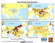
U.S. Population Grids (Summary File 1), 2000: New Orleans Metropolitan Statistical Area, Alpha Version
National Aeronautics and Space Administration —
U.S. Population Grids (Summary File 1), 2000: New Orleans Metropolitan Statistical Area, Alpha Version contains an ARC/INFO Workspace with grids of demographic data... -
Federal
LBA-ECO CD-10 H2O Profiles at km 67 Tower Site, Tapajos National Forest
National Aeronautics and Space Administration —
This data set reports vertical profiles of H2O vapor concentrations measured at the Para Western (Santarem) - km 67, Primary Forest Tower Site (Figure 1). This site... -
Federal
MRIR/Nimbus-3 Images of Daytime Brightness Temperature on 4 x 5 inch Film Sheets V001 (MRIRN3IM) at GES DISC
National Aeronautics and Space Administration —
MRIRN3IM is the Nimbus-3 Medium Resolution Infrared Radiometer (MRIR) data product consisting of 4 x 5 inch photographic film sheets. Each film sheet contains an... -
Federal
LBA-ECO LC-09 Landsat TM and ETM+ Data, Sites in Rondonia and Para, Brazil: 1985-2004
National Aeronautics and Space Administration —
This data set includes 15 zipped archives of rectified .tif format Landsat 5 TM and Landsat 7 ETM+ scenes from near the study sites of Altamira, Santarem, Ponta de... -
Federal
Mars Map Catalog
National Aeronautics and Space Administration —
The Mars Maps Catalog includes various mappings of the surface of Mars. -
Federal
CORONA Satellite Photographs from the U.S. Geological Survey
National Aeronautics and Space Administration —
The first generation of U.S. photo intelligence satellites collected more than 860,000 images of the Earth’s surface between 1960 and 1972. The classified military... -
Federal
AIRSAR_TOPSAR_DEM
National Aeronautics and Space Administration —
AIRSAR topographic SAR digital elevation model product

Official websites use .gov
A
.gov website belongs to an official government
organization in the United States.
Secure .gov websites use HTTPS
A
lock (
) or https:// means you’ve safely connected to
the .gov website. Share sensitive information only on official,
secure websites.