
-
Federal
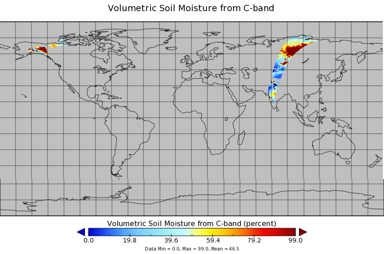
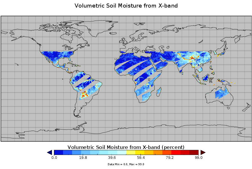
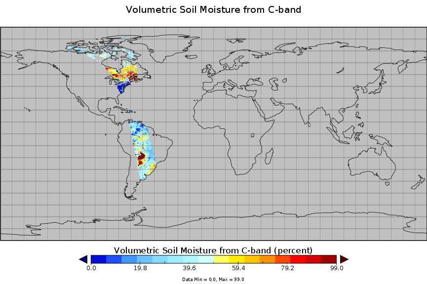
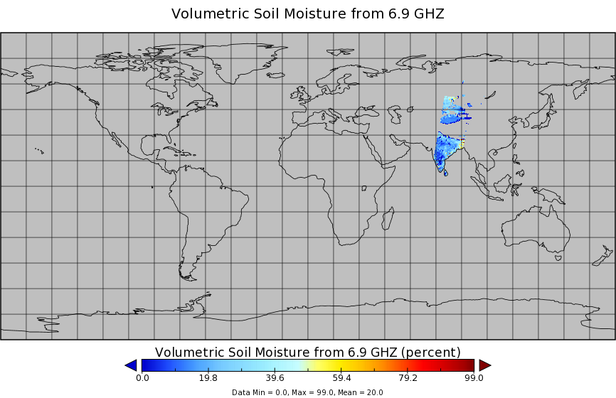
AMSR2/GCOM-W1 surface soil moisture (LPRM) L3 1 day 25 km x 25 km descending V001 (LPRM_AMSR2_D_SOILM3) at GES DISC recent views
National Aeronautics and Space Administration —
AMSR2/GCOM-W1 surface soil moisture (LPRM) L3 1 day 25 km x 25 km descending V001 is a Level 3 (gridded) data set. Its land surface parameters, surface soil moisture,... -
Federal
AMSR2/GCOM-W1 surface soil moisture (LPRM) L3 1 day 10 km x 10 km ascending V001 (LPRM_AMSR2_DS_A_SOILM3) at GES DISC recent views
National Aeronautics and Space Administration —
AMSR2/GCOM-W1 surface soil moisture (LPRM) L3 1 day 10 km x 10 km ascending V001 is a Level 3 (gridded) data set. Its land surface parameters, surface soil moisture,... -
Federal
TMI/TRMM surface soil moisture (LPRM) L2 V001 (LPRM_TMI_SOILM2) at GES DISC recent views
National Aeronautics and Space Administration —
TMI/TRMM surface soil moisture (LPRM) L2 V001 is a Level 2 (swath) data set. Its land surface parameters, surface soil moisture, land surface (skin) temperature, and... -
Federal
NLDAS Noah Land Surface Model L4 Monthly 0.125 x 0.125 degree V2.0 (NLDAS_NOAH0125_M) at GES DISC recent views
National Aeronautics and Space Administration —
This data set contains fifty-two fields simulated from the Noah land-surface model (LSM) for Phase 2 of the North American Land Data Assimilation System (NLDAS-2).... -
Federal
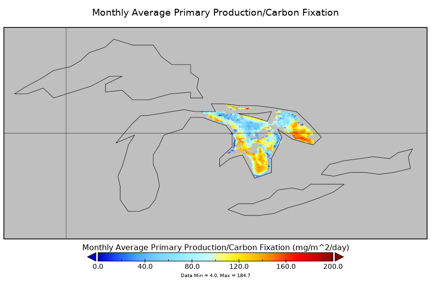
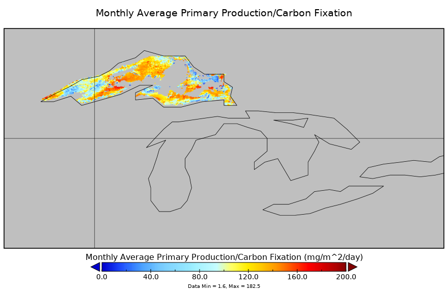
Carbon Monitoring System Lake Huron Primary Production Monthly V1 (CMSLakeHuronPPM) at GES DISC NGDA recent views
National Aeronautics and Space Administration —
Monthly Average primary production/carbon fixation data for Lake Huron. The primary production data is derived using MODIS imagery with model data. The NASA Carbon... -
Federal
WindSat/Coriolis surface soil moisture (LPRM) L2 V001 (LPRM_WINDSAT_SOILM2) at GES DISC recent views
National Aeronautics and Space Administration —
WindSat/Coriolis surface soil moisture (LPRM) L2 V001 is a Level 2 (swath) data set. Its land surface parameters, surface soil moisture, land surface (skin)... -
Federal
AMSR2/GCOM-W1 surface soil moisture (LPRM) L3 1 day 25 km x 25 km ascending V001 (LPRM_AMSR2_A_SOILM3) at GES DISC recent views
National Aeronautics and Space Administration —
AMSR2/GCOM-W1 surface soil moisture (LPRM) L3 1 day 25 km x 25 km ascending V001 is a Level 3 (gridded) data set. Its land surface parameters, surface soil moisture,... -
Federal
NLDAS VIC Land Surface Model L4 Monthly 0.125 x 0.125 degree V2.0 (NLDAS_VIC0125_M) at GES DISC recent views
National Aeronautics and Space Administration —
This data set contains forty-three fields simulated from the VIC land-surface model (LSM) for Phase 2 of the North American Land Data Assimilation System (NLDAS-2).... -
Federal
OCO-2 Level 2 bias-corrected solar-induced fluorescence and other select fields from the IMAP-DOAS algorithm aggregated as daily files, Retrospective processing V10r (OCO2_L2_Lite_SIF) at GES DISC recent views
National Aeronautics and Space Administration —
Version 10r is the current version of the data set. Older versions will no longer be available and are superseded by Version 10r. The OCO-2 SIF Lite files contain... -
Federal
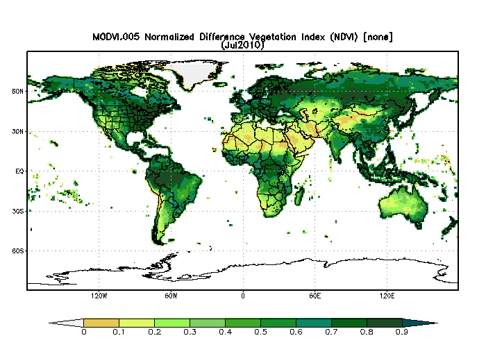
MODIS/Terra Monthly Vegetation Indices Global 1x1 degree V005 (MODVI) at GES DISC NGDA recent views
National Aeronautics and Space Administration —
The global monthly gridded MODIS vegetation indices product is derived from the standard 0.05 CMG MODIS Terra Vegetation Indices Monthly product MOD13C2 (Huete et al,... -
Federal
TMI/TRMM surface soil moisture (LPRM) L3 1 day 25 km x 25 km daytime V001 (LPRM_TMI_DY_SOILM3) at GES DISC recent views
National Aeronautics and Space Administration —
TMI/TRMM surface soil moisture (LPRM) L3 1 day 25 km x 25 km daytime V001 is a Level 3 (gridded) data set. Its land surface parameters, surface soil moisture, land... -
Federal
MERRA-2 tavgM_2d_lnd_Nx: 2d,Monthly mean,Time-Averaged,Single-Level,Assimilation,Land Surface Diagnostics 0.625 x 0.5 degree V5.12.4 (M2TMNXLND) at GES DISC recent views
National Aeronautics and Space Administration —
M2TMNXLND (or tavgM_2d_lnd_Nx) is a time-averaged 2-dimensional monthly mean data collection in Modern-Era Retrospective analysis for Research and Applications... -
Federal
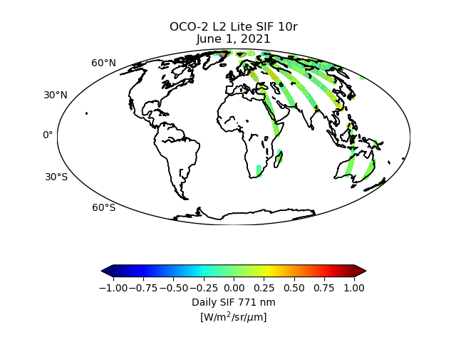
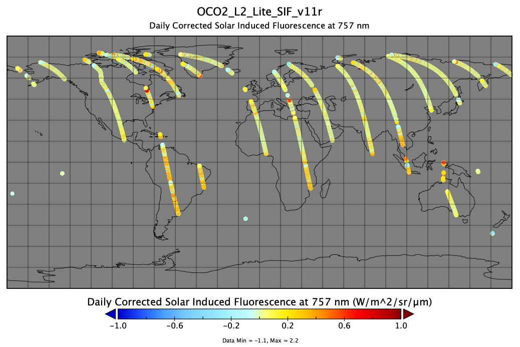
OCO-2 Level 2 bias-corrected solar-induced fluorescence and other select fields from the IMAP-DOAS algorithm aggregated as daily files, Retrospective processing V11r (OCO2_L2_Lite_SIF) at GES DISC recent views
National Aeronautics and Space Administration —
Version 11r is the current version of the data set. Older versions will no longer be available and are superseded by Version 11r. The OCO-2 SIF Lite files contain... -
Federal
Carbon Monitoring System Lake Superior Primary Production Monthly V1 (CMSLakeSuperiorPPM) at GES DISC NGDA recent views
National Aeronautics and Space Administration —
Monthly Average primary production/carbon fixation data for Lake Superior. The primary production data is derived using MODIS imagery with model data. The NASA Carbon... -
Federal
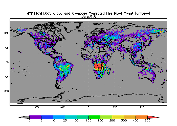
MODIS/Aqua 1 degree Gridded MODIS Active Fire Product V005 (MYD14CM1) at GES DISC NGDA recent views
National Aeronautics and Space Administration —
The gridded MODIS active fire products present statistical summaries of fire pixel information (Giglio et al., 2003). The global monthly products are generated at 1x1... -
Federal
AMSR-E/Aqua surface soil moisture (LPRM) L2B V002 (LPRM_AMSRE_SOILM2) at GES DISC recent views
National Aeronautics and Space Administration —
AMSR-E/Aqua surface soil moisture (LPRM) L2B V002 is a Level 2 (swath) data set. Its land surface parameters, surface soil moisture, land surface (skin) temperature,... -
Federal
NLDAS Mosaic Land Surface Model L4 Monthly Climatology 0.125 x 0.125 degree V002 (NLDAS_MOS0125_MC) at GES DISC recent views
National Aeronautics and Space Administration —
This monthly climatology data set contains a series of land surface parameters simulated from the Mosaic land-surface model (LSM) for Phase 2 of the North American... -
Federal
NLDAS Mosaic Land Surface Model L4 Hourly 0.125 x 0.125 degree V2.0 (NLDAS_MOS0125_H) at GES DISC recent views
National Aeronautics and Space Administration —
This data set contains thirty-eight fields simulated from the Mosaic land-surface model (LSM) for Phase 2 of the North American Land Data Assimilation System... -
Federal
AMSR2/GCOM-W1 downscaled surface soil moisture (LPRM) L2B V001 (LPRM_AMSR2_DS_SOILM2) at GES DISC recent views
National Aeronautics and Space Administration —
AMSR2/GCOM-W1 downscaled surface soil moisture (LPRM) L2B V001 is a Level 2 (swath) data set. Its land surface parameters, surface soil moisture, land surface (skin)... -
Federal
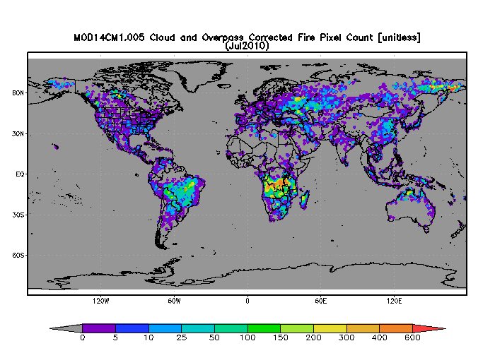
MODIS/Terra 1 degree Gridded MODIS Active Fire Product V005 (MOD14CM1) at GES DISC NGDA recent views
National Aeronautics and Space Administration —
The gridded MODIS active fire products present statistical summaries of fire pixel information (Giglio et al., 2003). The global monthly products are generated at 1x1...

Official websites use .gov
A
.gov website belongs to an official government
organization in the United States.
Secure .gov websites use HTTPS
A
lock (
) or https:// means you’ve safely connected to
the .gov website. Share sensitive information only on official,
secure websites.