
-
Federal
Last of the Wild Project, Version 2, 2005 (LWP-2): Global Human Footprint Dataset (IGHP)
National Aeronautics and Space Administration —
The Global Human Footprint Dataset of the Last of the Wild Project, Version 2, 2005 (LWP-2) is the Human Influence Index (HII) normalized by biome. The HII is a... -
Federal
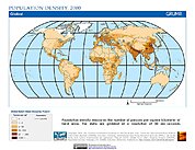
Gridded Population of the World, Version 3 (GPWv3): Population Density Grid
National Aeronautics and Space Administration —
The Gridded Population of the World, Version 3 (GPWv3): Population Density Grid consists of estimates of human population for the years 1990, 1995, and 2000 by 2.5... -
Federal
Gridded Population of the World, Version 4 (GPWv4): Data Quality Indicators, Revision 11
National Aeronautics and Space Administration —
The Gridded Population of the World, Version 4 (GPWv4): Data Quality Indicators, Revision 11 consists of three data layers created to provide context for the... -
Federal
ACCLIP WB-57 Aircraft Merge Data
National Aeronautics and Space Administration —
ACCLIP_Merge_WB57-Aircraft_Data is the pre-generated merge files created from a variety of in-situ instrumentation collecting measurements onboard the WB-57 aircraft... -
Federal
ACCLIP WB-57 Aircraft Model Data
National Aeronautics and Space Administration —
ACCLIP_Model_WB57_Data contains modeled meteorological, chemical, and aerosol data along the flight tracks of the WB-57 aircraft during the Asian Summer Monsoon... -
Federal
COSMOS Field VLBA Observations 1.4-GHz Source Catalog
National Aeronautics and Space Administration —
This table contains the results of a project using wide-field Very Long Baseline Interferometry (VLBI) observations at 1.4 GHz of 2,865 known radio sources in the... -
Federal
30 Doradus Catalog ConeSearch
National Aeronautics and Space Administration —
30 Doradus (a.k.a. the Tarantula Nebula), with its ionizing cluster R136, is one of the few known starbursts in the Local Group. For size (~200 pc in diameter) and... -
Federal
XTE All-Sky Slew Survey AGN Catalog
National Aeronautics and Space Administration —
This table contains the RXTE All-Sky Slew Survey Catalog of AGN and AGN candidates. The catalog authors compiled a sample of 95 AGNs which were serendipitously... -
Federal
Planck High-Redshift Source Candidates Catalog
National Aeronautics and Space Administration —
The Planck mission, thanks to its large frequency range and all-sky coverage, has a unique potential for systematically detecting the brightest, and rarest, sub-... -
Federal
West Africa Coastal Vulnerability Mapping: Social Vulnerability Indices
National Aeronautics and Space Administration —
The West Africa Coastal Vulnerability Mapping: Social Vulnerability Indices data set includes three indices: Social Vulnerability, Population Exposure, and Poverty... -
Federal
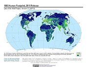
Last of the Wild Project, Version 3 (LWP-3): 1993 Human Footprint, 2018 Release
National Aeronautics and Space Administration —
The 1993 Human Footprint, 2018 Release provides a global map of the cumulative human pressure on the environment in 1993, at a spatial resolution of ~1 km. The human... -
Federal
Global Rural-Urban Mapping Project, Version 1 (GRUMPv1): Population Density Grid
National Aeronautics and Space Administration —
The Global Rural-Urban Mapping Project, Version 1 (GRUMPv1): Population Density Grid estimates population per square km for the years 1990, 1995, and 2000 by 30 arc-... -
Federal
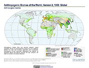
Anthropogenic Biomes of the World, Version 2: 1800
National Aeronautics and Space Administration —
The Anthropogenic Biomes of the World, Version 2: 1800 data set describes anthropogenic transformations within the terrestrial biosphere caused by sustained direct... -
Federal
National Aggregates of Geospatial Data Collection: Population, Landscape, And Climate Estimates, Version 2 (PLACE II)
National Aeronautics and Space Administration —
The National Aggregates of Geospatial Data Collection: Population, Landscape, And Climate Estimates, Version 2 (PLACE II) data set contains estimates of national-... -
Federal
West Africa Coastal Vulnerability Mapping: GPW Version 4 Population Density, Preliminary Release 1, 2010
National Aeronautics and Space Administration —
The West Africa Coastal Vulnerability Mapping: GPW Version 4 Population Density, Preliminary Release 1, 2010, represents the number of persons per square kilometer,... -
Federal
Gridded Population of the World, Version 4 (GPWv4): Population Density Adjusted to Match 2015 Revision UN WPP Country Totals, Revision 11
National Aeronautics and Space Administration —
The Gridded Population of the World, Version 4 (GPWv4): Population Density Adjusted to Match 2015 Revision of UN WPP Country Totals, Revision 11 consists of estimates... -
Federal
Global 15 x 15 Minute Grids of the Downscaled Population Based on the SRES B2 Scenario, 1990 and 2025
National Aeronautics and Space Administration —
The Global 15x15 Minute Grids of the Downscaled Population Based on the Special Report on Emissions Scenarios (SRES) B2 Scenario, 1990 and 2025, are geospatial... -
Federal
Gridded Population of the World, Version 3 (GPWv3): Population Density Grid, Future Estimates
National Aeronautics and Space Administration —
The Gridded Population of the World, Version 3 (GPWv3): Population Density Grid, Future EstimatesFuture Estimates consists of estimates of human population for the... -
Federal
Global Multihazard Total Economic Loss Risk Deciles
National Aeronautics and Space Administration —
The Global Multihazard Total Economic Loss Risk Deciles is a 2.5 minute grid of global multihazard total economic loss risks. First, for each of the considered...

Official websites use .gov
A
.gov website belongs to an official government
organization in the United States.
Secure .gov websites use HTTPS
A
lock (
) or https:// means you’ve safely connected to
the .gov website. Share sensitive information only on official,
secure websites.