

192 datasets found for "9 Digit ZIP Codes"
-
Federal
ABoVE: Synthesis of Burned and Unburned Forest Site Data, AK and Canada, 1983-2016
National Aeronautics and Space Administration —
This dataset is a synthesis of field plot characterization data, derived above-ground and below-ground combusted carbon, and acquired Fire Weather Index (FWI) System... -
Federal
ABoVE/ASCENDS: Atmospheric Backscattering Coefficient Profiles from CO2 Sounder, 2017
National Aeronautics and Space Administration —
This dataset provides atmospheric backscattering coefficient profiles collected during Active Sensing of CO2 Emissions over Nights, Days, and Seasons (ASCENDS)... -
Federal
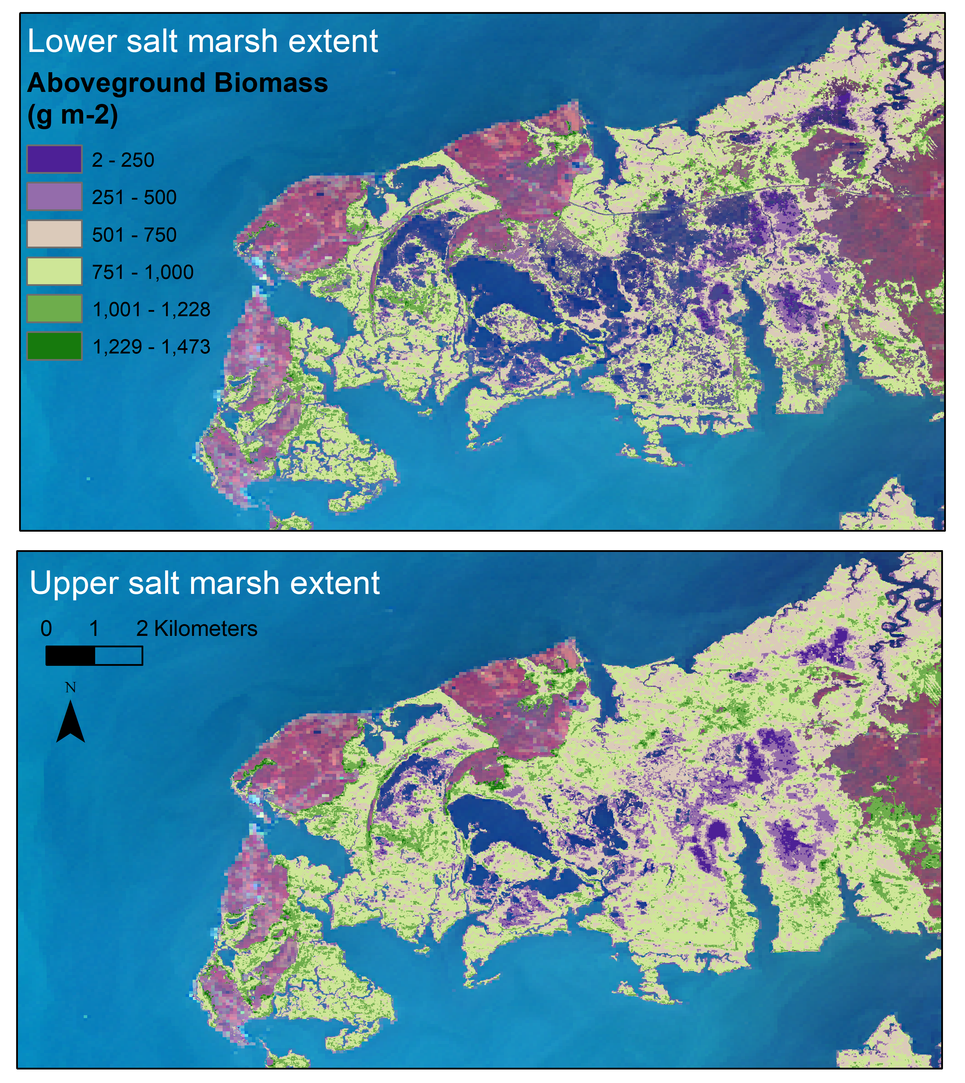
Aboveground Biomass Estimates for Salt Marsh for the Contiguous United States, 2020
National Aeronautics and Space Administration —
This dataset provides estimates of aboveground biomass (AGB) and salt marsh extent in the contiguous United States for 2020 and includes all coastal watersheds across... -
Federal
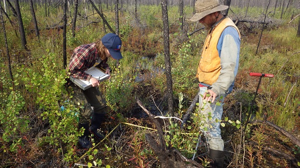
ABoVE: Post-Fire and Unburned Vegetation Community and Field Data, NWT, Canada, 2017
National Aeronautics and Space Administration —
This dataset provides vegetation community characteristics, soil moisture, and biophysical data collected in 2017 from 11 study sites in the ABoVE Study area. The 11... -
Federal
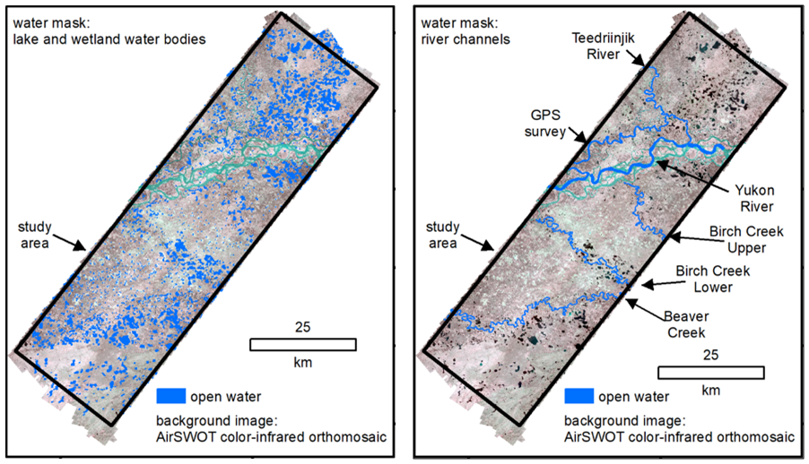
ABoVE: AirSWOT Radar, Orthomosaic, and Water Masks, Yukon Flats Basin, Alaska, 2015
National Aeronautics and Space Administration —
This dataset provides NASA AirSWOT Ka-band (35.75 GHz) radar interferometry data products for water surface elevation (WSE), a derived color-infrared (CIR) digital... -
Federal
Arctic Vegetation Plots Legacy Project Barter Island and Point Barrow, Alaska, 1994
National Aeronautics and Space Administration —
This dataset provides vegetation cover and environmental plot and soil data collected at two U.S. Air Force sites at Barter Island (BI) and Point Barrow (B), on the... -
Federal
BOREAS TE-20 Supplementary Site Information For NSA Tower Sites
National Aeronautics and Space Administration —
The BOREAS TE-20 team collected several data sets for use in developing and testing models of forest ecosystem dynamics. This data set and documentation were compiled... -
Federal
CMS: Mangrove Canopy Height from High-resolution Stereo Image Pairs, Mozambique, 2012
National Aeronautics and Space Administration —
This data set provides canopy height estimates for mangrove forests at 0.6 x 0.6 m resolution in three study sites located in southeastern Mozambique, Africa: two... -
Federal
BOREAS Level-0 AOCI Imagery: Digital Counts in BIL Format
National Aeronautics and Space Administration —
The level-0 AOCI imagery, along with the other remotely sensed images, was collected to provide spatially extensive information about radiant energy over the primary... -
Federal
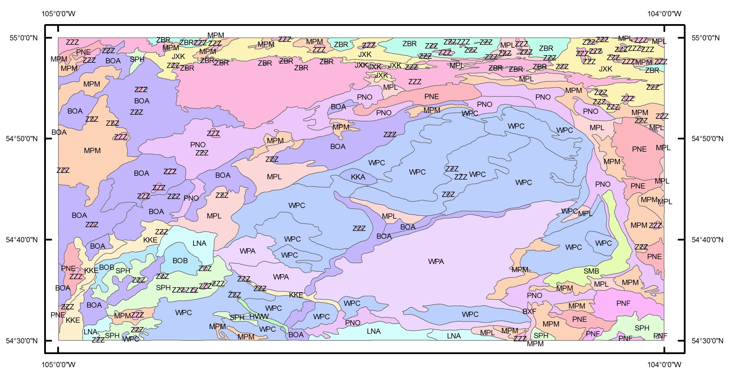
BOREAS Agriculture Canada Central Saskatchewan Vector Soils Data, R1
National Aeronautics and Space Administration —
This data set provides soil descriptions for forested areas in the BOREAS southern study area (SSA) in central Saskatchewan, Canada provided by Agriculture Canada.... -
Federal
BOREAS Regional DEM in Raster Format and AEAC Projection
National Aeronautics and Space Administration —
This data set is based on the GTOPO30 DEM produced by the USGS EDC. The BOREAS region (1,000km x 1000km) was extracted from the GTOPO30 data and reprojected by BOREAS... -
Federal
Data over the SSA in Raster Format and AEAC Projection
National Aeronautics and Space Administration —
This data set consists of GIS layers that describe the soils of the BOREAS SSA. The original data were submitted as vector layers that were gridded by BOREAS staff to...
192 datasets found for "9 Digit ZIP Codes"