

15 datasets found
-
Federal
SPURS-2 Passive Accoustic Listener (PAL) data from ARGO float deployments during the E. Tropical Pacific field campaign
National Aeronautics and Space Administration —
The SPURS (Salinity Processes in the Upper Ocean Regional Study) project is a NASA-funded oceanographic process study and associated field program that aim to... -
Federal
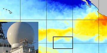
SPURS-2 research vessel along track SEA-POL rain radar imaging data for E. Tropical Pacific R/V Revelle-2 cruise
National Aeronautics and Space Administration —
The SPURS (Salinity Processes in the Upper Ocean Regional Study) project is NASA-funded oceanographic process study and associated field program that aim to elucidate... -
Federal
SASSIE Arctic Field Campaign Shipboard Meteorology Data Fall 2022
National Aeronautics and Space Administration —
The Salinity and Stratification at the Sea Ice Edge (SASSIE) project is a NASA experiment that aims to understand how salinity anomalies in the upper ocean generated... -
Federal
ECCO Ocean and Sea-Ice Surface Freshwater Fluxes - Monthly Mean 0.5 Degree (Version 4 Release 4)
National Aeronautics and Space Administration —
This dataset contains monthly-averaged ocean and sea-ice surface freshwater fluxes interpolated to a regular 0.5-degree grid from the ECCO Version 4 revision 4 (V4r4)... -
Federal
ECCO Ocean and Sea-Ice Surface Freshwater Fluxes - Monthly Mean llc90 Grid (Version 4 Release 4)
National Aeronautics and Space Administration —
This dataset provides monthly-averaged ocean and sea-ice surface freshwater fluxes on the native Lat-Lon-Cap 90 (LLC90) model grid from the ECCO Version 4 Release 4... -
Federal
Remote Sensing Systems Radiometer Rain Collocations with JPL RapidScat L2B Swath Grid
National Aeronautics and Space Administration —
This dataset contains the multi-sourced microwave radiometer wind speed, rain and cloud liquid water data collocated to RapidScat Level 2B wind vector cell (WVC)... -
Federal
SPURS-1 research vessel Meteorological series data for N. Atlantic Endeavor cruises
National Aeronautics and Space Administration —
The SPURS (Salinity Processes in the Upper Ocean Regional Study) project is an oceanographic process study and associated field program that aim to elucidate key... -
Federal
SPURS-2 Research vessel Meteorological series data for the E. Tropical Pacific field campaign R/V Revelle cruises
National Aeronautics and Space Administration —
The SPURS (Salinity Processes in the Upper Ocean Regional Study) project is a NASA-funded oceanographic process study and associated field program that aim to... -
Federal
ECCO Ocean and Sea-Ice Surface Freshwater Fluxes - Daily Mean 0.5 Degree (Version 4 Release 4)
National Aeronautics and Space Administration —
This dataset contains daily-averaged ocean and sea-ice surface freshwater fluxes interpolated to a regular 0.5-degree grid from the ECCO Version 4 revision 4 (V4r4)... -
Federal
WHOI mooring CTD, surface flux and meterorological data for the SPURS-1 N. Atlantic field campaign
National Aeronautics and Space Administration —
The SPURS (Salinity Processes in the Upper Ocean Regional Study) project is an oceanographic process study and associated field program that aim to elucidate key... -
Federal
SPURS-2 S/V Lady Amber underway Thermosalinograph and Sea Snake data for the E. Tropical Pacific field campaign
National Aeronautics and Space Administration —
The SPURS (Salinity Processes in the Upper Ocean Regional Study) project is a NASA-funded oceanographic process study and associated field program that aim to... -
Federal
ECCO Ocean and Sea-Ice Surface Freshwater Fluxes - Daily Mean llc90 Grid (Version 4 Release 4)
National Aeronautics and Space Administration —
This dataset provides daily-averaged ocean and sea-ice surface freshwater fluxes on the native Lat-Lon-Cap 90 (LLC90) model grid from the ECCO Version 4 Release 4... -
Federal
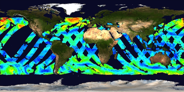
MetOp-B ASCAT ESDR Level 2 Ancillary Ocean Surface Fields Version 1.1
National Aeronautics and Space Administration —
This dataset contains model output interpolated in space and time to observations from the MetOp-B ASCAT (ASCAT-B) instrument (a satellite-based scatterometer),... -
Federal
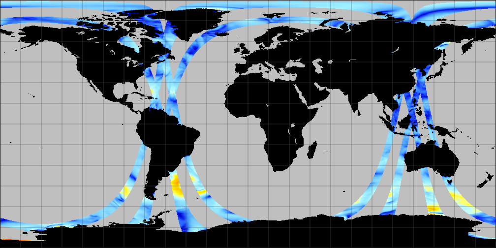
SCATSAT-1 ESDR Level 2 Ancillary Ocean Surface Fields Version 1.1
National Aeronautics and Space Administration —
This dataset contains the first science quality release (post-provisional after v1.0) of the MEaSUREs-funded Earth Science Data Record (ESDR) of ancillary data... -
Federal
MetOp-A ASCAT ESDR Level 2 Ancillary Ocean Surface Fields Version 1.1
National Aeronautics and Space Administration —
This dataset contains model output interpolated in space and time to the ESDR product from the MetOp-A ASCAT (ASCAT-A) instrument (a satellite-based scatterometer),...
15 datasets found