
-
Federal
Sentinel-6A Level 1B GNSS Radio Occultation Daily RINEX V1 (S6A_RO_1B_POD_RNX_) at GES DISC
National Aeronautics and Space Administration —
This dataset provides the L1B Global Navigation Satellite System (GNSS) Radio Occultation (RO) Precise Orbit Determination (POD) data generated by NASA JPL from... -
Federal
GLDAS Noah Land Surface Model L4 3 hourly 0.25 x 0.25 degree V2.0 (GLDAS_NOAH025_3H) at GES DISC
National Aeronautics and Space Administration —
NASA Global Land Data Assimilation System Version 2 (GLDAS-2) has three components: GLDAS-2.0, GLDAS-2.1, and GLDAS-2.2. GLDAS-2.0 is forced entirely with the... -
Federal
GPM IMERG Final Precipitation L3 1 day 0.1 degree x 0.1 degree V07 (GPM_3IMERGDF) at GES DISC
National Aeronautics and Space Administration —
Version 07 is the current version of the data set. Older versions will no longer be available and have been superseded by Version 07.The Integrated Multi-satellitE... -
Federal
NASA Ocean Biogeochemical Model assimilating satellite chlorophyll data global monthly VR2017 (NOBM_MON) at GES DISC
National Aeronautics and Space Administration —
This is the assimilated monthly data from NASA Ocean Biogeochemical Model (NOBM). The NOBM is a comprehensive, interactive ocean biogeochemical model coupled with a... -
Federal
TROPESS Chemical Reanalysis Surface Total NOx emissions Monthly 2-dimensional Product V1 (TRPSCRENOXTM2D) at GES DISC
National Aeronautics and Space Administration —
The TROPESS Chemical Reanalysis Surface Total NOx emissions Monthly 2-dimensional Product contains nitrogen oxides (NO and NO2) emissions from the total of all... -
Federal
OMPS-NPP L2 LP Aerosol Extinction Vertical Profile swath daily 3slit V2.5 (OMPS_NPP_LP_L2_AER_DAILY) at GES DISC
National Aeronautics and Space Administration —
The OMPS-NPP L2 LP Aerosol Extinction Vertical Profile swath daily 3slit (AER) product contains the retrieved aerosol extinction coefficients measured by the Ozone... -
Federal
MERRA-2 tavgU_3d_udt_Np: 3d,diurnal,Time-Averaged,Pressure-Level,Assimilation,Wind Tendencies 0.625 x 0.5 degree V5.12.4 (M2TUNPUDT) at GES DISC
National Aeronautics and Space Administration —
M2TUNPUDT (or tavgU_3d_udt_Np) is a 3-dimensional monthly diurnal means data collection in Modern-Era Retrospective analysis for Research and Applications version 2... -
Federal
GLDAS Noah Land Surface Model L4 monthly 0.25 x 0.25 degree V2.1 (GLDAS_NOAH025_M) at GES DISC
National Aeronautics and Space Administration —
NASA Global Land Data Assimilation System Version 2 (GLDAS-2) has three components: GLDAS-2.0, GLDAS-2.1, and GLDAS-2.2. GLDAS-2.0 is forced entirely with the... -
Federal
GPCP Precipitation Level 3 Daily 0.5-Degree V3.3 (GPCPDAY) at GES DISC
National Aeronautics and Space Administration —
Version 3.3 is the current version. Older versions have been superseded by Version 3.3.Product latency/update: The products are currently paused at September 2024... -
Federal
Daily FluxSat GPP of biomass over Land, Based on MODIS Terra and Aqua adjusted reflectance Collection 6.1, on a Global 0.5 by 0.625 Degree Grid, Level 3 Version 2.2
National Aeronautics and Space Administration —
This dataset provides global gridded daily estimates of gross primary production (GPP) and uncertainties at 0.5 deg latitude by 0.625 deg longitude resolution for the... -
Federal
CAR INTEX-B Long-range Pollution Transportation L1 V1 (CAR_INTEXB_L1C) at GES DISC
National Aeronautics and Space Administration —
INTEX-B (Intercontinental Chemical Transport Experiment-Phase B) focuses on the long-range transport of pollution, global atmospheric photochemistry, and the effects... -
Federal
GLDAS CLM Land Surface Model L4 3 hourly 1.0 x 1.0 degree Subsetted V001 (GLDAS_CLM10SUBP_3H) at GES DISC
National Aeronautics and Space Administration —
With the upgraded Land Surface Models (LSMs) and updated forcing data sets, the GLDAS version 2.1 (GLDAS-2.1) production stream serves as a replacement for GLDAS-001.... -
Federal
GLDAS Catchment Land Surface Model L4 daily 0.25 x 0.25 degree GRACE-DA1 V2.2 (GLDAS_CLSM025_DA1_D_EP) at GES DISC
National Aeronautics and Space Administration —
NASA Global Land Data Assimilation System Version 2 (GLDAS-2) has three components: GLDAS-2.0, GLDAS-2.1, and GLDAS-2.2. GLDAS-2.0 is forced entirely with the... -
Federal
HAQAST Sentinel-5P TROPOMI Nitrogen Dioxide (NO2) GLOBAL Annual Level 3 0.1 x 0.1 Degree Gridded Data Version 2.4 (HAQ_TROPOMI_NO2_GLOBAL_A_L3) at GES DISC
National Aeronautics and Space Administration —
This product provides level 3 annual averages of tropospheric Nitrogen dioxide (NO2) vertical column density derived from the level 2 Tropospheric Monitoring... -
Federal
TROPESS Chemical Reanalysis OH Monthly 3-dimensional Product V1 (TRPSCROHM3D) at GES DISC
National Aeronautics and Space Administration —
The TROPESS Chemical Reanalysis OH Monthly 3-dimensional Product contains vertical concentrations of the hydroxyl radical. The data are part of the Tropospheric... -
Federal
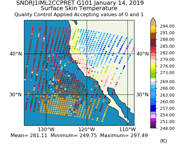
Sounder SIPS: JPSS-1 CrIS Level 2 CLIMCAPS: Atmosphere cloud and surface geophysical state V2 (SNDRJ1IML2CCPRET) at GES DISC
National Aeronautics and Space Administration —
WARNING: To users of the derived product “co_mmr_midtrop” (carbon monoxide mass mixing ratio to dry air [kg/kg] at ~500 hPa). This variable has a significant bias due... -
Federal
NLDAS Noah Land Surface Model L4 Hourly 0.125 x 0.125 degree V2.0 (NLDAS_NOAH0125_H) at GES DISC
National Aeronautics and Space Administration —
This data set contains fifty-three fields simulated from the Noah land-surface model (LSM) for Phase 2 of the North American Land Data Assimilation System (NLDAS-2).... -
Federal
GPM MHS on METOP-A (GPROF) Radiometer Precipitation Profiling L3 1 month 0.25 degree x 0.25 degree V07 (GPM_3GPROFMETOPAMHS_CLIM) at GES DISC
National Aeronautics and Space Administration —
Version 07 is the current version of the data set. Older versions are no longer available and have been superseded by Version 07. The "CLIM" products differ from... -
Federal
GPM SSMIS on F16 (GPROF) Radiometer Precipitation Profiling L3 1 day 0.25 degree x 0.25 degree V07 (GPM_3GPROFF16SSMIS_DAY) at GES DISC
National Aeronautics and Space Administration —
Version 07 is the current version of the data set. Older versions will no longer be available and have been superseded by Version 07.3GPROF products provide global... -
Federal
GPM IMERG Late Precipitation L3 1 day 0.1 degree x 0.1 degree V07 (GPM_3IMERGDL) at GES DISC
National Aeronautics and Space Administration —
Version 07 is the current version of the data set. Older versions will no longer be available and have been superseded by Version 07.The Integrated Multi-satellitE...

Official websites use .gov
A
.gov website belongs to an official government
organization in the United States.
Secure .gov websites use HTTPS
A
lock (
) or https:// means you’ve safely connected to
the .gov website. Share sensitive information only on official,
secure websites.