
-
Federal
MODIS/Terra Temperature and Water Vapor Profiles 5-Min L2 Swath 5km NGDA 10 recent views
National Aeronautics and Space Administration —
The MODIS/Terra Temperature and Water Vapor Profiles 5-Min L2 Swath 5km (MOD07_L2) product consists of a numbers of parameters related to atmospheric stability,... -
Federal
GLDAS Noah Land Surface Model L4 monthly 0.25 x 0.25 degree V2.0 (GLDAS_NOAH025_M) at GES DISC
National Aeronautics and Space Administration —
NASA Global Land Data Assimilation System Version 2 (GLDAS-2) has three components: GLDAS-2.0, GLDAS-2.1, and GLDAS-2.2. GLDAS-2.0 is forced entirely with the... -
Federal
Aqua/AIRS L2 Standard Physical Retrieval (AIRS+AMSU) V7.0 at GES DISC
National Aeronautics and Space Administration —
The Atmospheric Infrared Sounder (AIRS) is a grating spectrometer (R = 1200) aboard the second Earth Observing System (EOS) polar-orbiting platform, EOS Aqua. The... -
Federal
DISCOVER-AQ California Deployment P-3B Aircraft In Situ Meteorological and Navigational Data
National Aeronautics and Space Administration —
DISCOVERAQ_California_MetNav_AircraftInSitu_P3B_Data contains in situ meteorological and navigational data collected onboard NASA's P-3B aircraft during the... -
Federal
MERRA-2 tavg1_2d_slv_Nx: 2d,1-Hourly,Time-Averaged,Single-Level,Assimilation,Single-Level Diagnostics 0.625 x 0.5 degree V5.12.4 (M2T1NXSLV) at GES DISC
National Aeronautics and Space Administration —
M2T1NXSLV (or tavg1_2d_slv_Nx) is an hourly time-averaged 2-dimensional data collection in Modern-Era Retrospective analysis for Research and Applications version 2... -
Federal
UARS High Resolution Doppler Imager (HRDI) Level 3AL V011 (UARHR3AL) at GES DISC
National Aeronautics and Space Administration —
The High Resolution Doppler Imager (HRDI) Level 3AL data product consists of daily, 4 degree increment latitude-ordered vertical profiles of meridional and zonal wind... -
Federal
GLDAS Noah Land Surface Model L4 monthly 0.25 x 0.25 degree V2.1 (GLDAS_NOAH025_M) at GES DISC
National Aeronautics and Space Administration —
NASA Global Land Data Assimilation System Version 2 (GLDAS-2) has three components: GLDAS-2.0, GLDAS-2.1, and GLDAS-2.2. GLDAS-2.0 is forced entirely with the... -
Federal
MERRA-2 tavg3_3d_rad_Np: 3d,3-Hourly,Time-Averaged,Pressure-Level,Assimilation,Radiation Diagnostics 0.625 x 0.5 degree V5.12.4 (M2T3NPRAD) at GES DISC
National Aeronautics and Space Administration —
M2T3NPRAD (or tavg3_3d_rad_Np) is a 3-dimensional 3-hourly time averaged data collection in Modern-Era Retrospective analysis for Research and Applications version 2... -
Federal
SCATSAT-1 ESDR Level 2 Modeled Ocean Surface Auxiliary Fields Version 1.0
National Aeronautics and Space Administration —
This dataset contains the first provisional release of the MEaSUREs-funded Earth Science Data Record (ESDR) of ancillary data corresponding to the SCATSAT-1 Level 2... -
Federal
GLDAS Catchment Land Surface Model L4 daily 0.25 x 0.25 degree V2.0 (GLDAS_CLSM025_D) at GES DISC
National Aeronautics and Space Administration —
NASA Global Land Data Assimilation System Version 2 (GLDAS-2) has three components: GLDAS-2.0, GLDAS-2.1, and GLDAS-2.2. GLDAS-2.0 is forced entirely with the... -
Federal
CLPX-Model: Land Data Assimilation System (LDAS) Data, Version 1
National Aeronautics and Space Administration —
The LDAS data set contains 43 model and observation-based fields produced by the LDAS uncoupled modeling system at the NASA Goddard Space Flight Center using the... -
Federal
TES/Aura L2 Ammonia Nadir Special Observation V007
National Aeronautics and Space Administration —
TL2NH3NS_7 is the Tropospheric Emission Spectrometer (TES)/Aura Level 2 Ammonia Nadir Special Observation Version 7 data product. TES was an instrument aboard NASA's... -
Federal
TES/Aura L2 H2O Lite Nadir V006
National Aeronautics and Space Administration —
TL2H2OLN_6 is the Tropospheric Emission Spectrometer (TES)/Aura Level 2 H2O Lite Nadir Version 6 data product. It consists of information for one molecular species... -
Federal
SMEX02 SMACEX Tower Meteorological/Flux Data: Iowa, Version 1
National Aeronautics and Space Administration —
Notice to Data Users: The documentation for this data set was provided solely by the Principal Investigator(s) and was not further developed, thoroughly reviewed, or... -
Federal
MERRA-2 instU_3d_asm_Np: 3d,diurnal,Instantaneous,Pressure-Level,Assimilation,Assimilated Meteorological Fields 0.625 x 0.5 degree V5.12.4 (M2IUNPASM) at GES DISC
National Aeronautics and Space Administration —
M2IUNPASM (or instU_3d_asm_Np) is an instantaneous 3-dimensional monthly diurnal means data collection in Modern-Era Retrospective analysis for Research and... -
Federal
First ISCCP Regional Experiment (FIRE) Cirrus Phase I Rawinsonde Data
National Aeronautics and Space Administration —
The First ISCCP Regional Experiments have been designed to improve data products and cloud/radiation parameterizations used in general circulation models (GCMs).... -
Federal
CLPX-Model: Rapid Update Cycle 40km (RUC-40) Model Output Reduced Data, Version 1
National Aeronautics and Space Administration —
The Rapid Update Cycle, version 2 at 40km (RUC-2, known to the Cold Land Processes community as RUC40) model is a Mesoscale Analysis and Prediction System (MAPS) data... -
Federal
CERES A-Train Integrated CALIPSO, CloudSat, CERES, and MODIS (CCCM) Merged Release B1 NGDA
National Aeronautics and Space Administration —
CER-NEWS_CCCM_Aqua-FM3-MODIS-CAL-CS_RelB1 is the Clouds and the Earth's Radiant Energy System (CERES) NASA Energy and Water cycle Study (NEWS) A-Train Integrated... -
Federal
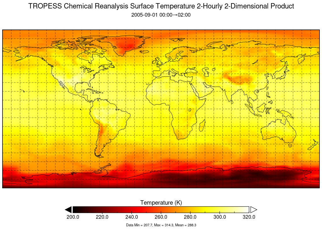
TROPESS Chemical Reanalysis Surface Temperature 2-Hourly 2-dimensional Product V1 (TRPSCRT2H2D) at GES DISC
National Aeronautics and Space Administration —
The TROPESS Chemical Reanalysis Surface Temperature 2-Hourly 2-dimensional Product contains surface temperature values, a meteorological field. The data are part of... -
Federal
First ISCCP Regional Experiment (FIRE) Atlantic Stratocumulus Transition Experiment (ASTEX) ECMWF Surface Diagnostics
National Aeronautics and Space Administration —
A special set of analysis products for the Atlantic Stratocumulus Transition Experiment (ASTEX) region during June 1-28, 1992 was prepared by Ernst Klinker and Tony...

Official websites use .gov
A
.gov website belongs to an official government
organization in the United States.
Secure .gov websites use HTTPS
A
lock (
) or https:// means you’ve safely connected to
the .gov website. Share sensitive information only on official,
secure websites.