
-
Federal
Poverty Mapping Project: Poverty and Food Security Case Studies
National Aeronautics and Space Administration —
The Poverty Mapping Project: Poverty and Food Security Case Studies data set consists of small area estimates of poverty, inequality, food security and related... -
Federal
Global Rural-Urban Mapping Project, Version 1 (GRUMPv1): Urban Extents Grid
National Aeronautics and Space Administration —
The Global Rural-Urban Mapping Project, Version 1 (GRUMPv1): Urban Extents Grid distinguishes urban and rural areas based on a combination of population counts... -
Federal
Global Rural-Urban Mapping Project, Version 1 (GRUMPv1): Settlement Points
National Aeronautics and Space Administration —
The Global Rural-Urban Mapping Project, Version 1 (GRUMPv1): Settlement Points contains geospatial location for selected settlements. This data set is produced by the... -
Federal
Global Rural-Urban Mapping Project, Version 1 (GRUMPv1): Land and Geographic Unit Area Grids
National Aeronautics and Space Administration —
The Global Rural-Urban Mapping Project, Version 1 (GRUMPv1): Land and Geographic Unit Area Grids measure land areas in square kilometers and the mean Unit size... -
Federal
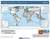
Global Rural-Urban Mapping Project, Version 1 (GRUMPv1): National Administrative Boundaries
National Aeronautics and Space Administration —
The Global Rural-Urban Mapping Project, Version 1 (GRUMPv1): National Administrative Boundaries are derived from the land area grid to show the outlines of pixels... -
Federal
Global Rural-Urban Mapping Project, Version 1 (GRUMPv1): Population Count Grid
National Aeronautics and Space Administration —
The Global Rural-Urban Mapping Project, Version 1 (GRUMPv1): Population Count Grid estimates human population for the years 1990, 1995, and 2000 by 30 arc-second (1... -
Federal
Global Mangrove Forests Distribution, 2000
National Aeronautics and Space Administration —
The Global Mangrove Forests Distribution, 2000 data set is a compilation of the extent of mangroves forests from the Global Land Survey and the Landsat archive with... -
Federal
Gridded Population of the World, Version 3 (GPWv3): Subnational Administrative Boundaries
National Aeronautics and Space Administration —
The Gridded Population of the World, Version 3 (GPWv3): Subnational Administrative Boundaries are the basis of the population data products in GPWv3. Due to copyright... -
Federal
Gridded Population of the World, Version 3 (GPWv3): National Identifier Grid
National Aeronautics and Space Administration —
The Gridded Population of the World, Version 3 (GPWv3): National Identifier Grid is derived from the land area grid to create a raster surface where pixels (cells)... -
Federal
Global Rural-Urban Mapping Project, Version 1 (GRUMPv1): National Identifier Grid
National Aeronautics and Space Administration —
The Global Rural-Urban Mapping Project, Version 1 (GRUMPv1): National Identifier Grid is derived from the land area grid to create a raster surface where pixels... -
Federal
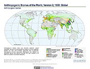
Anthropogenic Biomes of the World, Version 2: 1800
National Aeronautics and Space Administration —
The Anthropogenic Biomes of the World, Version 2: 1800 data set describes anthropogenic transformations within the terrestrial biosphere caused by sustained direct... -
Federal
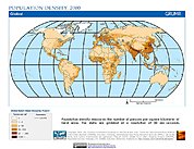
Global Rural-Urban Mapping Project, Version 1 (GRUMPv1): Population Density Grid
National Aeronautics and Space Administration —
The Global Rural-Urban Mapping Project, Version 1 (GRUMPv1): Population Density Grid estimates population per square km for the years 1990, 1995, and 2000 by 30 arc-... -
Federal
Global Summer Land Surface Temperature (LST) Grids, 2013
National Aeronautics and Space Administration —
The Global Summer Land Surface Temperature (LST) Grids, 2013, represent daytime maximum temperature and nighttime minimum temperature in degree Celsius at a spatial... -
Federal
Gridded Population of the World, Version 3 (GPWv3): Population Density Grid, Future Estimates
National Aeronautics and Space Administration —
The Gridded Population of the World, Version 3 (GPWv3): Population Density Grid, Future EstimatesFuture Estimates consists of estimates of human population for the... -
Federal
Gridded Population of the World, Version 3 (GPWv3): National Administrative Boundaries
National Aeronautics and Space Administration —
The Gridded Population of the World, Version 3 (GPWv3): National Administrative Boundaries are derived from the land area grid to show the outlines of pixels (cells)... -
Federal
Gridded Population of the World, Version 3 (GPWv3): Land and Geographic Unit Area Grids
National Aeronautics and Space Administration —
The Gridded Population of the World, Version 3 (GPWv3): Land and Geographic Unit Area Grids measure land areas in square kilometers and the mean Unit size... -
Federal
NOAA/WDS Paleoclimatology - Malindi - Coral d18O Data
National Oceanic and Atmospheric Administration, Department of Commerce —
This archived Paleoclimatology Study is available from the NOAA National Centers for Environmental Information (NCEI), under the World Data Service (WDS) for...

Official websites use .gov
A
.gov website belongs to an official government
organization in the United States.
Secure .gov websites use HTTPS
A
lock (
) or https:// means you’ve safely connected to
the .gov website. Share sensitive information only on official,
secure websites.