
-
University
2012 Whitewater Baldy Post Fire, Negrito Mountain NE SW, RGB
Earth Data Analysis Center, University of New Mexico —
This dataset contains imagery for the Gila National Forest, Catron and Grant County, New Mexico. The imagery was flown to provide coverage after the 2012 Whitewater-... -
University
2012 Whitewater Baldy Post Fire, Bearwallow Mountain NE NE, RGB
Earth Data Analysis Center, University of New Mexico —
This dataset contains imagery for the Gila National Forest, Catron and Grant County, New Mexico. The imagery was flown to provide coverage after the 2012 Whitewater-... -
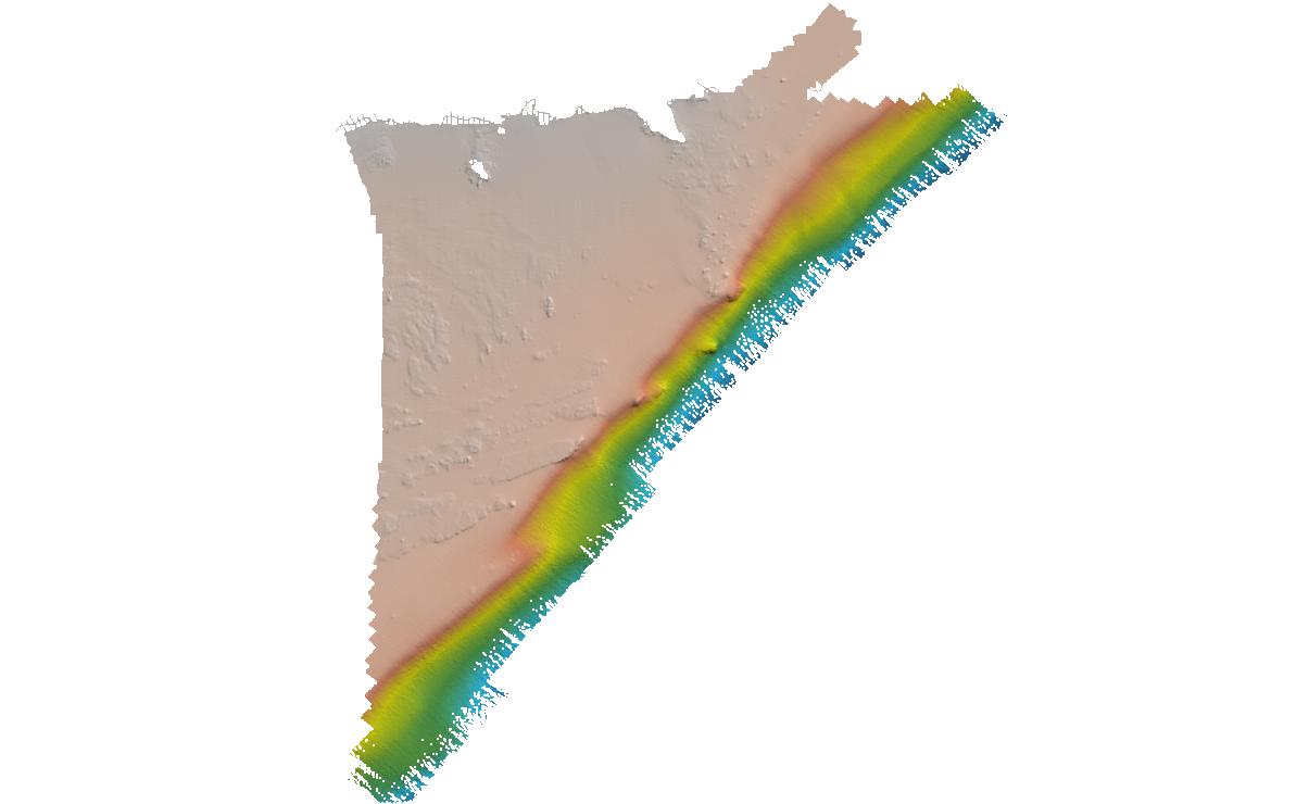
Federal
H10475: NOS Hydrographic Survey , Delaware Bay, New Jersey, 1993-08-12
National Oceanic and Atmospheric Administration, Department of Commerce —
The National Oceanic and Atmospheric Administration (NOAA) has the statutory mandate to collect hydrographic data in support of nautical chart compilation for safe... -
University
2011 Mayhill Post Fire Imagery, Mayhill NW SE, CIR
Earth Data Analysis Center, University of New Mexico —
This dataset contains imagery for the Lincoln National Forest. The imagery was flown to provide coverage after the 2011 Mayhill Fire. -
Federal
H11172: NOS Hydrographic Survey , Prince William Sound, Alaska, 2002-09-12
National Oceanic and Atmospheric Administration, Department of Commerce —
The National Oceanic and Atmospheric Administration (NOAA) has the statutory mandate to collect hydrographic data in support of nautical chart compilation for safe... -
University
2011 Las Conchas Post Fire, a436106_se_nw, RGB
Earth Data Analysis Center, University of New Mexico —
Wilson and Company collected and processed multi-spectral (red, green, blue, near-infrared) digital aerial imagery of the Las Conchas Fire that burned in the Santa Fe... -
Federal
H10697: NOS Hydrographic Survey , Southwest Alaska Peninsula, Alaska, 1996-07-31
National Oceanic and Atmospheric Administration, Department of Commerce —
The National Oceanic and Atmospheric Administration (NOAA) has the statutory mandate to collect hydrographic data in support of nautical chart compilation for safe... -
Federal
H10684: NOS Hydrographic Survey , Southern Puget Sound, Washington, 1996-07-19
National Oceanic and Atmospheric Administration, Department of Commerce —
The National Oceanic and Atmospheric Administration (NOAA) has the statutory mandate to collect hydrographic data in support of nautical chart compilation for safe... -
Federal
H10979: NOS Hydrographic Survey , Southwest Alaska Peninsula, Alaska, 2001-06-22
National Oceanic and Atmospheric Administration, Department of Commerce —
The National Oceanic and Atmospheric Administration (NOAA) has the statutory mandate to collect hydrographic data in support of nautical chart compilation for safe... -
University
2011 Las Conchas Post Fire, e335106_ne_sw, CIR
Earth Data Analysis Center, University of New Mexico —
Wilson and Company collected and processed multi-spectral (red, green, blue, near-infrared) digital aerial imagery of the Las Conchas Fire that burned in the Santa Fe... -
University
2011 Pacheco Post Fire, Sierra Mosca SW SE, CIR
Earth Data Analysis Center, University of New Mexico —
This dataset contains imagery for the Carson National Forest. The imagery was flown to provide coverage after the 2011 Pacheco Fire. -
University
2011 Las Conchas Post Fire, g535106_ne_ne, CIR
Earth Data Analysis Center, University of New Mexico —
Wilson and Company collected and processed multi-spectral (red, green, blue, near-infrared) digital aerial imagery of the Las Conchas Fire that burned in the Santa Fe... -
University
2011 Las Conchas Post Fire, f335106_sw_ne, CIR
Earth Data Analysis Center, University of New Mexico —
Wilson and Company collected and processed multi-spectral (red, green, blue, near-infrared) digital aerial imagery of the Las Conchas Fire that burned in the Santa Fe... -
University
2011 Las Conchas Post Fire, g535106_nw_se, RGB
Earth Data Analysis Center, University of New Mexico —
Wilson and Company collected and processed multi-spectral (red, green, blue, near-infrared) digital aerial imagery of the Las Conchas Fire that burned in the Santa Fe... -
University
2012 Whitewater Baldy Post Fire, Sign Camp Mountain SE NE, CIR
Earth Data Analysis Center, University of New Mexico —
This dataset contains imagery for the Gila National Forest, Catron and Grant County, New Mexico. The imagery was flown to provide coverage after the 2012 Whitewater-... -
University
2011 Mayhill Post Fire Imagery, Elk NW NE, RGB
Earth Data Analysis Center, University of New Mexico —
This dataset contains imagery for the Lincoln National Forest. The imagery was flown to provide coverage after the 2011 Mayhill Fire. -
Federal
H10999: NOS Hydrographic Survey , Bowie Seamount, British Columbia, 2000-08-01
National Oceanic and Atmospheric Administration, Department of Commerce —
The National Oceanic and Atmospheric Administration (NOAA) has the statutory mandate to collect hydrographic data in support of nautical chart compilation for safe... -
Federal
H10794: NOS Hydrographic Survey , Approaches to Jacksonville, Florida, 1998-05-08
National Oceanic and Atmospheric Administration, Department of Commerce —
The National Oceanic and Atmospheric Administration (NOAA) has the statutory mandate to collect hydrographic data in support of nautical chart compilation for safe... -
University
2011 Las Conchas Post Fire, e435106_se_sw, CIR
Earth Data Analysis Center, University of New Mexico —
Wilson and Company collected and processed multi-spectral (red, green, blue, near-infrared) digital aerial imagery of the Las Conchas Fire that burned in the Santa Fe... -
Federal
H10755: NOS Hydrographic Survey , Northern Puget Sound, Washington, 1997-10-06
National Oceanic and Atmospheric Administration, Department of Commerce —
The National Oceanic and Atmospheric Administration (NOAA) has the statutory mandate to collect hydrographic data in support of nautical chart compilation for safe...

Official websites use .gov
A
.gov website belongs to an official government
organization in the United States.
Secure .gov websites use HTTPS
A
lock (
) or https:// means you’ve safely connected to
the .gov website. Share sensitive information only on official,
secure websites.
.jpg)
.jpg)
.jpg)