
-
Federal
The NOAA NCEI Global Marine Microplastics Data Collection (1972-present)
National Oceanic and Atmospheric Administration, Department of Commerce —
Microplastics (i.e., plastics measuring less than 5mm) pollution is a growing problem affecting coastal communities, marine ecosystems, aquatic life, and human... -
Federal
2025 NOAA NGS Emergency Response Imagery: Hurricane Melissa
National Oceanic and Atmospheric Administration, Department of Commerce —
Aerial imagery was acquired following Hurricane Melissa in targeted areas in Jamaica. The aerial photography missions were conducted by the NOAA Remote Sensing... -
Federal
Quality-controlled sea surface marine physical, meteorological and other in situ measurements from the NCEI Surface Underway Marine Database (NCEI-SUMD)
National Oceanic and Atmospheric Administration, Department of Commerce —
This collection contains global in-situ sea surface underway measurements from the NOAA NCEI Surface Underway Marine Database (NCEI-SUMD, formerly the NCEI... -
Federal
2024 NOAA NGS Emergency Response Imagery: Hurricane Helene
National Oceanic and Atmospheric Administration, Department of Commerce —
Aerial imagery was acquired following Hurricane Helene. The aerial photography missions were conducted by the NOAA Remote Sensing Division. The images were acquired... -
Federal
Meteorological and oceanographic data collected from the National Data Buoy Center Coastal-Marine Automated Network (C-MAN) and moored (weather) buoys
National Oceanic and Atmospheric Administration, Department of Commerce —
The National Data Buoy Center (NDBC) established the Coastal-Marine Automated Network (C-MAN) for the National Weather Service in the early 1980's. NDBC has installed... -
Federal
Pensacola, Florida 1/3 arc-second NAVD 88 Coastal Digital Elevation Model
National Oceanic and Atmospheric Administration, Department of Commerce —
NOAA's National Centers for Environmental Information (NCEI) is building high-resolution digital elevation models (DEMs) for select U.S. coastal regions. These... -
Federal
Marine animal satellite telemetry location and profile data from the U.S. Animal Telemetry Network (ATN)
National Oceanic and Atmospheric Administration, Department of Commerce —
This dataset contains satellite telemetry location and profile data collected from satellite-linked tags deployed on marine animals and contributed by organizations... -
Federal
2025 NOAA NGS Emergency Response Imagery: Kentucky
National Oceanic and Atmospheric Administration, Department of Commerce —
Aerial imagery was acquired following flooding in targeted areas in Kentucky. The aerial photography missions were conducted by the NOAA Remote Sensing Division. The... -
Federal
2025 NOAA NGS Emergency Response Imagery: Texas Flooding
National Oceanic and Atmospheric Administration, Department of Commerce —
Aerial imagery was acquired following flooding in targeted areas in Texas. The aerial photography missions were conducted by the NOAA Remote Sensing Division. The... -
Federal
Sea surface temperature and salinity from the Global Ocean Surface Underway Data (GOSUD) from 1980-01-03 to present
National Oceanic and Atmospheric Administration, Department of Commerce —
This collection contains the Global Ocean Surface Underway Data (GOSUD) from 1980-01-03 to present as submitted to NOAA/NCEI. The data includes information about sea... -
Federal
Deepwater Horizon MC252 GIS data from the Environmental Response Management Application (ERMA) collected and/or used during the DWH response between 1989-11-15 and 2015-11-30 in the Northern Gulf of Mexico
National Oceanic and Atmospheric Administration, Department of Commerce —
This collection contains Environmental Response Management Application (ERMA) GIS layers used as part of the Programmatic Damage Assessment and Restoration Plan... -
Federal
H12527: NOS Hydrographic Survey , 2013-06-12
National Oceanic and Atmospheric Administration, Department of Commerce —
The National Oceanic and Atmospheric Administration (NOAA) has the statutory mandate to collect hydrographic data in support of nautical chart compilation for safe... -
Federal
OCS Marine Minerals Lease Areas NGDA
Department of the Interior —
The Federal Outer Continental Shelf (OCS) Marine Mineral (e.g. sand and gravel) Lease Areas layer is maintained by the Bureau of Ocean Energy Management (BOEM), part... -
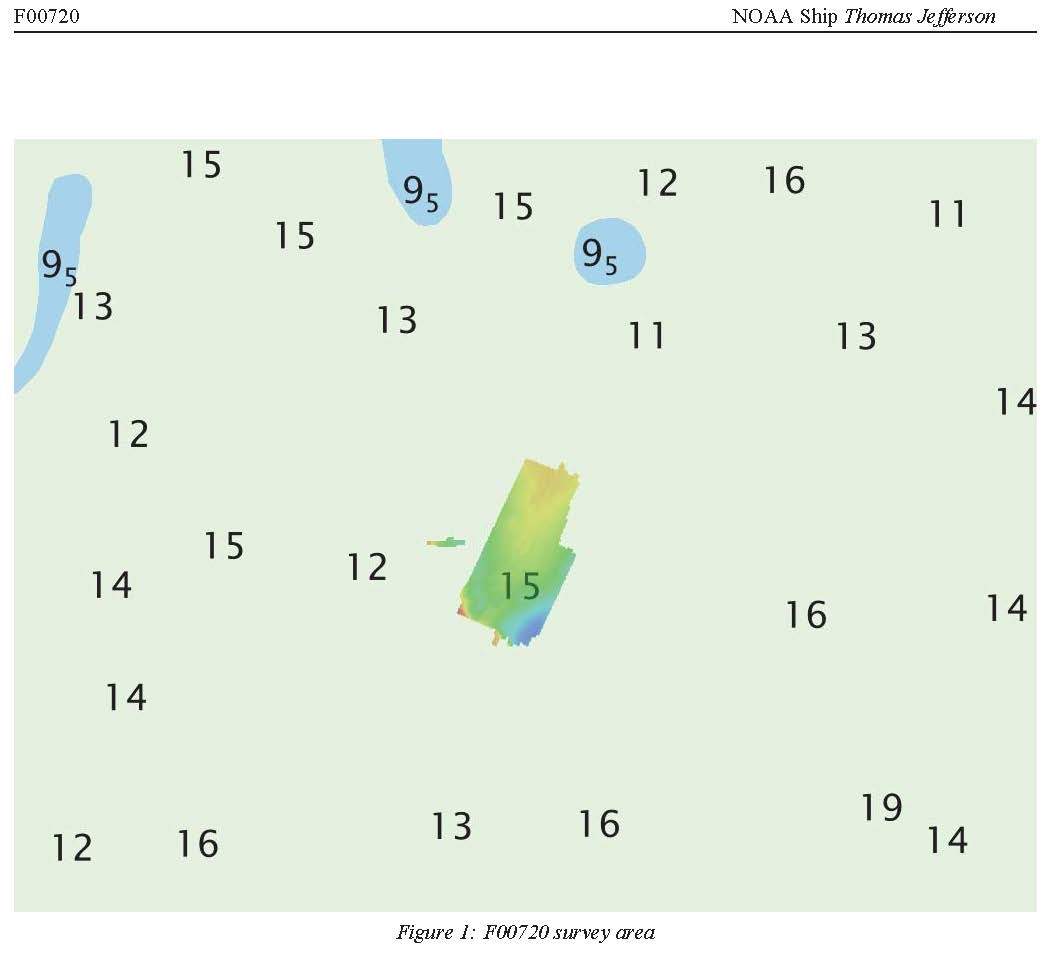
Federal
F00720: NOS Hydrographic Survey , 2018-05-01
National Oceanic and Atmospheric Administration, Department of Commerce —
The National Oceanic and Atmospheric Administration (NOAA) has the statutory mandate to collect hydrographic data in support of nautical chart compilation for safe... -
Federal
Surface ocean radial velocities obtained by HF-radar from stations located along coastal waters of Hawaii, North Slope Alaska, Gulf of Alaska, Puerto Rico/Virgin Islands, eastern U.S./Gulf of America, western U.S., and the Great Lakes
National Oceanic and Atmospheric Administration, Department of Commerce —
This dataset contains surface ocean radial velocities data obtained by HF-radar from stations located along coastal waters of the United States. Radial velocity files... -
Federal
F00484: NOS Hydrographic Survey , Chart Investigations: Ports of Los Angeles and Long Beach, California, 2002-04-26
National Oceanic and Atmospheric Administration, Department of Commerce —
The National Oceanic and Atmospheric Administration (NOAA) has the statutory mandate to collect hydrographic data in support of nautical chart compilation for safe... -
Federal
Near-real-time surface ocean velocities derived from HF-radar stations located along coastal waters of North Slope Alaska, Gulf of Alaska, Puerto Rico/Virgin Islands, eastern U.S./Gulf of America, Hawaii, Great Lakes, and western U.S.
National Oceanic and Atmospheric Administration, Department of Commerce —
This dataset contains near-real-time ocean surface velocities, also known as total vector velocities, derived from high-frequency (HF) radar stations. The velocities... -
Federal
H09366: NOS Hydrographic Survey , Vicinity of Jacksonville, Florida, 1973-10-05
National Oceanic and Atmospheric Administration, Department of Commerce —
The National Oceanic and Atmospheric Administration (NOAA) has the statutory mandate to collect hydrographic data in support of nautical chart compilation for safe... -
Federal
NEOWAVE Regional Tsunami Model: South Hawaii PMT: Hawaii: Hawaii Island: Punaluu
National Oceanic and Atmospheric Administration, Department of Commerce —
Non-hydrostatic Evolution of Ocean WAVEs (NEOWAVE) regional tsunami model for the south-southeast coast of Hawaii Island in the State of Hawaii, stretching from... -
Federal
F00247: NOS Hydrographic Survey , Atlantic Beach, North Carolina, 1983-06-01
National Oceanic and Atmospheric Administration, Department of Commerce —
The National Oceanic and Atmospheric Administration (NOAA) has the statutory mandate to collect hydrographic data in support of nautical chart compilation for safe...

Official websites use .gov
A
.gov website belongs to an official government
organization in the United States.
Secure .gov websites use HTTPS
A
lock (
) or https:// means you’ve safely connected to
the .gov website. Share sensitive information only on official,
secure websites.
.jpg)
.jpg)