

15 datasets found for "Countries"
-
Federal
ISLSCP II EDGAR 3 Gridded Greenhouse and Ozone Precursor Gas Emissions recent views
National Aeronautics and Space Administration —
The EDGAR (Emission Database for Global Atmospheric Research) database project is a comprehensive task carried out jointly by the National Institute for Public Health... -
Federal
Global Gas Flare Survey by Infrared Imaging, VIIRS Nightfire, 2012-2019 recent views
National Aeronautics and Space Administration —
This dataset contains annual global flare site surveys from 2012-2019 derived from Visible Infrared Imaging Radiometer Suite (VIIRS) on the Suomi National Polar... -
Federal
GEDI L4B Country-level Summaries of Aboveground Biomass recent views
National Aeronautics and Space Administration —
This dataset provides country-level estimates of land surface mean aboveground biomass density (AGBD), total aboveground biomass (AGB) stocks, and the associated... -
Federal
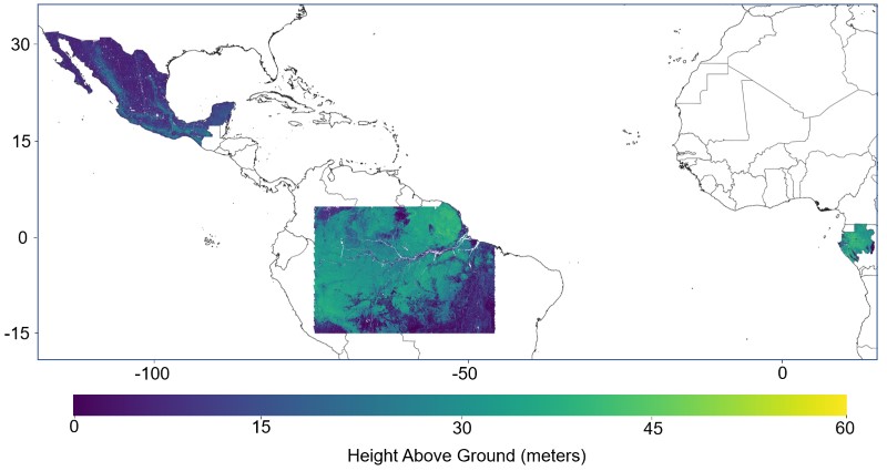
Pantropical Forest Height and Biomass from GEDI and TanDEM-X Data Fusion recent views
National Aeronautics and Space Administration —
This dataset includes maps of canopy height and aboveground biomass at spatial resolutions of 25 m and 100 m for Mexico, Gabon, French Guiana, and the Amazon Basin.... -
Federal
Soil Organic Carbon Stock Estimates with Uncertainty across Latin America recent views
National Aeronautics and Space Administration —
This dataset provides 5 x 5 km gridded estimates of soil organic carbon (SOC) across Latin America that were derived from existing point soil characterization data... -
Federal
SAFARI 2000 CV-580 Aerosol and Cloud Data, Dry Season 2000 (CARG) recent views
National Aeronautics and Space Administration —
The Cloud and Aerosol Research Group (CARG) of the University of Washington participated in the SAFARI-2000 Dry Season Aircraft campaign with their Convair-580... -
Federal
Soil Organic Carbon Estimates for 30-cm Depth, Mexico and Conterminous USA, 1991-2011 recent views
National Aeronautics and Space Administration —
This dataset provides two sets of gridded estimates of estimated soil organic carbon (SOC) and associated uncertainties for 0-30 cm topsoil layer in kg SOC/m2 at... -
Federal
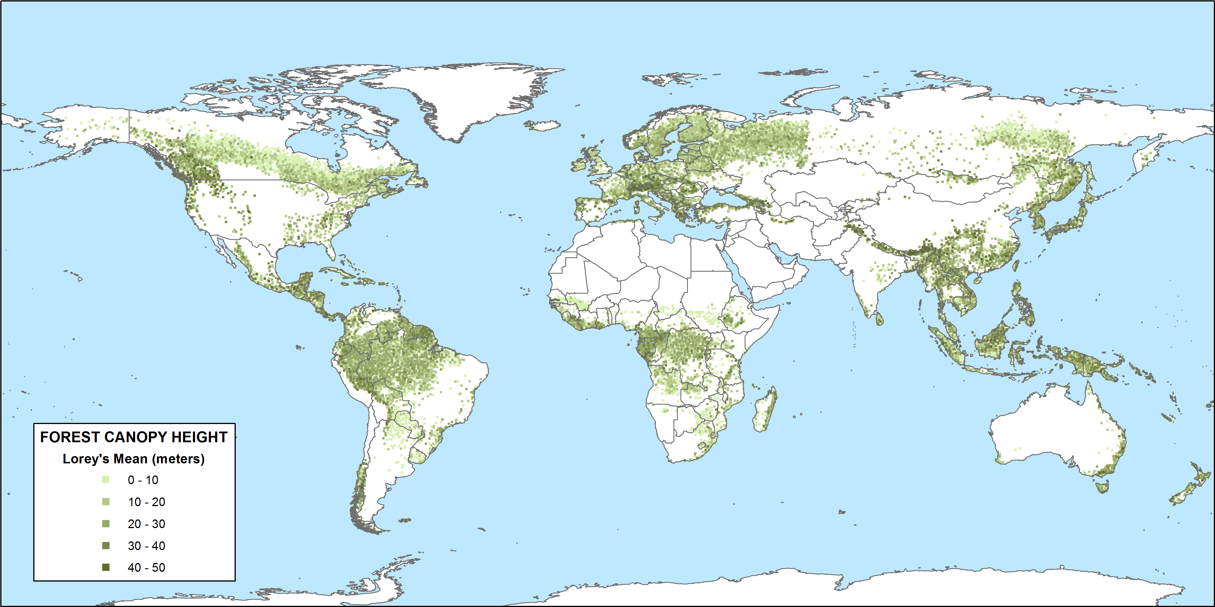
CMS: GLAS LiDAR-derived Global Estimates of Forest Canopy Height, 2004-2008 recent views
National Aeronautics and Space Administration —
This data set provides estimates of forest canopy height derived from the Geoscience Laser Altimeter System (GLAS) LiDAR instrument that was aboard the NASA Ice,... -
Federal
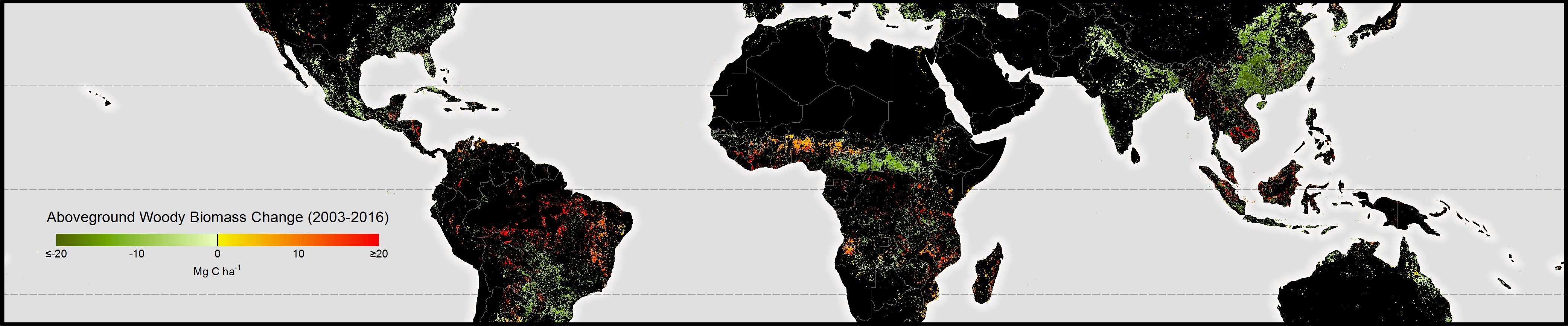
Aboveground Biomass Change for Amazon Basin, Mexico, and Pantropical Belt, 2003-2016 NGDA recent views
National Aeronautics and Space Administration —
This dataset provides gridded estimates of aboveground biomass (AGB) for live dry woody vegetation density in the form of both stock for the baseline year 2003 and... -
Federal
CMS: Mangrove Forest Cover Extent and Change across Major River Deltas, 2000-2016 recent views
National Aeronautics and Space Administration —
This dataset provides estimates of mangrove extent for 2016, and mangrove change (gain or loss) from 2000 to 2016, in major river delta regions of eight countries:... -
Federal
Global 1-degree Maps of Forest Area, Carbon Stocks, and Biomass, 1950-2010 recent views
National Aeronautics and Space Administration —
This data set provides global forest area, forest growing stock, and forest biomass data at 1-degree resolution for the period 1950-2010. The data set is based on a... -
Federal
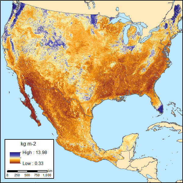
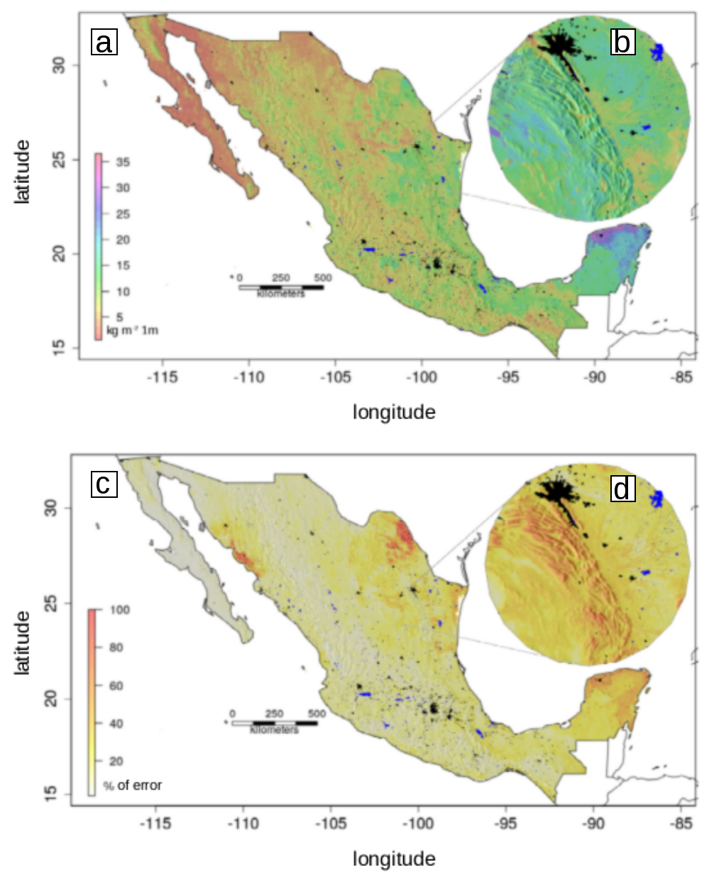
Soil Organic Carbon Estimates and Uncertainty at 1-m Depth across Mexico, 1999-2009 recent views
National Aeronautics and Space Administration —
This dataset provides an estimate of soil organic carbon (SOC) in the top one meter of soil across Mexico at a 90-m resolution for the period 1999-2009. Carbon... -
Federal
A Global Database of Carbon and Nutrient Concentrations of Green and Senesced Leaves recent views
National Aeronautics and Space Administration —
This data set provides carbon (C), nitrogen (N), phosphorus (P), potassium (K), calcium (Ca), and magnesium (Mg) concentrations in green and senesced leaves.... -
Federal
ISLSCP II Global Population of the World NGDA recent views
National Aeronautics and Space Administration —
Global Population of the World (GPW) translates census population data to a latitude-longitude grid so that population data may be used in cross-disciplinary studies.... -
Federal
MASTER: Geological Earth Mapping Experiment (GEMx), California-Arizona, Summer 2023 recent views
National Aeronautics and Space Administration —
This dataset includes Level 1B (L1B) and Level 2 (L2) data products from the MODIS/ASTER Airborne Simulator (MASTER) instrument. The spectral data were collected...
15 datasets found for "Countries"