
-
Federal
GHRSST NOAA/STAR GOES-17 ABI L3C America Region SST v2.71 dataset in GDS2 recent views
National Aeronautics and Space Administration —
The ACSPO G17/ABI L3C (Level 3 Collated) product is a gridded version of the ACSPO G17/ABI L2P product available at... -
Federal
SPURS-2 Passive Accoustic Listener (PAL) data from ARGO float deployments during the E. Tropical Pacific field campaign recent views
National Aeronautics and Space Administration —
The SPURS (Salinity Processes in the Upper Ocean Regional Study) project is a NASA-funded oceanographic process study and associated field program that aim to... -
Federal
Pre SWOT Hydrology Global Lake/Reservoir Surface Inland Water Height GREALM V.2 recent views
National Aeronautics and Space Administration —
The Global Lake/Reservoir Surface Inland Water Height Time Series is derived from the G-REALM10 lake level product... -
Federal
GHRSST NOAA/STAR Metop-C AVHRR FRAC ACSPO v2.80 0.02 L3U Dataset (GDS v2) recent views
National Aeronautics and Space Administration —
This L3U (Level 3 Uncollated) dataset contains global daily Sea Surface Temperature (SST) on a 0.02 degree grid resolution. It is produced by the National Oceanic and... -
Federal
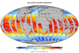
GHRSST Level 2P Global Subskin Sea Surface Temperature from the Advanced Scanning Microwave Radiometer - Earth Observing System (AMSR-E) on the NASA Aqua Satellite recent views
National Aeronautics and Space Administration —
The Advanced Microwave Scanning Radiometer (AMSR-E) was launched on 4 May 2002, aboard NASA's Aqua spacecraft. The National Space Development Agency of Japan (NASDA)... -
Federal
GHRSST NOAA/STAR GOES-16 ABI L3C America Region SST v2.70 dataset in GDS2 recent views
National Aeronautics and Space Administration —
The ACSPO G16/ABI L3C (Level 3 Collated) product is a gridded version of the ACSPO G16/ABI L2P product available at... -
Federal
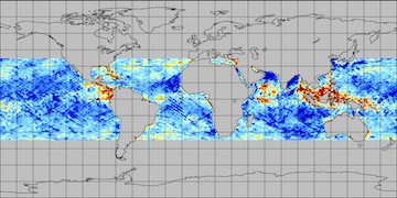
GHRSST Level 3U Global Near-Real-Time Subskin Sea Surface Temperature version 8a from the Advanced Microwave Scanning Radiometer 2 on the GCOM-W satellite recent views
National Aeronautics and Space Administration —
GDS2 Version -The Advanced Microwave Scanning Radiometer 2 (AMSR2) was launched on 18 May 2012, onboard the Golbal Change Observation Mission - Water (GCOM-W)... -
Federal
Pre SWOT Hydrology GRRATS Virtual Station River Heights Version 2 recent views
National Aeronautics and Space Administration —
The Global River Radar Altimeter Time Series (GRRATS) are simulated river gauge data that are derived from ERS-1, ERS-2, TOPEX/Poseidon OSTM/Jason-2, Jason-3 and... -
Federal
Pre SWOT Hydrology GRRATS Daily River Heights and Storage Version 2 recent views
National Aeronautics and Space Administration —
The Global River Radar Altimeter Time Series (GRRATS) 1km/daily interpolations are river heights from ERS-1, ERS-2, TOPEX/Poseidon OSTM/Jason-2 and Envisat that are... -
Federal
GHRSST L3C NOAA/ACSPO Himawari-09 AHI Pacific Ocean Region Sea Surface Temperature v2.90 dataset recent views
National Aeronautics and Space Administration —
The H09-AHI-L2P-ACSPO-v2.90 dataset contains the Subskin Sea Surface Temperature (SST) produced by the NOAA ACSPO system from the Advanced Himawari Imager (AHI;... -
Federal
GHRSST L3C global sub-skin Sea Surface Temperature from the Advanced Very High Resolution Radiometer (AVHRR) on Metop satellites (currently Metop-B) (GDS V2) produced by OSI SAF recent views
National Aeronautics and Space Administration —
A global Group for High Resolution Sea Surface Temperature (GHRSST) Level 3 Collated (L3C) dataset derived from the Advanced Very High Resolution Radiometer (AVHRR)... -
Federal
GHRSST NOAA/STAR Metop-B AVHRR FRAC ACSPO v2.80 0.02 L3U Dataset (GDS v2) recent views
National Aeronautics and Space Administration —
This L3U (Level 3 Uncollated) dataset contains global daily Sea Surface Temperature (SST) on a 0.02 degree grid resolution. It is produced by the National Oceanic and... -
Federal
GHRSST Level 3U Global Subskin Sea Surface Temperature from the Advanced Scanning Microwave Radiometer - Earth Observing System (AMSR-E) on the NASA Aqua Satellite recent views
National Aeronautics and Space Administration —
The Advanced Microwave Scanning Radiometer (AMSR-E) was launched on 4 May 2002, aboard NASA's Aqua spacecraft. The National Space Development Agency of Japan (NASDA)... -
Federal
Pre SWOT Hydrology Global Lake/Reservoir Surface Inland Water Area Extent V2 NGDA recent views
National Aeronautics and Space Administration —
The Global Lake/Reservoir Surface Inland Water Extent Mask Time Series are derived from the MODIS instruments. The purpose of this dataset is to provide surface water... -
Federal
JPL GRACE and GRACE-FO Mascon Ocean, Ice, and Hydrology Equivalent Water Height Coastal Resolution Improvement (CRI) Filtered Release 06.1 Version 03 recent views
National Aeronautics and Space Administration —
This dataset contains gridded monthly global water storage/height anomalies relative to a time-mean, derived from GRACE and GRACE-FO and processed at JPL using the... -
Federal
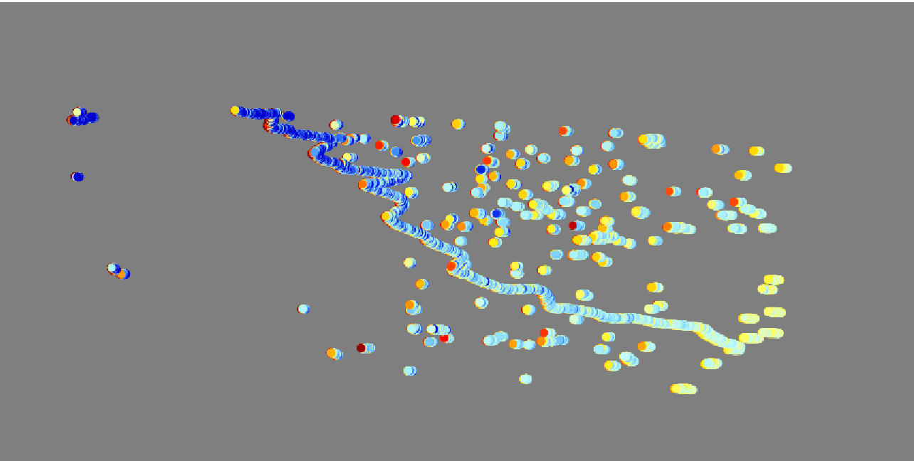
CYGNSS L3 Ocean Microplastic Concentration V1.0 recent views
National Aeronautics and Space Administration —
This dataset contains the version 1.0 CYGNSS level 3 ocean microplastic concentration data record, which provides 18 netCDF files, each containing one month of daily... -
Federal
SCATSAT-1 ESDR Level 2 Modeled Ocean Surface Auxiliary Fields Version 1.0 recent views
National Aeronautics and Space Administration —
This dataset contains the first provisional release of the MEaSUREs-funded Earth Science Data Record (ESDR) of ancillary data corresponding to the SCATSAT-1 Level 2... -
Federal
SWOT Simulated Level 2 North America Continent KaRIn High Rate Water Mask Pixel Cloud Product Version 1.0 recent views
National Aeronautics and Space Administration —
This dataset includes simulated water surface elevations that resemble the Ka-band Interferometer (KaRIn) measurements by the Surface Water and Ocean Topography... -
Federal
QuikSCAT ESDR Level 2 Modeled Ocean Surface Auxiliary Fields Version 1.0 recent views
National Aeronautics and Space Administration —
This dataset contains the first provisional release of the MEaSUREs-funded Earth Science Data Record (ESDR) of ancillary data corresponding to the QuikSCAT Level 2... -
Federal
SPURS-2 underway surface pCO2, DIC and pH data for the E. Tropical Pacific field campaign R/V Revelle cruises recent views
National Aeronautics and Space Administration —
The SPURS (Salinity Processes in the Upper Ocean Regional Study) project is a NASA-funded oceanographic process study and associated field program that aim to...

Official websites use .gov
A
.gov website belongs to an official government
organization in the United States.
Secure .gov websites use HTTPS
A
lock (
) or https:// means you’ve safely connected to
the .gov website. Share sensitive information only on official,
secure websites.