
-
Federal
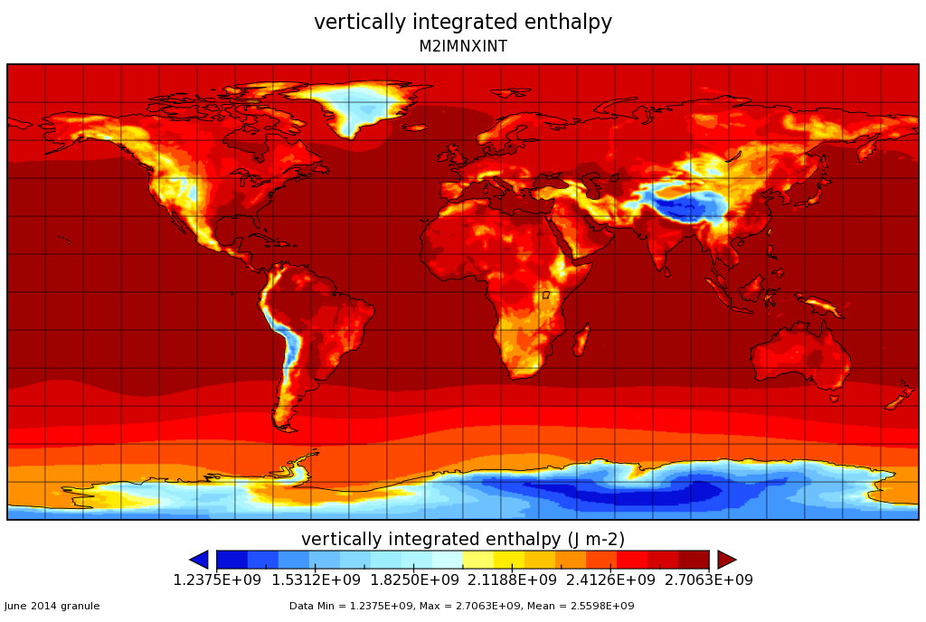
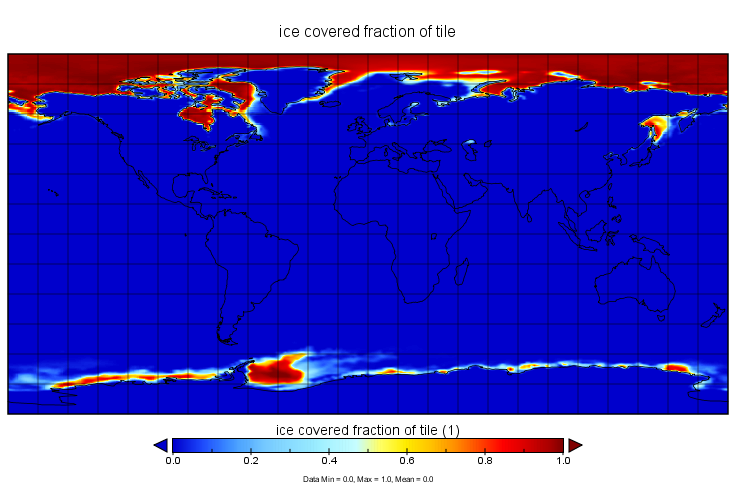
MERRA-2 instM_2d_int_Nx: 2d,Monthly mean,Instantaneous,Single-Level,Assimilation,Vertically Integrated Diagnostics 0.625 x 0.5 degree V5.12.4 (M2IMNXINT) at GES DISC recent views
National Aeronautics and Space Administration —
M2IMNXINT (or instM_2d_int_Nx) is an instantaneous 2-dimensional monthly mean data collection in Modern-Era Retrospective analysis for Research and Applications... -
Federal
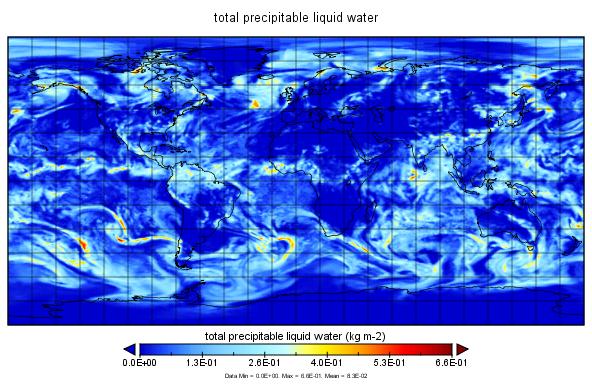
MERRA-2 tavgM_2d_int_Nx: 2d,Monthly mean,Time-Averaged,Single-Level,Assimilation,Vertically Integrated Diagnostics 0.625 x 0.5 degree V5.12.4 (M2TMNXINT) at GES DISC recent views
National Aeronautics and Space Administration —
M2TMNXINT (or tavgM_2d_int_Nx) is a time-averaged 2-dimensional monthly mean data collection in Modern-Era Retrospective analysis for Research and Applications... -
Federal
MERRA-2 tavgU_2d_int_Nx: 2d,diurnal,Time-Averaged,Single-Level,Assimilation,Vertically Integrated Diagnostics 0.625 x 0.5 degree V5.12.4 (M2TUNXINT) at GES DISC recent views
National Aeronautics and Space Administration —
M2TUNXINT (or tavgU_2d_int_Nx) is a time-averaged 2-dimensional monthly diurnal means data collection in Modern-Era Retrospective analysis for Research and... -
Federal
WLDAS Noah-MP 3.6 Land Surface Model L4 Daily 0.01 degree x 0.01 degree Version D1.0 (WLDAS_NOAHMP001_DA1) at GES DISC recent views
National Aeronautics and Space Administration —
The Western Land Data Assimilation System (WLDAS), developed at Goddard Space Flight Center (GSFC) and funded by the NASA Western Water Applications Office, provides... -
Federal
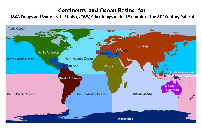
NASA Energy and Water cycle Study (NEWS) Monthly Climatology of the 1st decade of the 21st Century V1.0 (NEWS_WEB_MCLIM) at GES DISC recent views
National Aeronautics and Space Administration —
NASA Energy and Water cycle Study (NEWS) Climatology of the 1st decade of the 21st Century Dataset summarizes the original observationally-based mean fluxes of water... -
Federal
NLDAS Mosaic Land Surface Model L4 Hourly 0.125 x 0.125 degree V2.0 (NLDAS_MOS0125_H) at GES DISC recent views
National Aeronautics and Space Administration —
This data set contains thirty-eight fields simulated from the Mosaic land-surface model (LSM) for Phase 2 of the North American Land Data Assimilation System... -
Federal
NASA Energy and Water cycle Study (NEWS) Annual Climatology of the 1st decade of the 21st Century V1.0 (NEWS_WEB_ACLIM) at GES DISC recent views
National Aeronautics and Space Administration —
NASA Energy and Water cycle Study (NEWS) Climatology of the 1st decade of the 21st Century Dataset summarizes the original observationally-based mean fluxes of water... -
Federal
SRB/GEWEX evapotranspiration (Penman-Monteith) L4 3 hour 0.5 degree x 0.5 degree V1 (WC_PM_ET_050) at GES DISC recent views
National Aeronautics and Space Administration —
SRB/GEWEX evapotranspiration (Penman-Monteith) L4 3 hour 0.5 degree x 0.5 degree V1 is a global, 24-year (1984-2007), satellite-derived evapotranspiration over land... -
Federal
MERRA-2 tavg1_2d_int_Nx: 2d,1-Hourly,Time-Averaged,Single-Level,Assimilation,Vertically Integrated Diagnostics 0.625 x 0.5 degree V5.12.4 (M2T1NXINT) at GES DISC recent views
National Aeronautics and Space Administration —
M2T1NXINT (or tavg1_2d_int_Nx) is an hourly time-averaged 2-dimensional data collection in Modern-Era Retrospective analysis for Research and Applications version 2... -
Federal
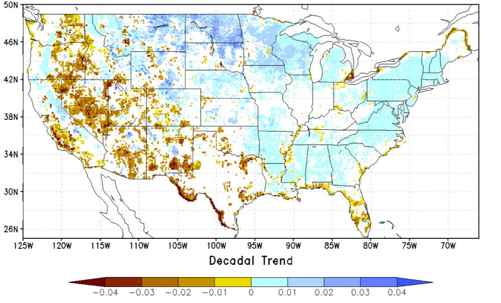
NCA-LDAS Noah-3.3 Land Surface Model L4 Trends 0.125 x 0.125 degree V2.0 (NCALDAS_NOAH0125_Trends) at GES DISC recent views
National Aeronautics and Space Administration —
The National Climate Assessment - Land Data Assimilation System, or NCA-LDAS, is a terrestrial water reanalysis in support of the United States Global Change Research... -
Federal
MERRA-2 tavg1_2d_ocn_Nx: 2d,1-Hourly,Time-Averaged,Single-Level,Assimilation,Ocean Surface Diagnostics 0.625 x 0.5 degree V5.12.4 (M2T1NXOCN) at GES DISC recent views
National Aeronautics and Space Administration —
M2T1NXOCN (or tavg1_2d_ocn_Nx) is an hourly time-averaged 2-dimensional data collection in Modern-Era Retrospective analysis for Research and Applications version 2... -
Federal
MERRA-2 tavgU_2d_ocn_Nx: 2d,diurnal,Time-Averaged,Single-Level,Assimilation,Ocean Surface Diagnostics 0.625 x 0.5 degree V5.12.4 (M2TUNXOCN) at GES DISC recent views
National Aeronautics and Space Administration —
M2TUNXOCN (or tavgU_2d_ocn_Nx) is a time-averaged 2-dimensional monthly diurnal means data collection in Modern-Era Retrospective analysis for Research and... -
Federal
MERRA-2 inst1_2d_int_Nx: 2d,1-Hourly,Instantaneous,Single-Level,Assimilation,Vertically Integrated Diagnostics 0.625 x 0.5 degree V5.12.4 (M2I1NXINT) at GES DISC recent views
National Aeronautics and Space Administration —
M2I1NXINT (or inst1_2d_int_Nx) is an instantaneous 2-dimensional hourly data collection in Modern-Era Retrospective analysis for Research and Applications version 2... -
Federal
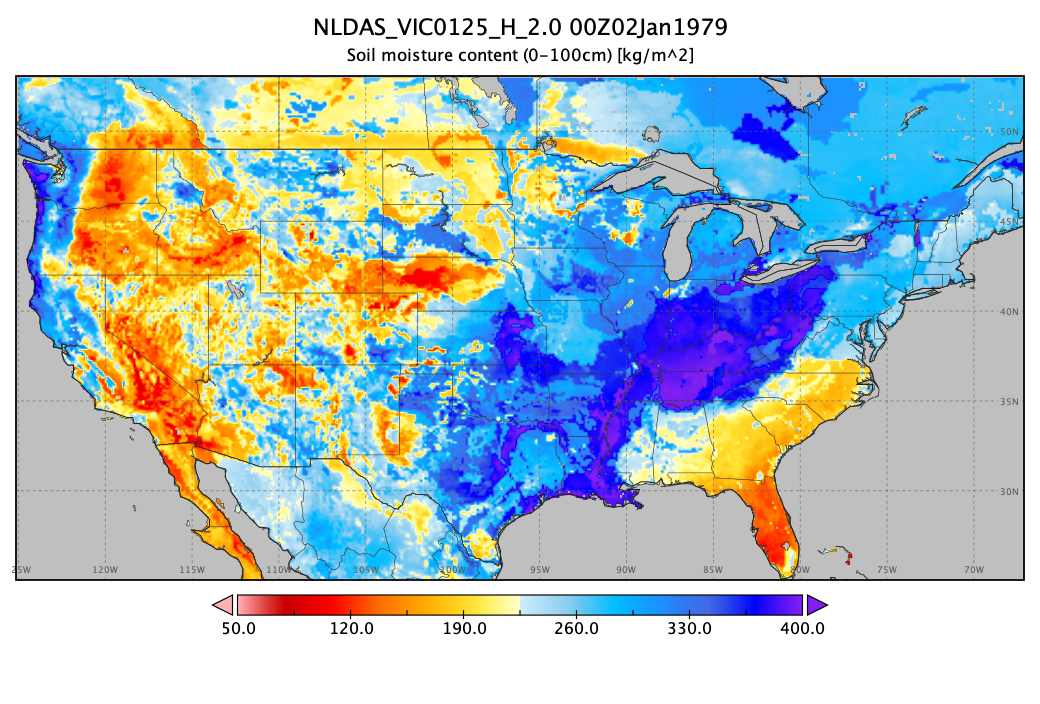
NLDAS VIC Land Surface Model L4 Hourly 0.125 x 0.125 degree V2.0 (NLDAS_VIC0125_H) at GES DISC recent views
National Aeronautics and Space Administration —
This data set contains forty-four fields simulated from the VIC land-surface model (LSM) for Phase 2 of the North American Land Data Assimilation System (NLDAS-2).... -
Federal
NLDAS Mosaic Land Surface Model L4 Hourly 0.125 x 0.125 degree V002 (NLDAS_MOS0125_H) at GES DISC recent views
National Aeronautics and Space Administration —
This data set contains a series of land surface parameters simulated from the Mosaic land-surface model (LSM) for Phase 2 of the North American Land Data Assimilation... -
Federal
NCA-LDAS Noah-3.3 Land Surface Model L4 Daily 0.125 x 0.125 degree V2.0 (NCALDAS_NOAH0125_D) at GES DISC recent views
National Aeronautics and Space Administration —
The National Climate Assessment - Land Data Assimilation System, or NCA-LDAS, is a terrestrial water reanalysis in support of the United States Global Change Research...

Official websites use .gov
A
.gov website belongs to an official government
organization in the United States.
Secure .gov websites use HTTPS
A
lock (
) or https:// means you’ve safely connected to
the .gov website. Share sensitive information only on official,
secure websites.