
-
Federal
Diffuse Attenuation K490, Aqua MODIS, NPP, Gulf of Mexico, 2002-2012 (3 Day Composite) recent views
National Oceanic and Atmospheric Administration, Department of Commerce —
NASA distributes Diffuse Attenuation Coefficient at 490 nm Wavelength data from NASA's Aqua satellite. Measurements are gathered by the Moderate Resolution Imaging... -
Federal
Remote Sensing Reflectance at 667 nm, Aqua MODIS, NPP, Gulf of Mexico, 2002-2012 (14 Day Composite) recent views
National Oceanic and Atmospheric Administration, Department of Commerce —
MODIS measures the remote sensing reflectance (Rrs) at 667nm. This can be used to view very high concentrations of phytoplankton in the very surface of the water. -
Federal
SST, Terra MODIS, NPP, Gulf of Mexico, Daytime (11 microns), 2000-2012 (1 Day Composite) recent views
National Oceanic and Atmospheric Administration, Department of Commerce —
NOAA CoastWatch provides SST data from NASA's Terra Spacecraft. Measurements are gathered by the Moderate Resolution Imaging Spectroradiometer (MODIS) carried aboard... -
Federal
Chromophoric Dissolved Organic Material, Aqua MODIS, NPP, Gulf of Mexico, 2002-2012 (Monthly Composite) recent views
National Oceanic and Atmospheric Administration, Department of Commerce —
MODIS data is used to develop an index of the amount of chromophoric dissolved organic material (CDOM) in the surface waters. CDOM absorbs heavily in the blue... -
Federal
National Assessment of Oil and Gas - Upper Jurassic-Cretaceous-Tertiary Composite Total Petroleum System, Gulf Coast (Provinces 047, 048 and 049) recent views
Department of the Interior —
The Total Petroleum System is used in the National Assessment Project and incorporates the Assessment Unit, which is the fundamental geologic unit used for the... -
Federal
Mapping Data of Eelgrass (Zostera marina) Distribution, Baja California, Mexico recent views
Department of the Interior —
Provided here are three vector geospatial datasets that characterize the distribution of (1) eelgrass (Zostera marina), (2) salt marshes, and (3) mangroves in three... -
Federal
"Deepwater CTD - 00005.ctd.nc - 26.83N, -90.5W - 1994-04-16" recent views
National Oceanic and Atmospheric Administration, Department of Commerce —
The Minerals Management Service (MMS) of the U. S. Department of the Interior funded the Deepwater Physical Oceanography Reanalysis and Synthesis of Historical Data... -
Federal
"NEGOM CTD - n1l06s15.nc - 28.98N, 86.92W - 1997-11-23" recent views
National Oceanic and Atmospheric Administration, Department of Commerce —
The Northeastern Gulf of Mexico Physical Oceanography Program (NEGOM) is supported by the Minerals Management Service (MMS) of the U.S. Department of the Interior.... -
Federal
NOAA/WDS Paleoclimatology - Villanueva - Fule Cuevecillas - PSME - ITRDB MEXI080 recent views
National Oceanic and Atmospheric Administration, Department of Commerce —
This archived Paleoclimatology Study is available from the NOAA National Centers for Environmental Information (NCEI), under the World Data Service (WDS) for... -
Federal
NOAA/WDS Paleoclimatology - Stahle - Cerro Baraja and Los Angeles Sawmill - PSME - ITRDB MEXI023 recent views
National Oceanic and Atmospheric Administration, Department of Commerce —
This archived Paleoclimatology Study is available from the NOAA National Centers for Environmental Information (NCEI), under the World Data Service (WDS) for... -
Federal
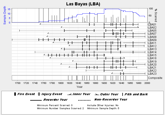
NOAA/WDS Paleoclimatology - Heyerdahl fire data from Las Bayas (LBA) - IMPD MXLBA001 recent views
National Oceanic and Atmospheric Administration, Department of Commerce —
This archived Paleoclimatology Study is available from the NOAA National Centers for Environmental Information (NCEI), under the World Data Service (WDS) for... -
Federal
NOAA/WDS Paleoclimatology - Villanueva - Pitorreal - PSME - ITRDB MEXI082 recent views
National Oceanic and Atmospheric Administration, Department of Commerce —
This archived Paleoclimatology Study is available from the NOAA National Centers for Environmental Information (NCEI), under the World Data Service (WDS) for... -
Federal
Gulf of California species and catch spatial distributions and historical time series - Developing end-to-end models of the Gulf of California recent views
National Oceanic and Atmospheric Administration, Department of Commerce —
The purpose of this project is to develop spatially discrete end-to-end models of the northern Gulf of California, linking oceanography, biogeochemistry, food web... -
Federal
Mineral commodity exporting ports of Latin America and the Caribbean recent views
Department of the Interior —
This dataset presents information about mineral commodity exporting ports relating to the mineral industries of Latin America and the Caribbean. Port data records... -
Federal
Data for ioos-station-wmo-42874-20190518_2037-20190518_2037 recent views
National Oceanic and Atmospheric Administration, Department of Commerce —
Current profile data from Downward-looking Teledyne RDI 38 kHz Ocean Observer ADCP, ADCP #1 on Deepwater Asgard, 28.94N, 87.72W, 2019/05/18 through 2019/06/29 -
Federal
Fugro Cruise C16185 Line 1164, 75 kHz VMADCP recent views
National Oceanic and Atmospheric Administration, Department of Commerce —
Program of vessel mount ADCP measurements comprising a combination of 300kHz and 75kHz ADCP data collected in the vicinity of the Loop Current and drilling blocks... -
Federal
FAST Eddy Sys 2 Transect 281, 150kHz kHz VMADCP recent views
National Oceanic and Atmospheric Administration, Department of Commerce —
Program of vessel mount ADCP measurements comprising a combination of 75kHz and 150kHz ADCP data collected in the vicinity of the Loop Current and drilling blocks... -
Federal
Yale stocks and flows database (YSTAFDB) describing anthropogenic materials cycles, recycling, and criticality for 102 materials on spatial scales ranging from suburbs to global and timescales from the early 1800s to circa 2013 recent views
Department of the Interior —
This data release presents the Yale stocks and flows database (YSTAFDB). Its data describe the use of 102 materials from the early 1800s to circa 2013 through... -
Federal
Demographics for US Census Tracts - 2012 (American Community Survey 2008-2012 Derived Summary Tables) recent views
U.S. Environmental Protection Agency —
This map service displays data derived from the 2008-2012 American Community Survey (ACS). Values derived from the ACS and used for this map service include: Total... -
Federal
"Deepwater CTD - d93d050.bdo.nc - 27.75N, -92.0W - 1993-02-00" recent views
National Oceanic and Atmospheric Administration, Department of Commerce —
The Minerals Management Service (MMS) of the U. S. Department of the Interior funded the Deepwater Physical Oceanography Reanalysis and Synthesis of Historical Data...

Official websites use .gov
A
.gov website belongs to an official government
organization in the United States.
Secure .gov websites use HTTPS
A
lock (
) or https:// means you’ve safely connected to
the .gov website. Share sensitive information only on official,
secure websites.