
-
Federal
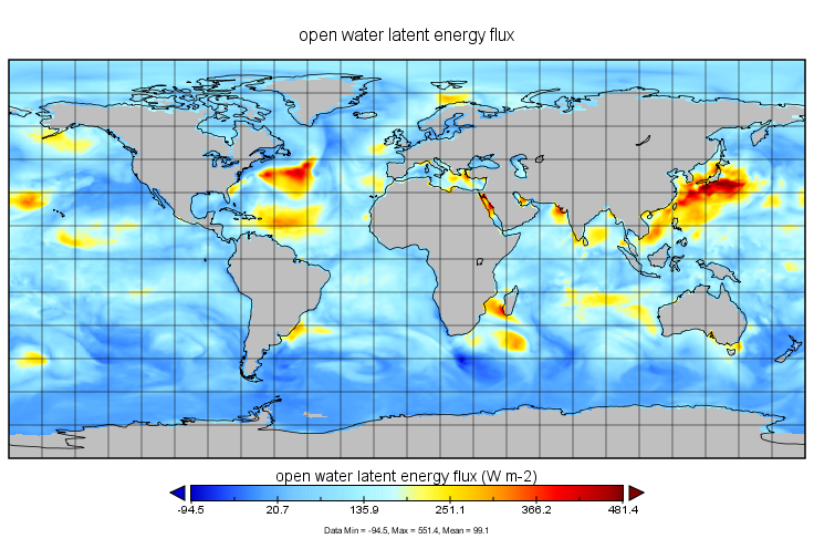
NASA Energy and Water cycle Study (NEWS) Monthly Climatology of the 1st decade of the 21st Century V1.0 (NEWS_WEB_MCLIM) at GES DISC recent views
National Aeronautics and Space Administration —
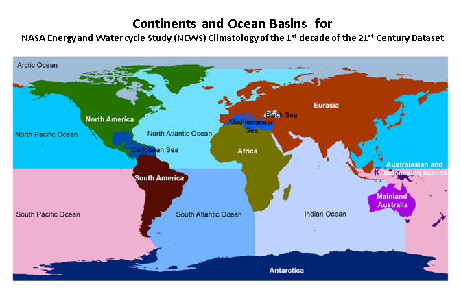
NASA Energy and Water cycle Study (NEWS) Climatology of the 1st decade of the 21st Century Dataset summarizes the original observationally-based mean fluxes of water... -
Federal
NLDAS Mosaic Land Surface Model L4 Hourly 0.125 x 0.125 degree V002 (NLDAS_MOS0125_H) at GES DISC recent views
National Aeronautics and Space Administration —
This data set contains a series of land surface parameters simulated from the Mosaic land-surface model (LSM) for Phase 2 of the North American Land Data Assimilation... -
Federal
NLDAS Mosaic Land Surface Model L4 Hourly 0.125 x 0.125 degree V2.0 (NLDAS_MOS0125_H) at GES DISC recent views
National Aeronautics and Space Administration —
This data set contains thirty-eight fields simulated from the Mosaic land-surface model (LSM) for Phase 2 of the North American Land Data Assimilation System... -
Federal
UARS PEM Level 2 AXIS 1 V001 (UARPE2AXIS1) at GES DISC recent views
National Aeronautics and Space Administration —
The UARS Particle Environment Monitor (PEM) level 2 Atmosphere X-Ray Imaging Spectrometer (AXIS) unit 1 daily product contains the X-ray high-resolution spectral data... -
Federal
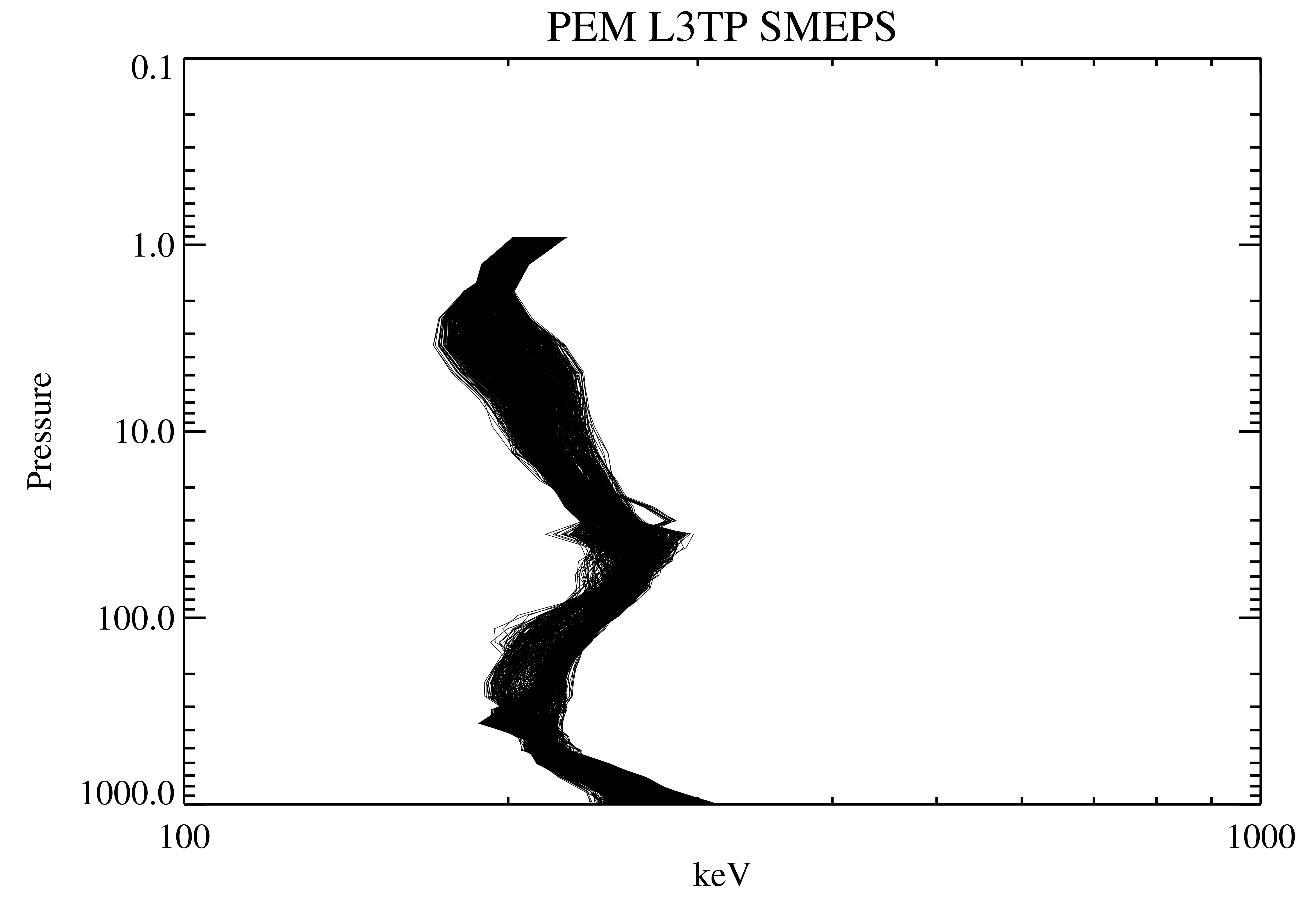
UARS Particle Environment Monitor (PEM) Level 3TP V004 (UARPE3TP) at GES DISC recent views
National Aeronautics and Space Administration —
The Particle Environment Monitor (PEM) Level 3TP data product consists of daily, 65.536 second and 2.048 interval time-ordered, vertical profiles of electron and... -
Federal
NASA Energy and Water cycle Study (NEWS) Annual Climatology of the 1st decade of the 21st Century V1.0 (NEWS_WEB_ACLIM) at GES DISC recent views
National Aeronautics and Space Administration —
NASA Energy and Water cycle Study (NEWS) Climatology of the 1st decade of the 21st Century Dataset summarizes the original observationally-based mean fluxes of water... -
Federal
UARS Particle Environment Monitor (PEM) Level 3AT V004 (UARPE3AT) at GES DISC recent views
National Aeronautics and Space Administration —
The Particle Environment Monitor (PEM) Level 3AT data product consists of daily, 65.536 second interval time-ordered, vertical profiles of electron, proton and x-ray... -
Federal
HRIR/Nimbus-3 Level 1 Meteorological Radiation Data V001 (HRIRN3L1) at GES DISC recent views
National Aeronautics and Space Administration —
HRIRN3L1 is the High Resolution Infrared Radiometer (HRIR) Nimbus-3 Level 1 Meteorological Radiance Data (NMRT) product and contains infrared radiances converted to... -
Federal
SRB/GEWEX evapotranspiration (Penman-Monteith) L4 3 hour 0.5 degree x 0.5 degree V1 (WC_PM_ET_050) at GES DISC recent views
National Aeronautics and Space Administration —
SRB/GEWEX evapotranspiration (Penman-Monteith) L4 3 hour 0.5 degree x 0.5 degree V1 is a global, 24-year (1984-2007), satellite-derived evapotranspiration over land... -
Federal
UARS PEM Level 2 MEPS V001 (UARPE2MEPS) at GES DISC recent views
National Aeronautics and Space Administration —
The Particle Environment Monitor (PEM) level 2 Medium-Energy Particle Spectrometer (MEPS) daily product contains the electron and proton high-resolution spectral data... -
Federal
UARS PEM Level 2 HEPS B V001 (UARPE2HEPSB) at GES DISC recent views
National Aeronautics and Space Administration —
The Particle Environment Monitor (PEM) level 2 High-Energy Particle Spectrometer (HEPS) B daily product contains the electron high-resolution spectral data converted... -
Federal
CAR FIREACE Arctic Ice and Cloud Radiation L1 V1 (CAR_FIREACE_L1C) at GES DISC recent views
National Aeronautics and Space Administration —
The scientific objectives of FIRE/ACE are to study impact of Arctic clouds on radiation exchange between surface, atmosphere, and space, and the influence of surface... -
Federal
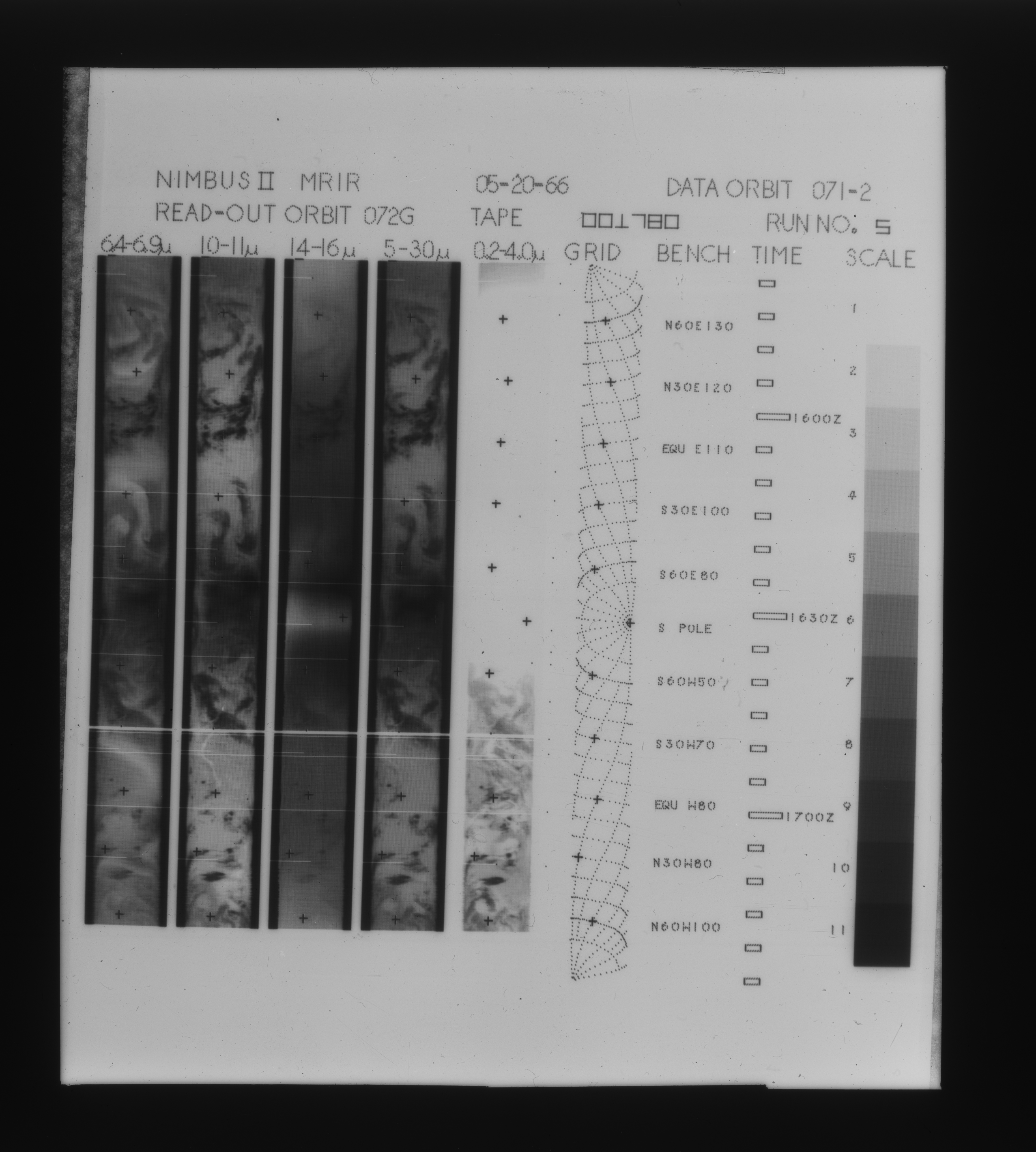
MRIR/Nimbus-2 Level 1 Meteorological Radiation Data V001 (MRIRN2L1) at GES DISC recent views
National Aeronautics and Space Administration —
The Nimbus 2 Medium Resolution Infrared Radiometer (MRIR) was designed to measure electromagnetic radiation emitted and reflected from the earth and its atmosphere at... -
Federal
MERRA-2 tavg1_2d_int_Nx: 2d,1-Hourly,Time-Averaged,Single-Level,Assimilation,Vertically Integrated Diagnostics 0.625 x 0.5 degree V5.12.4 (M2T1NXINT) at GES DISC recent views
National Aeronautics and Space Administration —
M2T1NXINT (or tavg1_2d_int_Nx) is an hourly time-averaged 2-dimensional data collection in Modern-Era Retrospective analysis for Research and Applications version 2... -
Federal
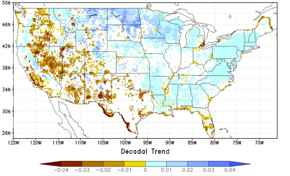
NCA-LDAS Noah-3.3 Land Surface Model L4 Trends 0.125 x 0.125 degree V2.0 (NCALDAS_NOAH0125_Trends) at GES DISC recent views
National Aeronautics and Space Administration —
The National Climate Assessment - Land Data Assimilation System, or NCA-LDAS, is a terrestrial water reanalysis in support of the United States Global Change Research... -
Federal
MERRA-2 tavg1_2d_ocn_Nx: 2d,1-Hourly,Time-Averaged,Single-Level,Assimilation,Ocean Surface Diagnostics 0.625 x 0.5 degree V5.12.4 (M2T1NXOCN) at GES DISC recent views
National Aeronautics and Space Administration —
M2T1NXOCN (or tavg1_2d_ocn_Nx) is an hourly time-averaged 2-dimensional data collection in Modern-Era Retrospective analysis for Research and Applications version 2... -
Federal
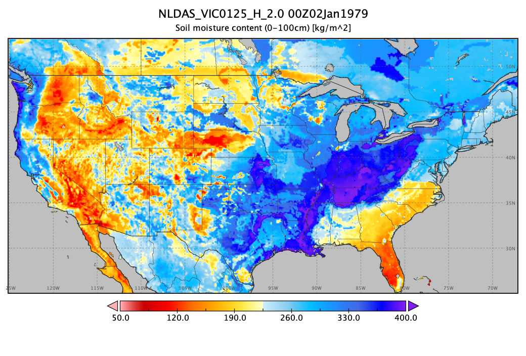
NLDAS VIC Land Surface Model L4 Hourly 0.125 x 0.125 degree V2.0 (NLDAS_VIC0125_H) at GES DISC recent views
National Aeronautics and Space Administration —
This data set contains forty-four fields simulated from the VIC land-surface model (LSM) for Phase 2 of the North American Land Data Assimilation System (NLDAS-2).... -
Federal
AMSR-E L2 Rainfall Subset, collocated with CloudSat track V002 (AMSERR_CPR) at GES DISC recent views
National Aeronautics and Space Administration —
This is a subset of AMSR-E rain rate product along CloudSat field of view track. The goal of the subset is to select and return AMSR-E data that are within -100 km... -
Federal
MERRA-2 tavgU_2d_ocn_Nx: 2d,diurnal,Time-Averaged,Single-Level,Assimilation,Ocean Surface Diagnostics 0.625 x 0.5 degree V5.12.4 (M2TUNXOCN) at GES DISC recent views
National Aeronautics and Space Administration —
M2TUNXOCN (or tavgU_2d_ocn_Nx) is a time-averaged 2-dimensional monthly diurnal means data collection in Modern-Era Retrospective analysis for Research and... -
Federal
GPCP Precipitation Level 3 Monthly 0.5-Degree V3.2 (GPCPMON) at GES DISC recent views
National Aeronautics and Space Administration —
Version 3.2 is the current version. Older versions have been superseded by Version 3.2. The Global Precipitation Climatology Project (GPCP) is the precipitation...

Official websites use .gov
A
.gov website belongs to an official government
organization in the United States.
Secure .gov websites use HTTPS
A
lock (
) or https:// means you’ve safely connected to
the .gov website. Share sensitive information only on official,
secure websites.