

69 datasets found for "9 Digit ZIP Codes"
-
Federal
CERES Bidirectional Scans JPSS-1 FM6 Edition1
National Aeronautics and Space Administration —
CER_BDS_NOAA20-FM6_Edition1 is the Clouds and the Earth's Radiant Energy System (CERES) Bidirectional Scans (BDS) Joint Polar Satellite System 1 (JPSS-1) Flight Model... -
Federal
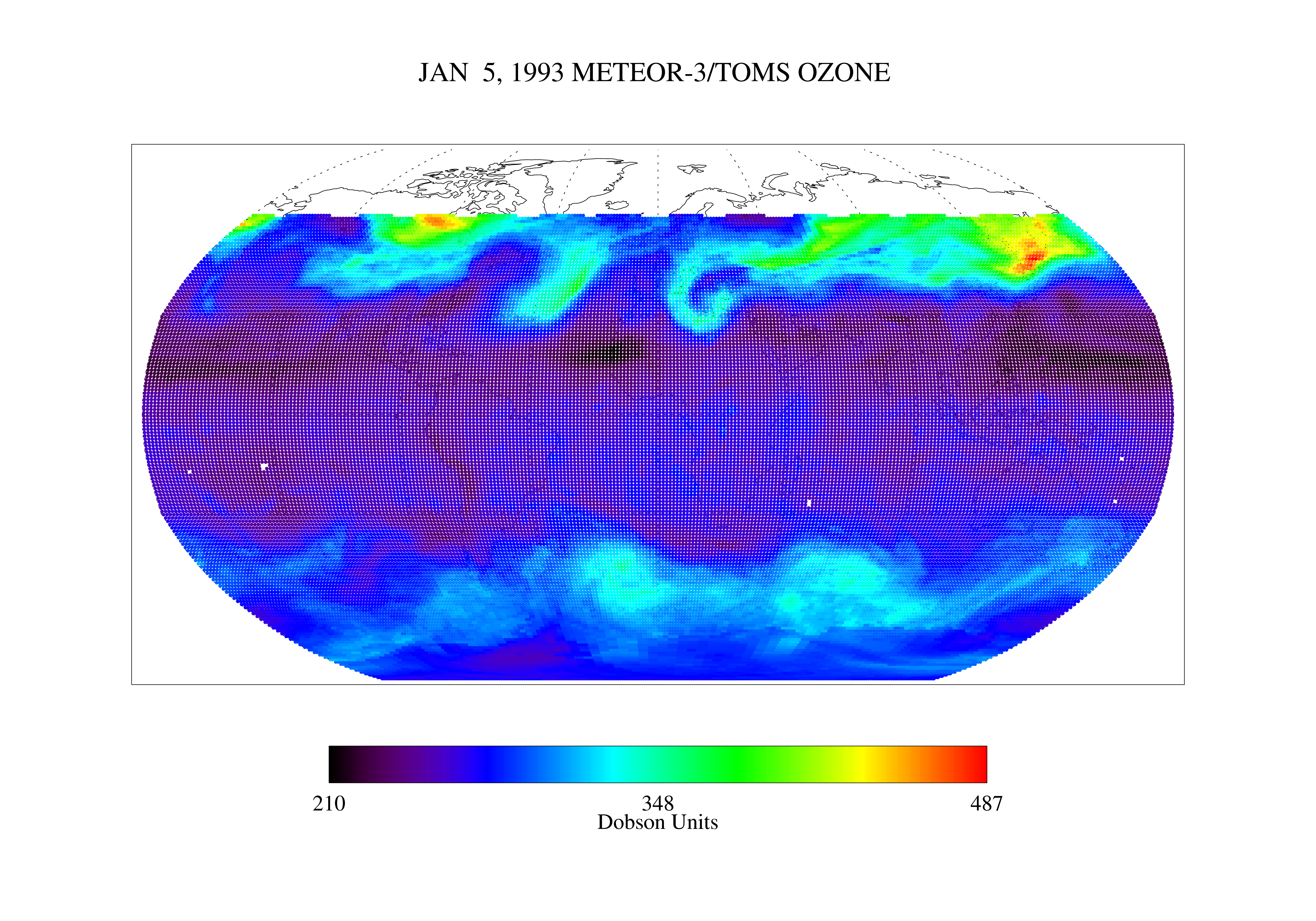
TOMS Nimbus-7 UV-B Erythemal Local Noon Irradiance Daily L3 Global 1 deg x 1.25 deg Lat/Lon Grid V008 (TOMSN7L3dery) at GES DISC
National Aeronautics and Space Administration —
This Nimbus-7 Total Ozone Mapping Spectrometer (TOMS) version 8 daily global gridded data product contains UV-B erythemal local noon irradiance values. The data are... -
Federal
LBA-ECO LC-03 Hypsography, Rivers, Roads, and DEM, Four Areas across Brazilian Amazon
National Aeronautics and Space Administration —
This data set provides four related spatial data products for four study areas across the Brazilian Amazon: Manaus, Amazonas; Tapajos National Forest, Para Western... -
Federal
TOMS Earth Probe Total Column Ozone Daily L3 Global 1 deg x 1.25 deg Lat/Lon Grid V008 (TOMSEPL3dtoz) at GES DISC
National Aeronautics and Space Administration —
This Earth Probe (EP) Total Ozone Mapping Spectrometer (TOMS) version 8 daily global gridded data product contains total column ozone values. The data are mapped to a... -
Federal
LBA-ECO LC-08 Soil, Vegetation, and Land Cover Maps for Brazil and South America
National Aeronautics and Space Administration —
This data set provides (1) soil maps for Brazil that are digital versions of the MAPA DE SOLOS DO BRASIL (EMBRAPA, 1981) classified at three levels of detail,... -
Federal
ASTER Global Water Bodies Database V001 NGDA
National Aeronautics and Space Administration —
The ASTER Global Water Bodies Database (ASTWBD) Version 1 data product provides global coverage of water bodies larger than 0.2 square kilometers at a spatial... -
Federal
Airborne Multi-angle Imaging SpectroRadiometer (AirMISR) Data from the Bartlett 2003 Campaign
National Aeronautics and Space Administration —
The AIRMISR_BARTLETT_2003 data were acquired during a flight over the Bartlett Experimental Forest, New Hampshire, USA, target as part of the AirMISR deployments from... -
Federal
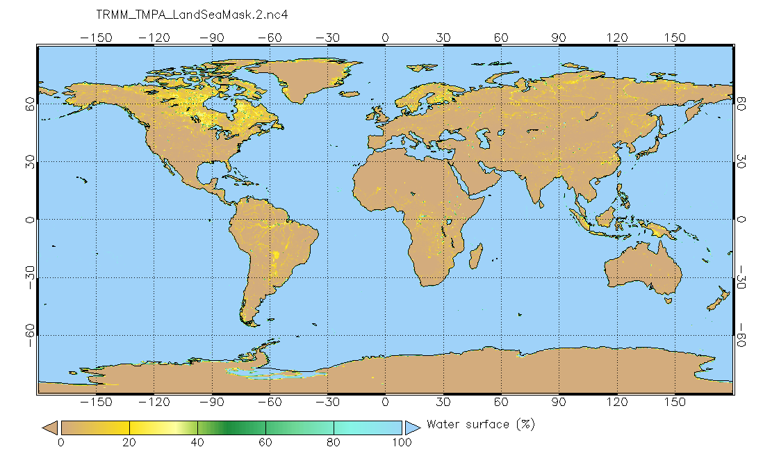
Land/Sea static mask relevant to TMPA precipitation 0.25x0.25 degree V2 (TRMM_TMPA_LandSeaMask) at GES DISC
National Aeronautics and Space Administration —
Version 2 is the current version of the data set. Older versions will no longer be available and have been superseded by Version 2. This land sea mask originated from... -
Federal
Ecosystem Demography Model: Scaling Vegetation Dynamics Across South America
National Aeronautics and Space Administration —
This model product contains the source code for the Ecosystem Demography Model (ED version 1.0) as well as model input and output data for a portion of South America...
69 datasets found for "9 Digit ZIP Codes"