
-
Federal
UARS Correlative NMC Daily Gridded Stratospheric Assimilated Data V001 (UARZCNMC) at GES DISC
National Aeronautics and Space Administration —
The UARS Correlative assimilation data from NOAA's National Meteorological Center (NMC) consists of daily model runs at 12 GMT as a means of providing an independent... -
Federal
GLDAS Catchment Land Surface Model L4 daily 0.25 x 0.25 degree V2.0 (GLDAS_CLSM025_D) at GES DISC
National Aeronautics and Space Administration —
NASA Global Land Data Assimilation System Version 2 (GLDAS-2) has three components: GLDAS-2.0, GLDAS-2.1, and GLDAS-2.2. GLDAS-2.0 is forced entirely with the... -
Federal
AIRS/Aqua L3 8-day Standard Physical Retrieval (AIRS+AMSU+HSB) 1 degree x 1 degree V006 (AIRH3ST8) at GES DISC
National Aeronautics and Space Administration —
The Atmospheric Infrared Sounder (AIRS) is a grating spectrometer (R = 1200) aboard the second Earth Observing System (EOS) polar-orbiting platform, EOS Aqua. In... -
Federal
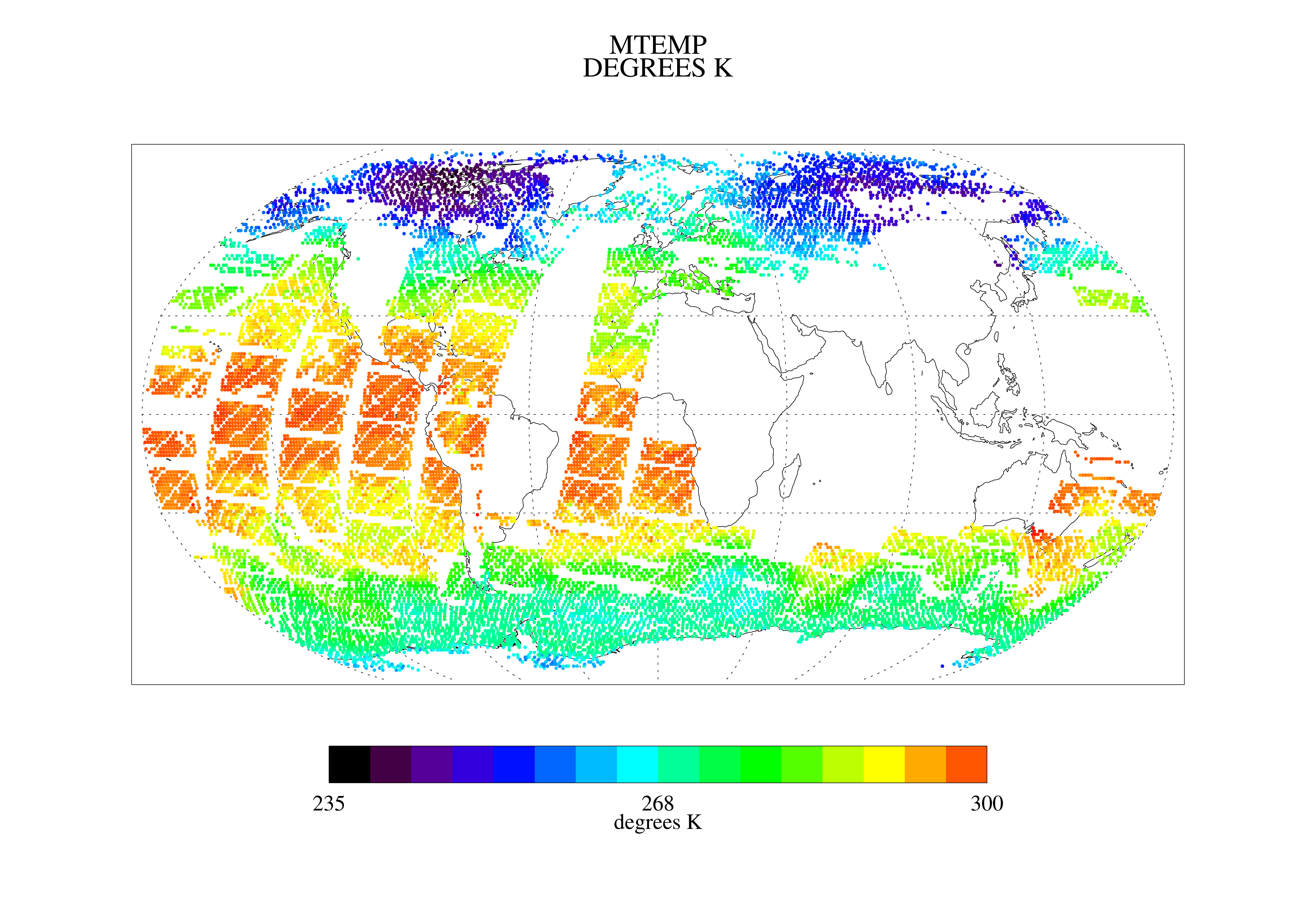
TOVS LMD DAILY GRIDS from NOAA-10 V01 (TOVSBDNG) at GES DISC
National Aeronautics and Space Administration —
Level 3 parameters from HIRS/2 and MSU radiances using the Improved Initialization Inversion (3I) classification retrieval scheme by the Laboratoire de Meteorologie... -
Federal
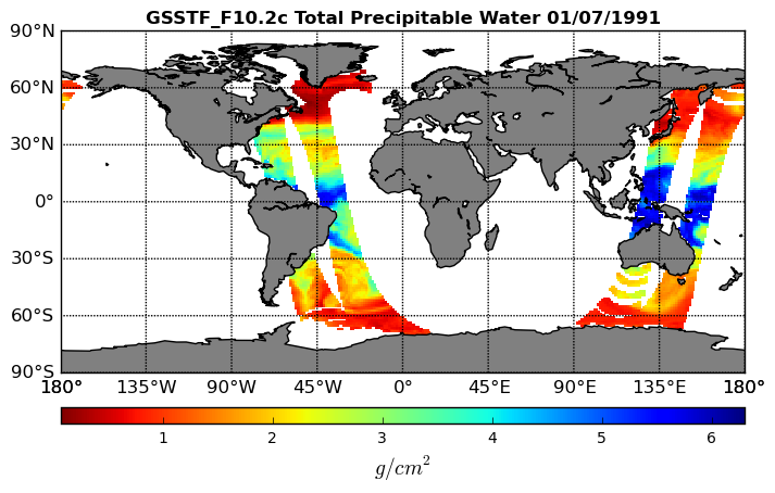
Goddard Satellite-Based Surface Turbulent Fluxes, 0.25 x 0.25 deg, Daily Grid F10 V3 (GSSTF_F10) at GES DISC
National Aeronautics and Space Administration —
These data are part of the Goddard Satellite-based Surface Turbulent Fluxes Version 3 (GSSTF3) Dataset recently produced through a MEaSURES funded project led by Dr.... -
Federal
AMSR-MODIS Boundary Layer Water Vapor L3 Monthly 1 degree x 1 degree V1 (AMMBLWV) at GES DISC NGDA
National Aeronautics and Space Administration —
This data set provides an estimate the marine boundary layer water vapor beneath uniform cloud fields. Microwave radiometry from AMSR-E and AMSR-2 provides the total... -
Federal
ECOSTRESS Evapotranspiration PT-JPL Daily L3 Global 70m V001
National Aeronautics and Space Administration —
The ECOsystem Spaceborne Thermal Radiometer Experiment on Space Station (ECOSTRESS) mission measures the temperature of plants to better understand how much water... -
Federal
Bowen Ratio Surface Flux: KSU (FIFE)
National Aeronautics and Space Administration —
Assessing the effects of annual burning & topography on surface energy exchanges -
Federal
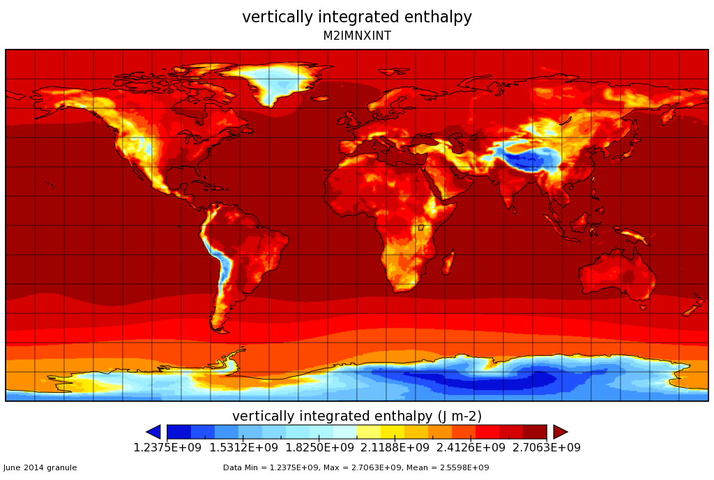
MERRA-2 instM_2d_int_Nx: 2d,Monthly mean,Instantaneous,Single-Level,Assimilation,Vertically Integrated Diagnostics 0.625 x 0.5 degree V5.12.4 (M2IMNXINT) at GES DISC
National Aeronautics and Space Administration —
M2IMNXINT (or instM_2d_int_Nx) is an instantaneous 2-dimensional monthly mean data collection in Modern-Era Retrospective analysis for Research and Applications... -
Federal
MERRA-2 inst3_3d_aer_Nv: 3d,3-Hourly,Instantaneous,Model-Level,Assimilation,Aerosol Mixing Ratio 0.625 x 0.5 degree V5.12.4 (M2I3NVAER) at GES DISC
National Aeronautics and Space Administration —
M2I3NVAER (or inst3_3d_aer_Nv) is an instantaneous 3-dimensional 3-hourly data collection in Modern-Era Retrospective analysis for Research and Applications version 2... -
Federal
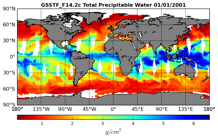
Goddard Satellite-Based Surface Turbulent Fluxes, 0.25 x 0.25 deg, Daily Grid F14 V3 (GSSTF_F14) at GES DISC
National Aeronautics and Space Administration —
These data are part of the Goddard Satellite-based Surface Turbulent Fluxes Version 3 (GSSTF3) Dataset recently produced through a MEaSURES funded project led by Dr.... -
Federal
TES/Aura L2 H2O Lite Nadir V006
National Aeronautics and Space Administration —
TL2H2OLN_6 is the Tropospheric Emission Spectrometer (TES)/Aura Level 2 H2O Lite Nadir Version 6 data product. It consists of information for one molecular species... -
Federal
Lake Untersee, Antarctica Climate Data, Version 1
National Aeronautics and Space Administration —
This data set is a five-year data record of meteorological conditions at Lake Untersee. The data covers five astral summer seasons comprised of December, January, and... -
Federal
SMEX04 Soil Climate Analysis Network (SCAN) Data: Arizona, Version 1
National Aeronautics and Space Administration —
Notice to Data Users: The documentation for this data set was provided solely by the Principal Investigator(s) and was not further developed, thoroughly reviewed, or... -
Federal
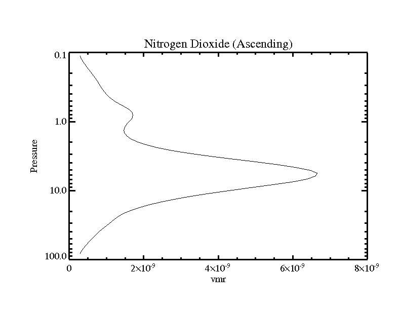
HIRDLS/Aura Level 2 Daily Geophysical Parameters V007 (HIRDLS2) at GES DISC
National Aeronautics and Space Administration —
The "HIRDLS/Aura Level 2 Geophysical Parameters" data product (HIRDLS2) contains an entire day's worth of Level-2 vertical profiles of O3, HNO3, H2O, CFC-11, CFC-12,... -
Federal
NCEP/DOE Reanalysis II, for GSSTF, 0.25x0.25 deg, Monthly grid V3 (GSSTFM_NCEP) at GES DISC
National Aeronautics and Space Administration —
These data are the Goddard Satellite-based Surface Turbulent Fluxes Version 3 Dataset recently produced through a MEaSURES funded project led by Dr. Chung-Lin Shie... -
Federal
Bowen Ratio Surface Flux: UNL (FIFE)
National Aeronautics and Space Administration —
Latent & sensible heat flux by Bowen Ratio & aerodynamic characterization of vegetation -
Federal
AIRS/Aqua L3 Daily Standard Physical Retrieval (AIRS-only) 1 degree x 1 degree V006 (AIRS3STD) at GES DISC
National Aeronautics and Space Administration —
The Atmospheric Infrared Sounder (AIRS) is a grating spectrometer (R = 1200) aboard the second Earth Observing System (EOS) polar-orbiting platform, EOS Aqua. In... -
Federal
MODIS/Terra Total Precipitable Water Vapor 5-Min L2 Swath 1km and 5km - NRT NGDA
National Aeronautics and Space Administration —
The MODIS Adaptive Processing System (MODAPS) is currently generating an improved Collection 6.1 (061) for all MODIS Level-1 (L1) and higher-level Level-2 (L2) &... -
Federal
Sounder SIPS: Suomi NPP CrIMSS Level 3 Comprehensive Quality Control Gridded Monthly CHART Normal Spectral Resolution V1
National Aeronautics and Space Administration —
The objective of this limited edition data collection is to examine products generated by the Climate Heritage AIRS Retrieval Technique (CHART) algorithm to analyze...

Official websites use .gov
A
.gov website belongs to an official government
organization in the United States.
Secure .gov websites use HTTPS
A
lock (
) or https:// means you’ve safely connected to
the .gov website. Share sensitive information only on official,
secure websites.