
-
Federal
MAGELLAN RAW RADIO TRACKING DATA V1.0
National Aeronautics and Space Administration —
Archival Tracking Data Files (ATDFs, also sometimes known as TRK-2-25 data) from the MAGELLAN mission to Venus (1989-1994) and Orbit Data Files (ODFs, also known as... -
Federal
CASSINI RSS: IONOSPHERIC ELECTRON DENSITY PROFILES EDP1 V1.0
National Aeronautics and Space Administration —
This data set contains the complete collection of the published Cassini radio occultation electron density profiles of the Titan ionosphere as of September 2008. -
Federal
BOREAS RSS-08 Snow Maps Derived from Landsat TM Imagery
National Aeronautics and Space Administration —
The BOREAS RSS-08 team utilized Landsat TM images to perform mapping of snow extent over the SSA. This data set consists of two Landsat TM images which were used to... -
Federal
CASSINI RSS RAW DATA SET - GWE2 V1.0
National Aeronautics and Space Administration —
not applicable -
Federal
GHRSST Level 4 MW_OI Global Foundation Sea Surface Temperature analysis version 5.1 from REMSS
National Aeronautics and Space Administration —
A Group for High Resolution Sea Surface Temperature (GHRSST) global Level 4 sea surface temperature analysis produced daily on a 0.25-degree grid at Remote Sensing... -
Federal
BOREAS RSS-08 IFC-3 ADS-PSII Measurements of BRDF at SSA-OBS and SSA-OA Sites
National Aeronautics and Space Administration —
Ground BRDF measurements were acquired by the Remote Sensing Science (RSS)-08 team to aid in the development of advanced spectral vegetation indices. The RSS-08 team... -
Federal
BOREAS RSS-14 Level-3 Gridded Radiometer and Satellite Surface Radiation Images
National Aeronautics and Space Administration —
The BOREAS RSS-14 team collected and processed GOES-7 and -8 images of the BOREAS region as part of their effort to characterize the incoming, reflected and emitted... -
Federal
BOREAS RSS-12 Airborne Tracking Sunphotometer Measurements (C-130)
National Aeronautics and Space Administration —
The BOREAS RSS-12 team collected both ground and airborne sunphotometer measurements for use in characterizing the aerosol optical properties of the atmosphere during... -
Federal
CASSINI RSS RAW DATA SET - SCC14 V1.0
National Aeronautics and Space Administration —
The Cassini Radio Science Solar Corona Characterization Experiment (SCC14) Raw Data Archive is a time-ordered collection of radio science raw data acquired from... -
Federal
MARS GLOBAL SURVEYOR RAW DATA SET - EXT V1.0
National Aeronautics and Space Administration —
This data set contains archival raw, partially processed, and ancillary/supporting radio science data acquired during the Extended Mission (EXT) phase of the Mars... -
Federal
DAWN VESTA GRAVITY SCIENCE DERIVED SCIENCE DATA V2.0
National Aeronautics and Space Administration —
This data set contains archival results from gravity investigations conducted during the Dawn mission while the spacecraft was in orbit around the asteroid Vesta.... -
Federal
CASSINI RSS RAW DATA SET - SCC2 V1.0
National Aeronautics and Space Administration —
The Cassini Radio Science Solar Corona Characterization Experiment (SCC2) Raw Data Archive is a time-ordered collection of radio science raw data acquired from July... -
Federal
CASSINI RSS RAW DATA SET - SROC4B V1.0
National Aeronautics and Space Administration —
The Cassini Radio Science Saturn and Ring Occultation Experiment (SROC4B) Raw Data Archive is a time-ordered collection of radio science raw data acquired on June 28,... -
Federal
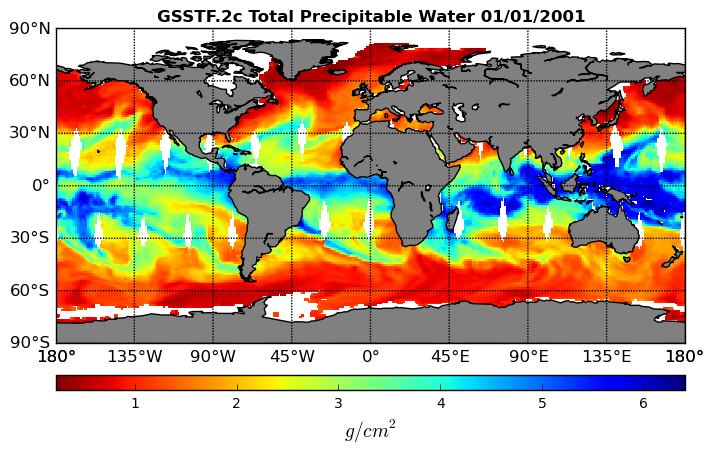
Goddard Satellite-Based Surface Turbulent Fluxes, 0.25 x 0.25 deg, Daily Grid V3 (GSSTF) at GES DISC
National Aeronautics and Space Administration —
These data are the Goddard Satellite-based Surface Turbulent Fluxes Version-3 (GSSTF3) Dataset recently produced through a MEaSUREs funded project led by Dr. Chung-... -
Federal
BOREAS RSS-17 Stem, Soil, and Air Temperature Data
National Aeronautics and Space Administration —
The BOREAS RSS-17 team collected several data sets in support of its research in monitoring and analyzing environmental and phenological states using radar data. This... -
Federal
BOREAS RSS-16 AIRSAR CM V6.1 Images
National Aeronautics and Space Administration —
The BOREAS RSS-16 team used satellite and aircraft SAR data in conjunction with various ground measurements to determine the moisture regime of the boreal forest.... -
Federal
BOREAS RSS-03 Reflectance Measured from a Helicopter-Mounted SE-590
National Aeronautics and Space Administration —
The BOREAS RSS-03 team collected multiple remotely sensed data sets from the NASA UH-1 helicopter. This data set includes helicopter-based radiometric measurements of... -
Federal
BOREAS RSS-20 POLDER C-130 Measurements of Surface BRDF
National Aeronautics and Space Administration —
This data set contains measurements of surface BRDF made by the POLDER instrument over several surface types (pine, spruce, fen) of the BOREAS SSA during the 1994... -
Federal
PDS Mars Reconnaissance Orbiter Data 24
National Aeronautics and Space Administration —
CRISM, CTX, HiRISE, MARCI, MCS, RSS, SPICE

Official websites use .gov
A
.gov website belongs to an official government
organization in the United States.
Secure .gov websites use HTTPS
A
lock (
) or https:// means you’ve safely connected to
the .gov website. Share sensitive information only on official,
secure websites.