

5 datasets found for "epa facilities shapefile"
-
Federal
NACP Regional: National Greenhouse Gas Inventories and Aggregated Gridded Model Data
National Aeronautics and Space Administration —
This data set provides two products that were derived from the recently published North American Carbon Program (NACP) Regional Synthesis 1-degree terrestrial... -
Federal
SHIFT: Wetland Spectra, Salinity, and Fractional Cover, Devereux Slough, CA, 2022
National Aeronautics and Space Administration —
This dataset includes field data, analysis code, and corresponding airborne imagery collected and generated during the 2022 NASA Surface Biology Geology (SBG) High... -
Federal
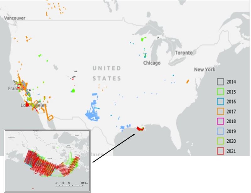
AVIRIS Facility Instruments: Flight Line Geospatial and Contextual Data
National Aeronautics and Space Administration —
This dataset provides attributed geospatial and tabular information for identifying and querying flight lines of interest for the Airborne Visible InfraRed Imaging... -
Federal
NACP MCI: CO2 Emissions Inventory, Upper Midwest Region, USA., 2007
National Aeronautics and Space Administration —
This data set provides a bottom-up CO2 emissions inventory for the mid-continent region of the United States for the year 2007. The study was undertaken as part of... -
Federal
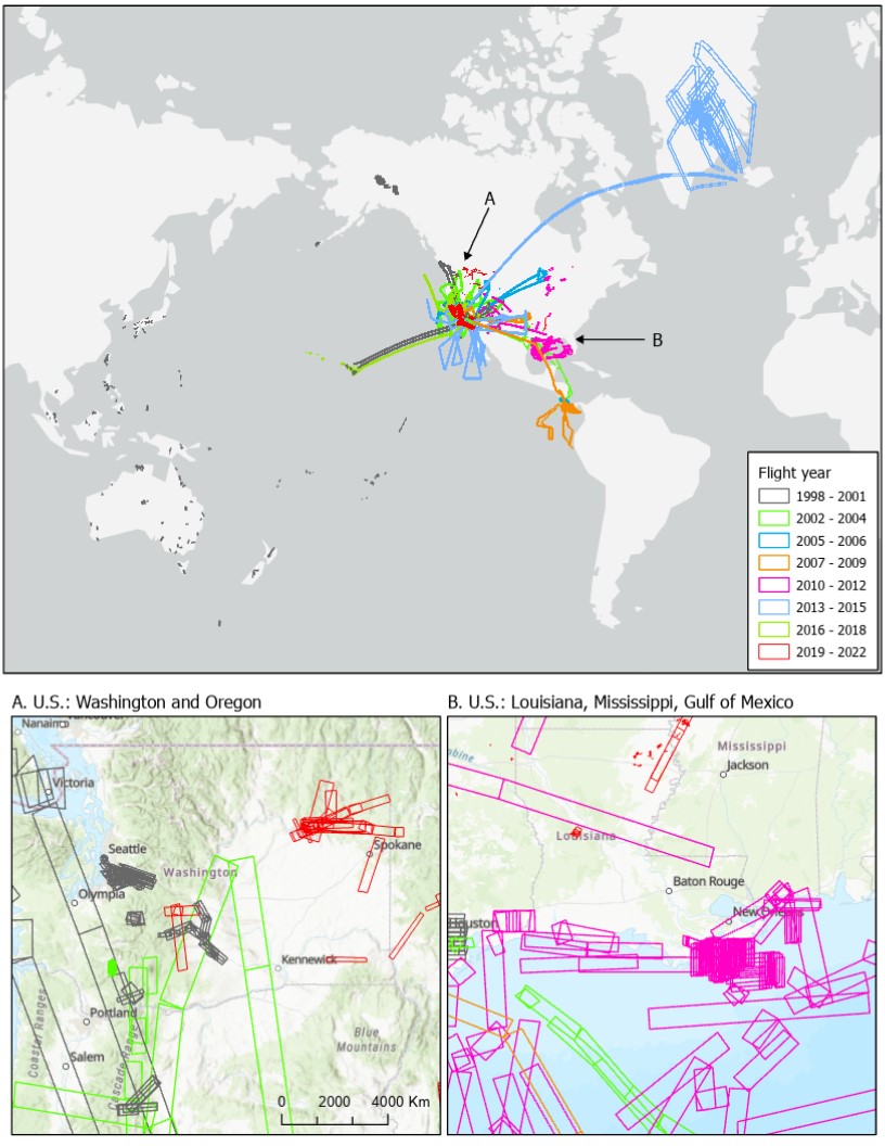
MASTER: Flight Line Geospatial Polygons and Contextual Data
National Aeronautics and Space Administration —
This dataset provides resources for identifying flight lines of interest for the MODIS/ASTER Airborne Simulator (MASTER) instrument based on spatial and temporal...
5 datasets found for "epa facilities shapefile"