
-
Federal
Geocoded Disasters (GDIS) Dataset
National Aeronautics and Space Administration —
The Geocoded Disasters (GDIS) Dataset is a geocoded extension of a selection of natural disasters from the Centre for Research on the Epidemiology of Disasters'... -
Federal
Ground-Based Global Navigation Satellite System (GNSS)-based Upper Atmospheric Realtime Disaster Information and Alert Network (GUARDIAN) Galileo daily antenna phase centers (24-hour files) from NASA CDDIS
National Aeronautics and Space Administration —
This product contains antenna phase center locations relative to the Galileo satellite's center of mass. The product is generated at JPL's Global Differential GPS... -
Federal
Landsat 7 Data Sets
National Aeronautics and Space Administration —
Landsat represents the world's longest continuously acquired collection of space-based moderate-resolution land remote sensing data. Four decades of imagery provides... -
Federal
HDDS_Baseline_Adhoc
National Aeronautics and Space Administration —
The U.S. Geological Survey (USGS) Emergency Operations, in support of the Department of Homeland Security, provides imagery and resources for use in disaster... -
Federal
Ground-Based GNSS-based Upper Atmospheric Realtime Disaster Information and Alert Network (GUARDIAN) GLONASS daily accumulated real-time Precise Orbit Determination (POD) Clock Corrections (60-second sampling, 24-hour files) from NASA CDDIS
National Aeronautics and Space Administration —
This product contains a high-rate time series of clock biases for healthy satellites in the GLONASS constellation that are accumulated every minute throughout the... -
Federal
Ground-Based GNSS-based Upper Atmospheric Realtime Disaster Information and Alert Network (GUARDIAN) Galileo daily accumulated real-time Precise Orbit Determination (POD) Clock Corrections (60-second sampling, 24-hour files) from NASA CDDIS
National Aeronautics and Space Administration —
This product contains a time series of clock biases for healthy satellites in the Galileo constellation that are accumulated every minute throughout the day. In... -
Federal
Ground-Based Global Navigation Satellite System (GNSS)-based Upper Atmospheric Realtime Disaster Information and Alert Network (GUARDIAN) GPS daily antenna phase maps (meta data, 24-hour files) from NASA CDDIS
National Aeronautics and Space Administration —
This product contains file names and URLs to files containing antenna phase map data used in the real-time GPS POD processing. In particular, the IGS ANTEX file name... -
Federal
INFORM Global Risk Index 2019 Mid Year, v0.3.7
National Aeronautics and Space Administration —
The INFORM Global Risk Index 2019 Mid Year, v0.3.7 data set identifies the countries at a high risk of humanitarian crisis that are more likely to require... -
Federal
Ground-Based Global Navigation Satellite System (GNSS)-based Upper Atmospheric Realtime Disaster Information and Alert Network (GUARDIAN) Near Real-Time Ionospheric Total Electron Count (5-second sampling, 24-hour files) from NASA CDDIS
National Aeronautics and Space Administration —
Developed at JPL, GUARDIAN is a near-real-time (NRT) ionospheric monitoring software (Martire et al.). Its main products are NRT total electronic content (TEC) time... -
Federal
Ground-Based GNSS-based Upper Atmospheric Realtime Disaster Information and Alert Network (GUARDIAN) GPS daily accumulated real-time Precise Orbit Determination (POD) orbits (60-second sampling, 24-hour files) from NASA CDDIS
National Aeronautics and Space Administration —
This product contains a time series of position and velocity components for healthy satellites in the GPS constellation that are accumulated every minute throughout... -
Federal
Ground-Based Global Navigation Satellite System (GNSS)-based Upper Atmospheric Realtime Disaster Information and Alert Network (GUARDIAN) GLONASS daily antenna phase maps (meta data, 24-hour files) from NASA CDDIS
National Aeronautics and Space Administration —
This product contains file names and URLs to files containing antenna phase map data used in the real-time GLONASS POD processing. In particular, the IGS ANTEX file... -
Federal
Ground-Based Global Navigation Satellite System (GNSS)-based Upper Atmospheric Realtime Disaster Information and Alert Network (GUARDIAN) GLONASS Earth Orientation Parameters (1-day sampling, 7-day files) from NASA CDDIS
National Aeronautics and Space Administration —
This product contains a time series of Earth orientation parameters from the IERS Bulletin A for the GLONASS constellation of satellites. The product is generated at... -
Federal
Ground-Based Global Navigation Satellite System (GNSS)-based Upper Atmospheric Realtime Disaster Information and Alert Network (GUARDIAN) GLONASS daily antenna phase centers (24-hour files) from NASA CDDIS
National Aeronautics and Space Administration —
This product contains antenna phase center locations relative to the GLONASS satellite's center of mass. The product is generated at JPL's Global Differential GPS... -
Federal
Ground-Based GNSS-based Upper Atmospheric Realtime Disaster Information and Alert Network (GUARDIAN) GLONASS daily accumulated real-time Precise Orbit Determination (POD) Clock Corrections (1-second sampling, 24-hour files) from NASA CDDIS
National Aeronautics and Space Administration —
This product contains a high-rate time series of clock biases for healthy satellites in the GLONASS constellation that are accumulated every minute throughout the... -
Federal
Ground-Based GNSS-based Upper Atmospheric Realtime Disaster Information and Alert Network (GUARDIAN) GLONASS daily accumulated real-time Precise Orbit Determination (POD) Attitude Quaternions (30-second sampling, 24-hour files) from NASA CDDIS
National Aeronautics and Space Administration —
This product contains a time series of attitude quaternion components for healthy satellites in the GLONASS constellation that are accumulated every minute throughout... -
Federal
Ground-Based GNSS-based Upper Atmospheric Realtime Disaster Information and Alert Network (GUARDIAN) Galileo daily accumulated real-time Precise Orbit Determination (POD) Clock Corrections (1-second sampling, 24-hour files) from NASA CDDIS
National Aeronautics and Space Administration —
This product contains a time series of clock biases for healthy satellites in the Galileo constellation that are accumulated every minute throughout the day. In... -
Federal
Ground-Based GNSS-based Upper Atmospheric Realtime Disaster Information and Alert Network (GUARDIAN) Galileo daily accumulated real-time Precise Orbit Determination (POD) orbits (60-second sampling, 24-hour files) from NASA CDDIS
National Aeronautics and Space Administration —
This product contains a time series of position and velocity components for healthy satellites in the Galileo constellation that are accumulated every minute... -
Federal
West Africa Coastal Vulnerability Mapping: Demographic and Health Survey Data Sets
National Aeronautics and Space Administration —
The West Africa Coastal Vulnerability Mapping: Demographic and Health Survey Data Sets present grids of maternal education levels and household wealth based on... -
Federal
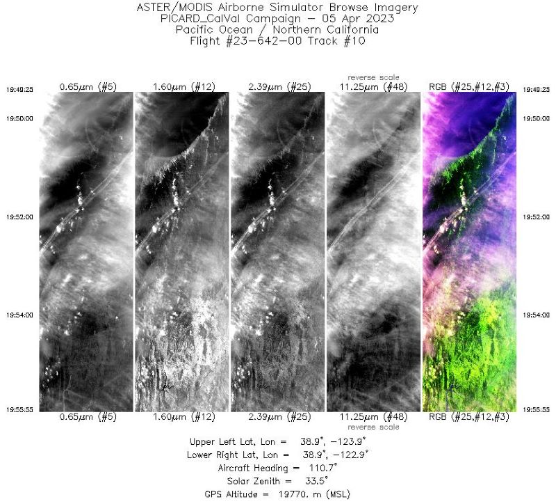
MASTER: Western Diversity Time Series Campaign, WDTS, Spring 2023
National Aeronautics and Space Administration —
This dataset includes Level 1B (L1B) and Level 2 (L2) data products from the MODIS/ASTER Airborne Simulator (MASTER) instrument. The spectral data were collected as... -
Federal
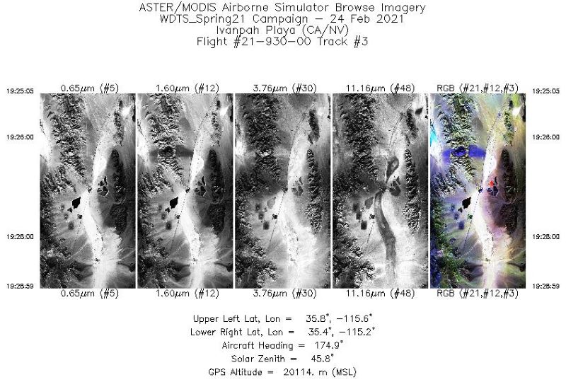
MASTER: Western Diversity Time Series Campaign, WDTS, California, USA, Spring 2021
National Aeronautics and Space Administration —
This dataset includes Level 1B (L1B) and Level 2 (L2) data products from the MODIS/ASTER Airborne Simulator (MASTER) instrument. The spectral data were collected as...

Official websites use .gov
A
.gov website belongs to an official government
organization in the United States.
Secure .gov websites use HTTPS
A
lock (
) or https:// means you’ve safely connected to
the .gov website. Share sensitive information only on official,
secure websites.